


As we live in an ever-changing world with cities and infrastructure continually growing at a rapid pace, the danger of hitting underground utilities is growing as more and more cables and pipes are buried to meet the needs of growing cities. To keep up with the demand of industries requiring the location of underground infrastructure building knowledge and skills through training is crucial to locate, map and avoid utilities.
Training is continual and adapts with new equipment and software to give the learner the best understanding to take their new-found knowledge onto the jobsite. There is a big difference between being taught by a work colleague how to operate equipment and going on a purpose-built training course with an experienced trainer. To truly understand the why’s, where’s and how’s takes time and effort from a trainer to breakdown the often-complicated scenarios and theory that come when using detection products and relate and demonstrate in a way the learner understands.
Training is not just telling a learner about a feature or theory of a product but assessing their knowledge levels and how they intake and retain information. A skilled trainer will allow the learner to thrive and expand their understanding through training and guidance.
Adequate training to learn how to sweep a site correctly before excavation, look for visual references to understand what may be beneath the ground and what may cause problems in a location is needed in combination with the right tools when detecting utilities:
1.Extensive and up-to-date training
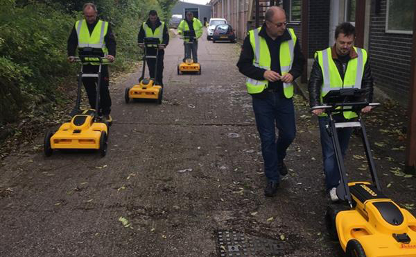
At Leica Detection Campus we train a wide range of professionals, from people taking avoidance tools to check before excavation up to utility surveyors working array GPR systems. With every training course, we are able to develop the learner’s skills and knowledge in what they will need to complete the tasks in their job. Every time we train in the use of detection products we see a marked improvement from when they arrive to when they leave. To achieve this, learners go through classroom tasks and apply the learned theory conducting practical sessions of real-site applications. To get the best from an employee and the equipment they are assigned, it is imperative users receive the correct professional training for the tasks of their jobs delivered in an understandable way.
2.Electromagnetic locator
Underground utility locating requires the use of a few different methods to accurately mark buried lines. An electromagnetic locator (EML), or pipe and cable locator, is used for tracing utility lines and metallic pipes, clearing excavation and drilling locations. These utility locators consist of two main parts; a transmitter and a receiver. To have better performance and avoid missing utilities, an EML should always go together with a transmitter that emits a frequency induced onto nearby pipes and cables. The receiver detects these radio frequencies, and the operator can accurately locate and trace the pipes and cables.
3.Ground Penetrating Radar
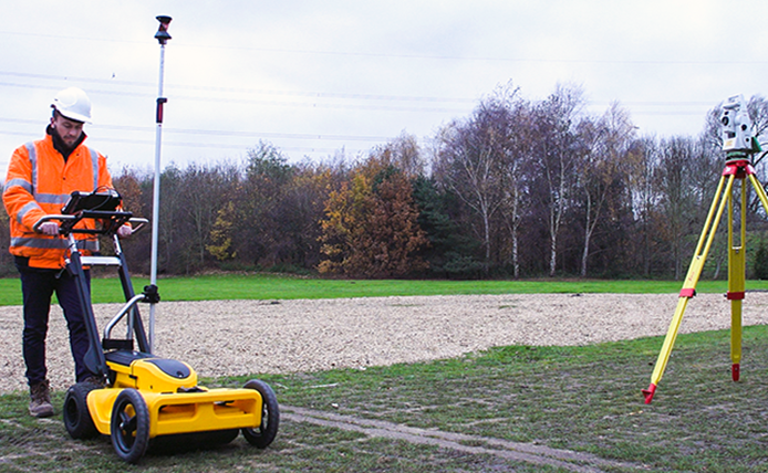
Ground Penetrating Radar (GPR) is a geophysical method using radar pulses to image the subsurface. This non-destructive method uses electromagnetic radiation waves and detects the reflected signals from subsurface structures. The GPR device is an essential tool for underground utility detection, requiring expertise to interpret its results.
4.Up-to-date equipment
Utility detection requires state-of-the-art equipment for all pre-excavation and site planning needs. In order to have a full overview of the underground utilities the use of not only electromagnetic locating equipment but also a GPR, like Leica DS200, is required. The right accessories and accurate positioning equipment, such as the Leica GG04 plus or Leica iCON gps 60 as well is key to accurately locate and map utilities.
Leica Geosystems has introduced a new GPR called the Leica DSX, a portable utility detection solution designed to bring non-skilled GPR users the latest developments in utility detection with simplified workflow, automated data processing and high accuracy. Users can now easily locate underground utilities and clearly visualize detected utilities via the onboard acquisition software.