


The Hellfire Caves are a network of man-made chalk and flint caverns which extend 250 metres underground. Visitors can find them above the village of West Wycombe, at the southern edge of the Chiltern Hills near High Wycombe in Buckinghamshire, Southeast England.
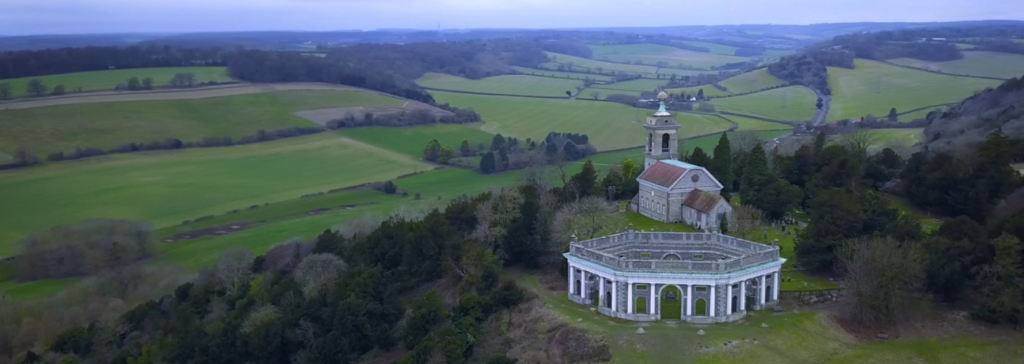
The caves were excavated between 1748 and 1752 for Sir Francis Dashwood co-founder of the Hellfire Club, whose meetings were held in the caves. The individual caves or “chambers” connect by a series of long, narrow tunnels and passageways.
The caves were used as a meeting place for Sir Francis Dashwood’s notorious Hellfire Club, whose members included various politically and socially important 18th-century figures.
The caves were disused from 1780 to the late 1940s and fell into disrepair. It was in the late 1940s and early 1950s that the caves were renovated and turned into a local visitor attraction by the late Sir Francis Dashwood.
George Dashwood son to Sir Edward Dashwood and owner of Hellfire Caves would like to revamp this unique system of caves. The idea is to completely renovate the interior, making the Hellfire caves a unique experience for the kids and the families.
Agripower Contractors, one of the UK’s leading natural and artificial sports pitch specialists, has undertaken the project. The team’s goal is the revamp the caves, tunnels and passageways so the visitors can experience the historic site in the most authentic way.
A new future for the historical caves
Agripower would like to install new lighting ducting in the caves which means that the team needs to measure the caves, these measurements will help them to plan for the installation. Jerry Anderson, director at Agripower Contractors, approached Leica Geosystems looking for the the best way to laser scan and document the cave system.
“For our ease of measurement and recording, we had to make a survey of the caves; the logistics of doing it via optical equipment can be very time consuming. Leica Geosystems recommended the Leica Pegasus:Backpack system, and explained its capabilities of mapping the cave system at speed,” said Anderson.
The Leica Pegasus:Backpack, combining Global Positioning Satellite Systems (GNSS) and Simultaneous Localisation and Mapping (SLAM) allowed for complete freedom to walk from the outside into the underground to map the Hellfire caves network in a complete 3D model. “After Agripower came to Leica Geosystems, my first thought was to deploy reality capture for such a demanding project. The Leica Pegasus:Backpack technology enables us to create a rich 3D digital reality of the entire cave system,” said Steven Cairns, reality capture consultant at Leica Geosystems.
The past meets the present
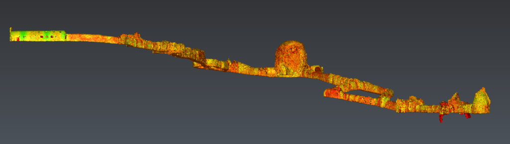
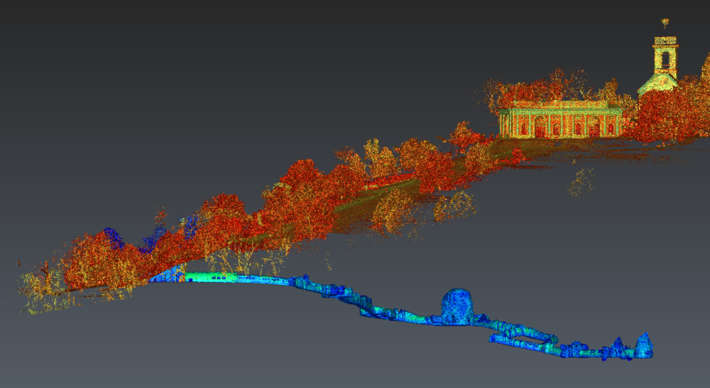
A total of 550 m of walking from over ground into the underground and back to the outside area was required to scan approximately 275 m linear distance of the cave system in just 25 minutes without GNSS. The calculated volume of the cave tunnels is approximately 2,000 m³. Cutting through the 3D data allows Leica Geosystems to quickly understand and measure the caves with ease.
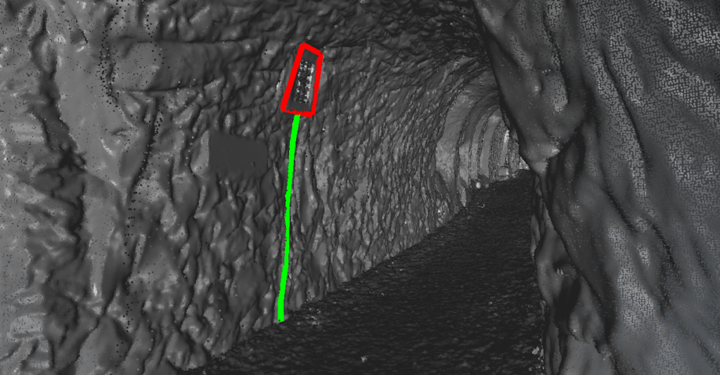
“At Leica Geosystems we have the Leica Pegasus: Backpack, a mobile reality capture wearable instrument which allows me complete freedom to walk around and document the caves in their natural shape and form,” said Cairns. “Using the high-resolution camera on the Pegasus:Backpack, it is possible to derive coordinates taken in from the outside world. So, we know the location of the existing lighting underground.”
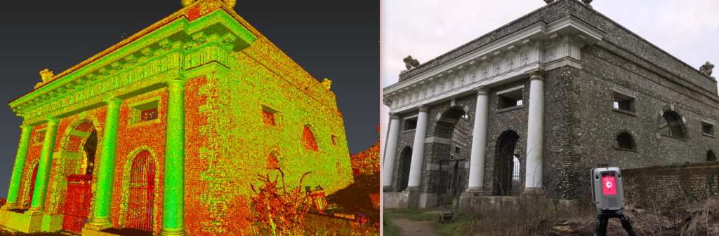
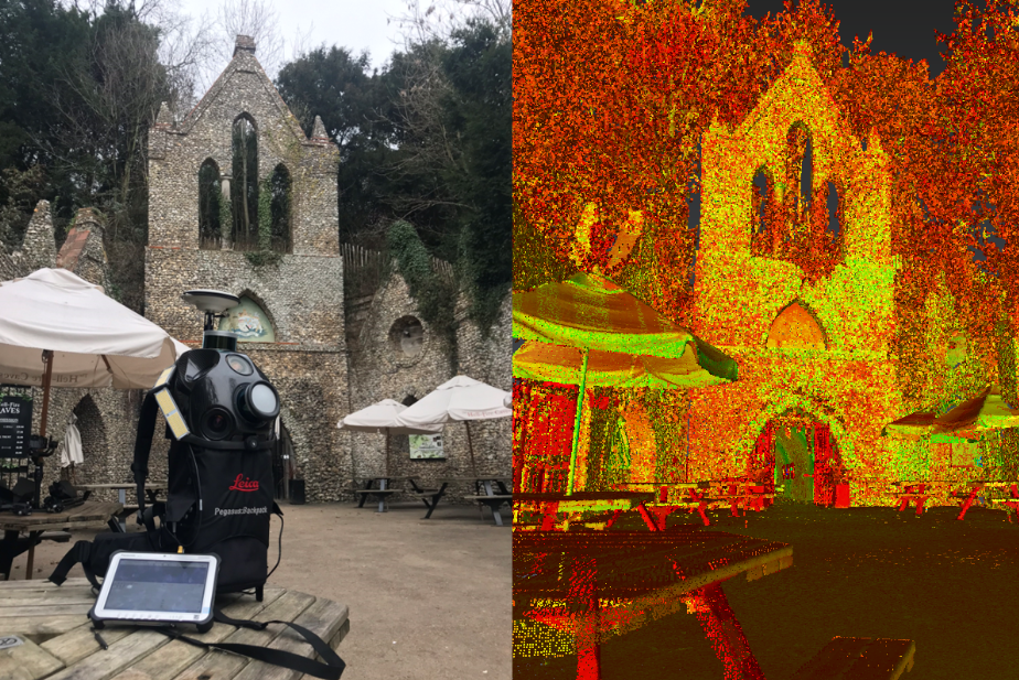
For the complete scanning of the caves Leica Geosystems also used the Leica RTC360 laser scanner to document and capture the complete environment in 3D. Preserving the history and every detail of the Mausoleum was crucial for the project, with the Leica RTC360 the team was able to capture accurate and reliable 3D representations of the site.
“For this project we have a range from mobile reality capture to static, for the static laser scanning we used the new Leica RTC360, which enables us from getting in and out of the nooks and crannies to scanning the finer details,” said Cairns. “Having both static and dynamic technologies working together in the same 3D space helps to bring the story together and that was a great advantage for this project.”
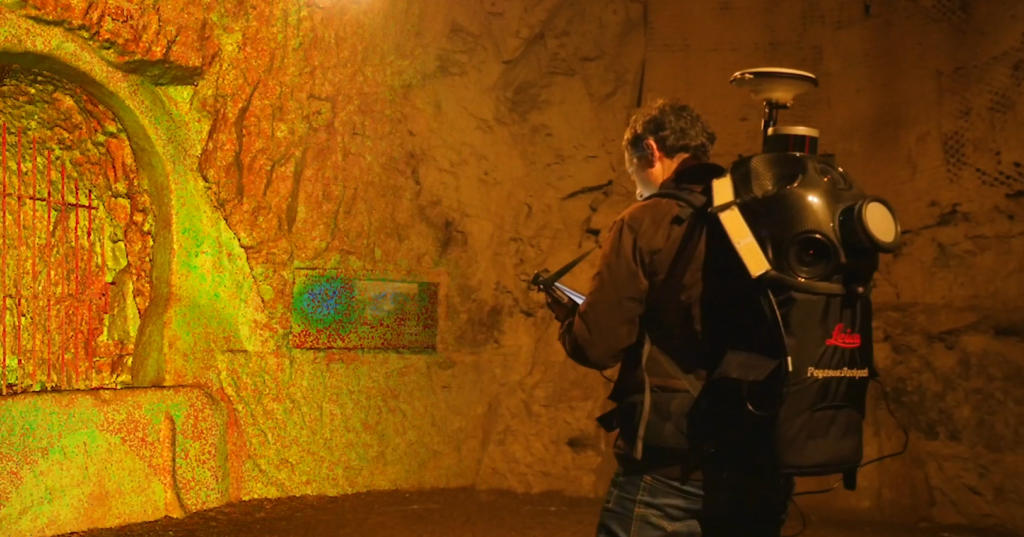
“The Leica Pegasus:Backpack allows users to create complete 3D models of any indoor, underground or difficult to access site. Without being an expert as such, you wear it, walk and capture in 3D any environment, more accessibility to mobile mapping technology is now a reality,” said Cairns.