


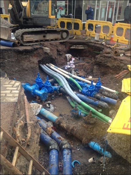
In the surveying world, there is a seemingly endless way to describe a utility survey. From mapping survey, PAS 128, Ground Penetrating Radar (GPR) survey, buried services survey to detection and location surveys. The common factor in all this terminology is the simple requirement to carry out a survey of buried infrastructure, using Electromagnetic Locators and GPR recording the line, position and depth of known, unknown, live, abandoned, metallic and non-metallic utilities and present the results in a clear and logical manner back to the client based on their specification requirement. There you go – it’s easy!
A quick history of utility surveying
Utility surveys have been around (as surveys in their own right) in various forms for over forty years. Historically, people have been using electromagnetic locating devices to detect pipes and cables since the early 20th century. The Electromagnetic Locator is still the first tool to go to when performing a utility survey.
The theory of detecting an EM field around buried conductors hasn’t changed since it was first investigated. Laws and rules of physics dictate how signals will behave when applied to various situations, so the way these signals are received and displayed back to the user is important.
The EM locator has evolved since the 1970s from a basic analogue needle-based display to very modern digital displays providing much information back to the user about signal strength, direction, current and much more. The same can be said for transmitter technology too which has made today’s equipment much more user-friendly, compact, rugged and efficient.
Back in the days
Starting out in the survey world as a teenager we had the only EM equipment on the market, a bag of tools and worked from the boot of a car – an estate car was a luxury! We were locating mostly metallic services – fibre optics were yet to become popular, GPS technology was a military application only and total stations were few and far between. Back then, survey data was mostly hand produced to scale on paper.
Since the late eighties, Ordnance Survey, a national mapping agency in the UK, plans has been setting the benchmarks and methodology for the surveyors and legislation of today. As a former employee of Ordnance Survey, we had simple rules back then; lift everything we could, trace everything we could, get answers for everything and don’t have loose ends. These are still my key points when performing a survey, why would they change? It’s only the equipment that has evolved, the theory is the same and the methodology should be almost the same when performing a survey.
As we moved through the nineties, a new piece of equipment started to be talked about; a machine that could see into the ground that would be the end of cable locators. Yes, the first GPR radar systems started to appear. I used my first GPR system in the early 2000s, but the legacy of ‘see all and no need for a cable locator’ still haunts the industry to some extent today. How some things have changed.
Redefining utility surveying
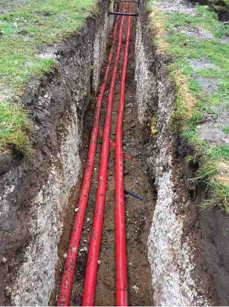
Today a utility survey can be a complicated beast, we’ve moved away from hard copies to digital collection. GPS/GNSS and total stations are now the norms for positioning accuracy as well as combining point cloud data and 3D modelling of the underground for the output. We have come a long way in a short time. Now, I work at Leica Geosystems where we offer a unique total solution for mapping and collecting data that can see your electromagnetic and GPR data issued to the client almost instantly depending on the final output requirements.
10 best practices for utility surveying
The key elements for a good survey today follow simple guidelines developed over the last forty years by many individuals and companies and are now widely accepted as the best methodology for successful surveys:
- Ensure your staff is trained and experienced enough to carry out the survey and have the necessary qualifications to competently perform to the client expectations. The minimum requirement that people ask for is ProQual Level 3 Certificate in Utility Mapping and Surveying (this qualification does not ‘make you a utility surveyor’ as it does not teach you how to use any equipment).
- Have a good specification from your client stating what they want and how they want it confirmed in writing.
- Be well prepared. Collect all available statutory undertakers’ information, the client may hold these already, so ask. Remember though, they have a ‘best before date’ in the UK with a three-month validity from date of issue and some issuers records are better than others in terms of information, legends, clarity and scale, so make sure that you can read and most importantly understand them. If the client does not hold these records, there are numerous companies in the UK who provide a collection service and other bespoke offerings for their presentation and a simple internet search will provide a solution.
- There may be a topographical survey available to fix your results to, again, ask.
- Do an initial site walk. Using the Statutory undertakers’ records, walk the site utilising the experience gained in the ProQual Level 3 Certificate in Utility Mapping and Surveying to perform a visual survey of the area. You must make the link between surface features, overhead lines, scars in the road, covers, and the records at hand, building up the survey in your head before even using any detection equipment. Keep an eye out for survey stations – if your using a supplied survey they will come in handy later in the survey.
- Be methodical in the way you execute the electromagnetic survey (admittedly this is easier said than done as your signals will always look for the path of least resistance as they return to you completing the circuit).
- Deploy your GPR correctly – it is a complementary tool for you to complete your survey and it doesn’t replace the cable locator. It too is bound by rules and laws of physics, which can and will impact the achievable effective performance.
- Use a simple but effective marking system for you and your client to understand what you’ve found. Street Works UK, formerly NJUG, gives guidelines for this.
- Collect your data efficiently, accurately and methodically, using photo or video evidence as a backup whilst processing data.
- Send the client exactly what they asked for at the beginning of this process.
Check out the Leica Detection Campus for courses, training and more.

Steve Davies
Global Trainer Detection Services at Leica Geosystems