Leica Geosystems has strong working relationships with academic institutions across the world. Nurturing students’ educational goals to partnering with researchers to create the latest measurement technologies, our commitment to advancing the field and future professional sometimes even brings former students into the company.
From academic to engineer
 Gabriele Colosimo is a software engineer within the Leica Geosystems Geomatics Division. He is responsible for the software development of SpiderQC. In this position, he conducts GNSS data analysis, quality checks, and a variety of data visualisation and screening operations. He also oversees the geodetic quality assessment of the Spider suite products, contributing to reviewing test procedures, test infrastructures, test results and applied methods.
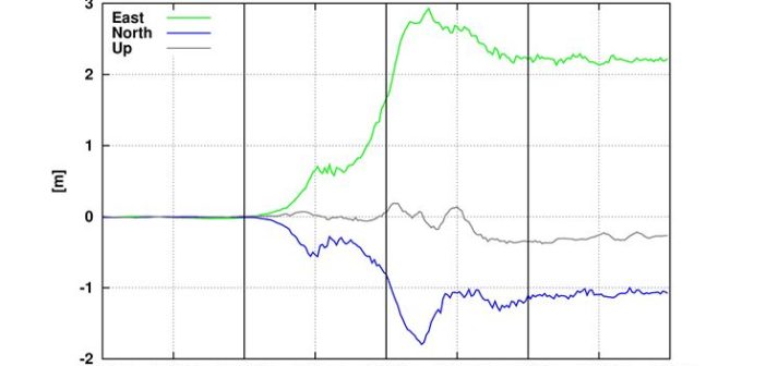
With Leica Geosystems since 2013, Colosimo came to work for the company after completing his doctoral thesis in GNSS seismic monitoring. His academic research at the La Sapienza University of Rome led to Leica Geosystems’ newest monitoring technology, VADASE, the world’s first GNSS monitoring solution integrated into a stand-alone receiver detecting fast movements of man-made and natural structures in real time.
“Personally, I believe some aspects of my work in the Geomatics Division are truly remarkable. I find interesting the challenge to improve reliability and quality of Leica Geosystems’ products. At the same time, the research towards new solutions for the market’s needs keeps me motivated and up to date with latest technologies results” said Colosimo. “As a fundamental component of my daily work, I like having the chance to grow and improve my skills and knowledge by being part of a team with heterogeneous and diverse expertise. Overall, I understand these are very convenient working conditions and pretty rare to find elsewhere; therefore I consider myself very lucky.”
Shaping change in monitoring
Colosimo was recognised for his groundbreaking work in 2010 when he and his research team were selected as the winners of that year’s European Satellite Navigation Competition, an event that brings together the leading global network of innovation and expertise in the field of GNSS. “The major advancement of the proposed solution introduces a novel strategy in performing real-time estimation of coseismic displacement and waveforms accurate down to a few centimetres,” read the award description.
 In light of the five-year anniversary of the award and Leica Geosystems’ recent release of VADASE, Colosimo, together with his former University colleagues, was invited to the Satellite Masters Conference, a combined awards ceremony for the ESNC and Copernicus Masters, this year to present on the success of turning VADASE from an academic theory into an industry solution. His presentation took place during the Managing Disasters and Security with Data from Space session 21 October.
“I think this is quite a nice example of how an idea born on the university side can grow, develop and finally become a working and valuable solution for professionals,” said Colosimo. “I was very proud in 2010 to see my research recognised at the competition level, but to now see the result of many working efforts being used out in the the field to not only help the industry but also to protect people all over the world is an honour beyond words.”
To download Colosimo’s presentation, click here.


