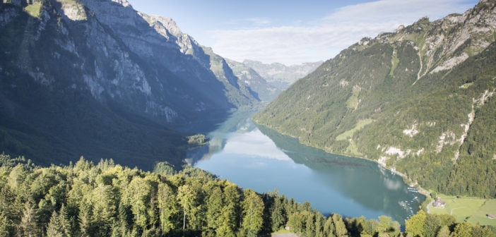
Determining the volume of a lake and the impact of changing water level seems to be a challenging undertaking, but having to do this in a remote area adds another layer of complexity. IngenieurTeam GEO GmbH from Karlsruhe, Germany, chose an innovative approach to generate a 3D map of an alpine lake below and above the water level in order to precisely determine its energy capacity. This article puts the spotlight on how the team combined newest technologies to reach levels of accuracy like never before in a remote area where losing GNSS RTK positions is unavoidable.
Natural lake serving as an energy reservoir in the Alps
The Kloentalersee is a natural lake situated in the Swiss Alps at 848 metres above sea level. Since 1908 it has been used as a reservoir, storing water for the production of electrical energy. A bulk dam (220 metres long, 21.5 metres high) increases the lake’s capacity to a maximum of approximately 39.8 million cubic metres of water. This water is used in the Loentsch hydropower plant to produce consumption-adjusted peak-load energy.
The task: Highly accurate determination of the water volume available at any water gauge
In 2016 IngenieurTeam GEO GmbH based in Karlsruhe, Germany was assigned to precisely map the lake. The contract was awarded by the owner of the Loentsch power plant, the AXPO Group, one of Switzerland’s major energy providers. The task was to capture the lake’s soiling situation and create a detailed 3D map of the lake’s ground. The purpose of the project was to be able to accurately calculate the water volume available at any water gauge. The 3D map had to be geo-referenced to the Swiss national coordinate system “LV03”.
An innovative approach combining newest technologies
The requested accuracy of a few centimetres was an extreme challenge, with no proven method existing to achieve it. In order to fulfill the accuracy requirement, IngenieurTeam GEO developed a completely new approach, a combination of three technologies:
- Hydrography using multibeam sonar
- Aerial photogrammetry using an unmanned aerial vehicle (UAV)
- Global navigation satellite system (GNSS) positioning technology with SmartLink by Leica Geosystems, as a key element to accurately reference the multibeam sonar and the UAV even under circumstances when RTK corrections have outages due to the surroundings.

High precision geo-referencing
For the high-precision hydrography IngenieurTeam GEO used the special sounding boat “Surveyor” equipped with a Teledyne Reson SeaBat 8101 Multibeam Echosounder. A Leica Viva GS16 GNSS smart antenna – mounted onto the cabin roof – should record the boat’s GNSS coordinates and assign them in real time with the sonar data with an accuracy of 1 to 3 cm.
For the UAV-based photogrammetry the team decided to use the Aibotix Aibot X6 UAV with the Aibot HP GNSS 2 RTK, a dual-frequency L1/L2 GNSS module. Aibotix is part of Hexagon Geosystems.
Before the measurements could start, the coordinates of 27 visual ground control points (GCPs) around the lake had to be measured. This was done with the Leica Viva GS16 GNSS smart antenna and with SmartLink for the most reliable real-time performance.

Challenge: Possible GNSS RTK position interruptions
Before starting their measurements, the experts had to make sure that the steep mountain slopes in close proximity to the water’s edge would not cause any problem to the GNSS positioning technique. The surrounding is challenging in two aspects:
- GNSS signals are obstructed in such an area and the use of multi constellation and multi frequency was key.
- The steep 2000 metre mountain face caused lots of cell phone outages – with the consequence that the positioning accuracy would have suddenly decreased from centimetres to metres.
Those interruptions could have been corrected by post-processing GNSS data, a very time consuming additional manual process step.
Additionally, the loss of GNSS RTK correction data would also mean the loss of quality control in real time. Real-time quality control is crucial to the 3D mapping experts. It gives them immediate assurance that their measurements are complete and that they have not missed to measure parts of the ground due to shadowing effects.
SmartLink: Real time L-band correction data in remote areas
With the deployment of Leica SmartLink, the problem to perform high-precision GNSS measurements in a completely remote area was easily overcome. Powered by Veripos, which is part of Hexagon Geosystems, seven geo-stationary satellites transmit L-band corrections SmartLink enables centimetre-level positioning accuracy while being independent of local RTK services.
Depending on whether the communication link to the local RTK service is available or not, the GS16 smart antenna automatically decides to switch to the extra-terrestrial SmartLink L-band service. The user does not have to take care or interact and normally does not even take notice if the Leica Geosystems GNSS smart antenna switches from the local terrestrial RTK service to SmartLink, with the benefit that precise measurements are not interrupted at all.
Astonishing results successfully delivered

Final result: 3D model of the Kloentalersee (screenshot by IngenieurTeam GEO GmbH)
IngenieurTeam GEO managed to successfully execute all measurements according to their plan in the autumn of 2016. The following results were delivered to the AXPO group’s satisfaction:
- Point cloud containing almost 135 million XYZ coordinates
- Recording of all 2’855’204 square metres of the Kloentalersee in just five days
- 4’400 high-resolution aerial images
- An accurate and reliable 3D model
- Precise topographic map with elevation lines
The desired outcome was fully achieved: AXPO is now able to exactly determine the lake’s water volume at any water gauge.
“The results of our new 3D mapping approach are ground-breaking. The Leica GS16 with SmartLink and multi-constellation support was a key element to successfully achieve these results,” Benjamin Busse, UAV Pilot, IngenieurTeam GEO GmbH, Karlsruhe, Germany.
To learn more about SmartLink and SmartLink fill, watch these videos:

Xiaoguang Luo,
Product Engineer GNSS
Leica Geosystems AG, Heerbrugg, Switzerland
Cover Image by Samuel Truempy Photography under Creative Commons CC BY 2.0


