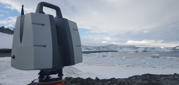
Severn Partnership uses Leica Geosystems solutions to support move of arctic research station.
After 17 years absent from Antarctica, Severn Partnership returned in January 2016 to prepare the unprecedented move of the Halley VI research station off an increasingly unstable floating ice shelf.
The route to Halley has seen Severn Partnership Associate Director Anett Dude land at Rothera Research station for what should have been a wait for the transfer flight to Halley some 1,000 miles south from Rothera. However, Leica Geosystems UK, who are providing the precise mapping solutions to facilitate the works planned at Halley, had also supplied the latest terrestrial Laser Scanner P40 to be used at Rothera.
Laser scanning without delay
All laser scanning, total station and GPS equipment is routinely delivered in flight cases and transferred halfway across the world on four flights over three days, posing little concern.
 Upon arrival, Anett attempted to locate the remains of existing survey control, which had been established by Severn Partnership over 17 years previous. In the meantime further buildings had been added to the base, and, yet, four survey control stations remained in an usable state.
Over the following week, Anett completed the external laser scanning of the entire base in approximately 100 separate scan setups, including the runway. This required close liaison with air traffic control to ensure non-disrupted continuation of flight operations. The short scan times of around three minutes per setup allowed the static capture top quality data of a 1km runway in less than a day’s work with no requirement to shut down the runway.
The P40’s range of a quoted 270m was put to the test and a whopping 264m was achieved. Obtaining measurements so close to its maximum range in site temperatures of -10°C degrees are well within its extreme temperatures ranging from -20° C to +50° C. This performance is testament to its ability to perform to its impressive specifications even in the most challenging environmental conditions.
“When planning for this challenging project, our only equipment consideration was to use Leica Geosystems. Their solutions have been tried and tested at the extreme temperatures that we would experience in Antarctica, which means we did not have to worry about potential downtime or inaccurate measurements,” explains Mark Combes, managing director at Severn Partnership.
In addition, selected buildings were captured internally, such as the generator building and the aircraft hangar.
The scan data was combined and mapped onto the existing survey control with a global error of less than 7mm over an area of nearly 1 square kilometre. Internal accuracies of less than 3mm were achieved.
Accurate laser scanning for efficient operations
To help non-technical stakeholders visualise the site, Anett captured panoramic imagery across the research station. This information can be augmented onto the generated model to add detail.
BAS representatives in Rothera have reviewed the data and are forming strategies on how to maximise the use of the 3D model derived from the scanned information. Various projects as part of the BAS 2020 initiative are in their feasibility stage and all will draw information from the spatial model generated. Such projects include the redevelopment of the wharf to accommodate a new £200m purpose built research vessel. Scientists are also keen to understand how to gain efficiencies by minimising transport routes through careful storage and depot planning.
The provision of this information would not be possible without the provision of the laser scanning instruments through Leica Geosystems, as only a small window of opportunity was available to capture it. British Antarctic Survey and Severn Partnership are grateful for this provision and the data captured with the Leica P40 will be at the heart of a modernised and more efficient Antarctic Research Station at Rothera.
 Natalie Binder is the marketing and communications manager at Leica Geosystems UK. She is responsible for marketing and communications plan and strategy through innovative marketing campaigns, PR and digital media.


