


Thomas Harring, President Hexagon’s Geosystems Division
I have attended INTERGEO for 20 years and always enjoy meeting the geospatial community and other professionals interested in geospatial technologies. INTERGEO is a fixed event on my agenda, and I’ve always learned a lot.
Hexagon will be at INTERGEO 2022 in Essen to connect with long-standing customers and partners and meet new people from the industry. In this blog, I would like to exemplify why you should join us at this year’s annual event for the international geospatial community.
1. Learn how you can go beyond the digital twin to create Smart Digital Realities
INTERGEO 2022 will be highlighting the topic of digital twins. Digital twins are merely digital representations of reality. At Hexagon, we prefer to talk about Smart Digital Realities, which are much more impactful. Smart Digital Realities are real-time — that is, continuously updated — digital representations of an object or an environment where the real and digital world fuse into one reality. They are intelligent because they include relevant information and insights and drive our vision of an autonomous future in which industry, people and the planet sustainably thrive.
Visit the Hexagon booth to witness how we bring autonomy to the digital twin to transform its function and utility far beyond a single source of truth.
2. Experience the technology to sustainably design, build and maintain cities and infrastructure
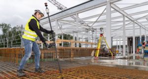
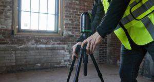
We empower geospatial professionals to capture, create and manage data sets to build a Smart Digital Reality, reimagining our cities and infrastructure. Our customers use Hexagon’s innovative sensing and software solutions to build connections among people, assets and data to facilitate better collaboration, faster decision making and safer work environments.
These are the most important products and innovations Hexagon will show at INTERGEO:
- Leica AP20 AutoPole is a unique and productivity-boosting smart solution for our robotic total stations, removing the last analogue steps in your digital survey workflow.
- Leica BLK360 is a supercharged next-gen imaging laser scanner. It is faster, smaller and easier to use than ever before.
- Leica Pegasus TRK Neo is a reality capture mobile mapping system, introducing artificial intelligence, autonomous workflows and intuitive interfaces.
-
- Leica AP20 AutoPole
-
- Leica BLK360
-

- Leica Pegasus TRK Neo
Visit us in Hall 3 to discover the technology to sustainably design, build or maintain the infrastructures that shape our world and create our future. Experts at our booth will answer your questions and provide hands-on demos.
3. Explore how industry trends can help you overcome industry obstacles
It seems predictions have become even more difficult in recent years amid geopolitical tension and increasing market uncertainty, which are undoubtedly challenges we see. However, we do not doubt that the next five to ten years will be exciting for the geospatial industry. Because of that, we must tackle the talent shortage – another one of the industry’s obstacles. It is our job — as a company and as an industry — to make young people aware of the attractive career opportunities in the geospatial industry.
Mid- to long-term obstacles are the pace of technology adoption and innovation diffusion. Still, easier-to-use sensor technologies and more intuitive software continue to make geospatial technologies more efficient, and accessible and expand its user base.
Discover the technology that can help grow your business, have the upper hand in attracting and retaining the best talent, win more business and generate new revenue. Learn how our solutions leverage technologies like AI, machine learning, edge computing, and cloud processing to support the real-time collaboration and transformation of data into intelligent information, helping you to reduce waste, rework and human intervention.
4. Get inspired on how you can play an active role in protecting the planet and your people while generating profit
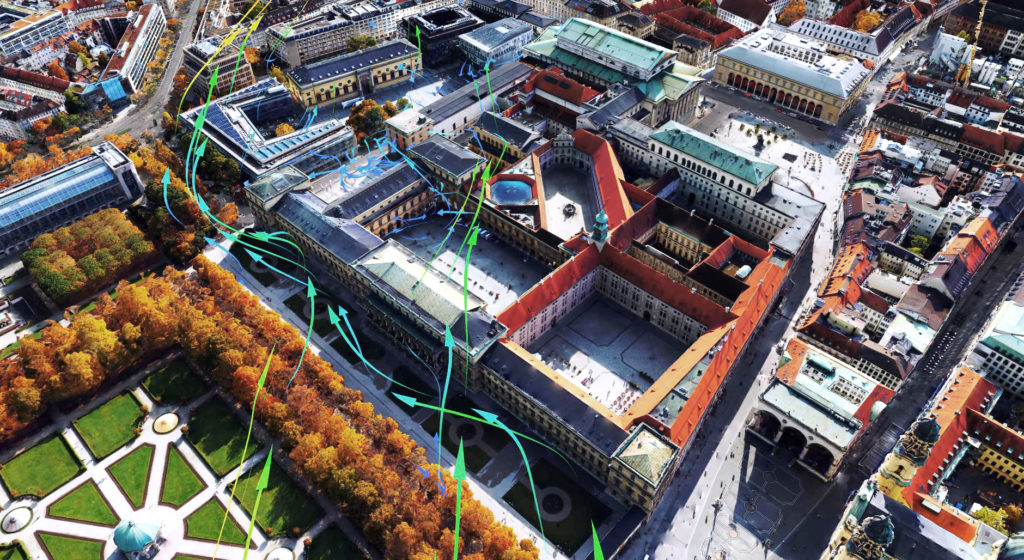
Sustainability will be an integral part of our business and, more broadly, the geospatial industry and will provide additional potential for customer solutions. Smart Digital Realities empower us to protect the planet, and geospatial professionals are key in creating them. Smart Digital Realities enable, for instance, policymakers to solve complex challenges, such as tackling urban overheating. The models enable simulation of various scenarios such as wind circulation and air exchange and inform decisions for structural measures to improve the urban climate long-term. Smart Digital Realities also allow decision-makers to make errors before investing — without affecting lives, damaging the environment and wasting resources.
Experts at our booth can show you how Smart Digital Realities empower you with the most accurate and complete geospatial data, automated processing and interconnected systems to make you more productive, more efficient and less wasteful, reducing the overall environmental costs of business operations.
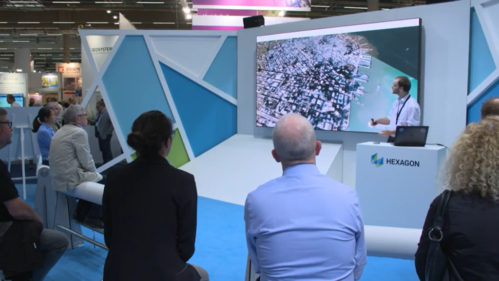
5. Discuss trends, business ideas and shared challenges in face-to-face conversations
I enjoy networking with the geospatial community and sharing information in the fair and conference program. Seeing many customers and business partners again will be great. It is always a pleasure to put our latest technology into your hands and watch users discover our workflows. We look forward to discussing long-term trends, concrete business ideas and shared challenges in face-to-face conversations.
With a large and comfortable lounge area, our booth will provide the right environment to reconnect with long-standing customers and colleagues and also meet new people from the industry