


Being a surveyor is the best job in the world. The days are never the same – each one brings a new challenge to resolve, an unknown environment explore, and a heavy responsibility that only unloads with a job well done. Surveyors are also superheroes, often supporting other engineering sciences with little credit. Still, they are the ones who make sure that a bridge built from both sides meets in the middle, and that a tunnel bored from each side of the mountain doesn’t result in two tunnels.
Surveyors may seem fearless, but there is one task that has a “kryptonite” effect on them, at least until they realise that the shiny green stone is, in fact, an emerald: MONITORING! It is often perceived as a “freaky thing no one understands” and there is even a special breed of surveyors called “monitoring specialists” capable of monitoring. Unlike surveying, automated monitoring includes 24/7 power supply and communication components, which aren’t taught at surveying universities or colleges.
But, to complete the monitoring tasks, do you really need to get deep into automatic monitoring? Is the step from surveying to monitoring a giant leap?
In this blog, I walk you through small steps to take the leap from surveying to monitoring.
STEP 1: Starting small
Understanding the problem is half of the solution, so let’s start with the question: What is monitoring?
To put it in simple words, monitoring is nothing more than repeatedly surveying the same object and comparing the results. So it is something every surveyor has already done before, at least to a certain degree.
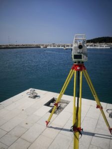
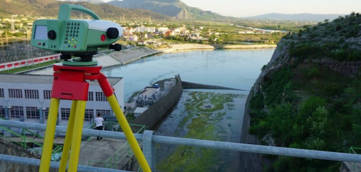
The most common way surveyors start with monitoring is when the periodic check of an object is needed, such as yearly dam levelling, bi-monthly surveying of a seawall, or weekly surveying of a bridge during its reconstruction.
Tasks like these are the first step from surveying to monitoring. Truth be told, this doesn’t seem so much different from “regular” surveying. For a proud owner of a Leica level (e.g. LS10/LS15) and a surveying total station like the Leica Viva TS16, tasks like these are executed by using Leica Captivate apps, Leica Infinity, and potentially Excel to calculate displacements, which are the changes in position between measurements. This first step of the campaign (periodic) monitoring is called manual monitoring.
STEP 2: When you need to go beyond manual monitoring
The trouble usually starts when a large number of points need to be measured in shorter intervals (e.g. once a day) with a campaign monitoring method. At this point, it becomes very time consuming to measure them manually, drive to the office, process the data, create a report, and send it out to whoever needs it. Not only is this inefficient, but also prone to errors, and it is every surveyor’s nightmare to reach the office and realise one point measurement was accidentally missed.
Wouldn’t it be great to see the measurement results already in the field?
You might be thinking that having a complete monitoring dataset with a generated measurement report in the field before even reaching the office is simply too much and definitely not possible on a surveying instrument like the TS16. But in fact, it is all possible – and easier than you think.
To take the next step and benefit from semi-automated data acquisition, you’ll need the onboard Captivate TPS Monitoring app. It is preloaded on every TS16 instrument and ready for trial use. If it’s missing on your instrument, you can easily download it from myWorld, Leica Geosystems’ customer portal, and load it to the total station.
So, what makes this app so special? Why can it complete the job better than other onboard apps?
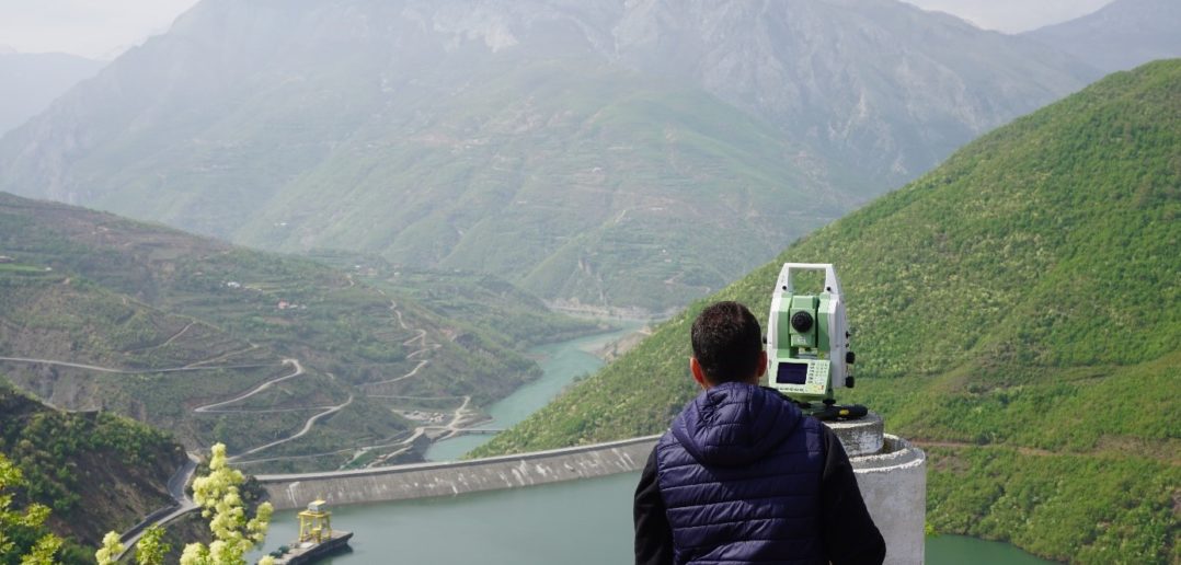
The TPS Monitoring app was developed to automate repeated measurements, and it is also the first move towards automating the monitoring process. The surveyor first needs to “teach” the instrument which points to measure by doing normal surveying measurements. After that, the app will automatically measure the points with the push of a button, and even perform quality checks as it does the measurements.
Of course, the surveyor decides how many rounds of measurements are needed, and defines the reference (control) points and the monitoring points. At the end of the process, all the points in the instrument’s line of sight are measured with the highest accuracy using Automatic Target Recognition (ATR). The latest developments enhance the autonomous workflow, as the app can now compare the calculated deformation to defined tolerances and automatically notify stakeholders over email in case movements exceed the thresholds.
STEP 3: Optimising the workflow
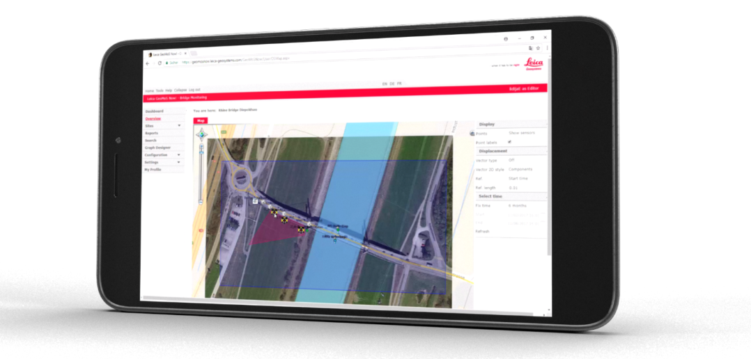
The TPS Monitoring app significantly optimises the data acquisition workflow by increasing measurement quality and efficiency while reducing errors and operational resources. But there is still a lot of work to be done before sending the final report to a client or a stakeholder. This is where GeoMoS Now! Survey Edition (SE) comes into play, a cloud-based service for the visualisation and analysis of monitoring data.
Is there a link between the TPS Monitoring app and the cloud service? How can the measured data reach the cloud and how to start using the cloud service?
To begin with, the only thing that’s required is a smartphone. Each GeoMoS Now! SE user gets credentials that need to be entered into the TPS Monitoring app. A hotspot function on the smartphone can be used to share the internet connection with the total station. Nothing more is needed for the measurements to reach the cloud.
By using the smartphone browser and the login credentials from the TPS Monitoring app, the measured data can be imported into the project. As soon as this is done, the graphs with calculated displacements are automatically created on the dashboard. The whole process is automatic and the user can define the frequency of data sync. In case of a missing internet connection, the data transfer can also be done by using the SD card, the same as with any coordinate import or data transfer of levelling, total station, and GNSS data.
Instantly accessing measurement results while standing next to the instrument in the field is a huge step forward in the workflow. However, there is still one task that needs to be completed before your monitoring work is completed: creating a report and sending it to the responsible person. This is also easily done within GeoMoS Now! SE. You can create a fully customized report template, and automatically generated reports will be emailed to recipients according to a user-defined schedule.
In this workflow, from the moment you push a button on the instrument till the moment you receive a monitoring report, the whole process runs automatically. This is why such a method is called semi-automated campaign monitoring.
What does this workflow mean for a surveying company?
Semi-automated campaign monitoring is a great time- and cost-saver. There is no need to drive back to the office and lose time on something that can already be done in the field. The time saved with the new workflow can be used for several other site visits and measurement campaigns. As the number of campaign monitoring projects grows, you will start seeing a bigger return on investment, resulting in more profit.
What comes after campaign monitoring?
Let’s summarise the steps we took so far.
- We started with manual monitoring, where the normal surveying workflow with some help from Excel is needed to complete campaign monitoring tasks.
- The second step introduced optimisations to the data acquisition process for campaign monitoring by using the TPS monitoring app.
- With the third step, we further optimised the workflow by automating the processing, visualisation, and reporting tasks, and eliminated the need for office work with GeoMoS Now! Survey Edition.
What happens if the measurements need to be taken continuously?
In that case, campaign monitoring won’t be able to meet requirements and you will need to install an automated monitoring system, but this is a topic big enough for a new blog post.
Is it worth investing in semi–automated campaign monitoring solution if it doesn’t fit all purposes?
Absolutely yes, because most monitoring projects can be carried out with semi-automated monitoring, whereas using automated monitoring would be an “overkill” on many projects and a poor investment.
What is the future of campaign monitoring?
A wise man once said, “Things always need monitoring.” Cities are growing, construction has never been faster, and the safety of people and equipment has never been more important. Campaign monitoring may be a step out of the comfort zone for surveyors, but it is not a difficult step, nor a step into the unknown.
Adding monitoring to your company’s service offering has the huge potential of making it even more interesting, successful, and profitable. So don’t hesitate and grow your business with monitoring!
Being a surveyor is the best job in the world. Having the opportunity to use high-quality instruments and software opens new doors for surveying companies and makes surveying superheroes invincible.
Please contact us to get started with monitoring.

Lidija Spiranec, Senior Product Engineer Monitoring Solutions