


Collecting data is just one step of the surveying process. Between planning and making the final deliverable to the client, there are many stages and steps in the cycle of every surveying job.
Whether you are transferring your data between the field and the office, preparing a design or Digital Terrain Model (DTM), or uploading data to your instrument, surveying office software is in the heart of the operation and simplifies and supports your workflow. Leica Infinity surveying office software empowers you in every step, be it visualising, preparing, collecting, processing, confirming, reporting and sharing data.
In this blog, we explore tips and benefits on how surveying office software can simplify your workflow throughout the four pillars of a surveying job:
- Preparing and connecting
- Measure and locate
- Process and report
- Share and deliver
-
Prepare and connect
Tip: Look for office software that allows you to visualise and connect data, extract fieldwork packages and access to services.
When preparing data, you have to check data formats can be imported to your instrument and the data flow from CAD, BIM or GIS is smooth.
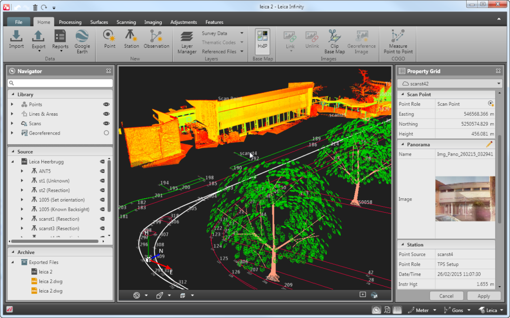
A surveying office software that recognises file formats and lets you visualise data in 3D can help to save time as users can interact with data and confirm correctness. It is also much easier to work on large data files on a computer than in the field.
With greater situational awareness, time on site can be more efficient. Surveying office software with 3D visualisation and integrated background maps that show physical situation can help users to understand the environment and visualise job locations.
Infinite benefits:
Beyond sending and receiving data from to the field to generate GIS, BIM, CAD output, Infinity allows you to:
- Prepare data easily before going to the field with georeferenced images, easy import, view and filter in most industry-standard data formats, such as DXF/DWG, IFC, InfraGML.
- Visualise data in a 3D view for a wide range of applications (e.g. infra-design, contour/topo features, report or BIM.)
- Prepare survey or infrastructure data for field crews including roads, surfaces, control points and stakeout data for Leica Captivate, iCON field and Leica FlexLine.
- Have complete spatial awareness with HxGN Content Program and default base maps.
- Connect to Leica Geosystems services and other data services, such as Bentley ProjectWise, Autodesk BIM360 & BricSYS 24/7, ESRI ArcGIS.
- Integrate easy-to-use map services, such as WFS/WMS/WMTS.
- Integrated workflow with Leica Geosystems’ surveying sensors.
-
Measure and stake
Tip: Look for office software that allows you to collect, group and combine survey data.
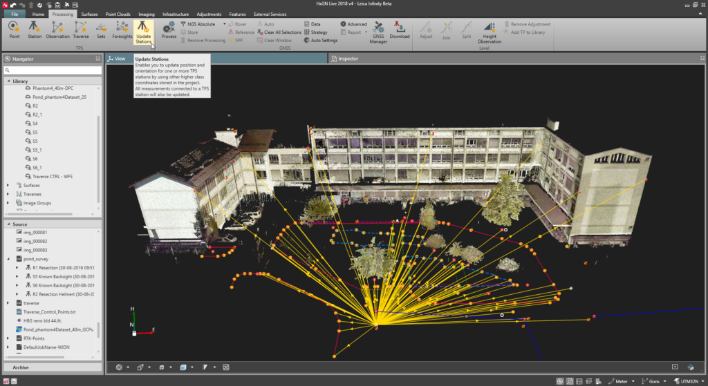
If you have different instruments, you might be having diverse software. Having just one software that combines all your surveying data (total stations, GNSS, levels, UAV) helps you to consolidate, manage and process different types of data in one project. You have to have the confidence you will get everything processed together in the office.
Ensure your team in the office and the field have the same data and can access it when they need. There is no need to wait for the crews to be back at the office to be able to update data. Also, working with software that allows you to measure points later in the office can save time used in the field doing measurements.
Infinite benefits:
Whether doing a classic cadastral job with total stations, GNSS, or a reality capture workflow with images to point clouds, orthophotos, or DTMs, Infinity is an easy-to-use data management software that will ease your measurement and staking tasks. Infinity allows you to:
- Import design (CAD, IFC, Revit etc.) to field crews.
- Plan the fieldwork – Defining survey technique and required equipment.
- Extract the required data and coordinates from design files.
- Get the controls to the side grid by applying the coordinate systems.
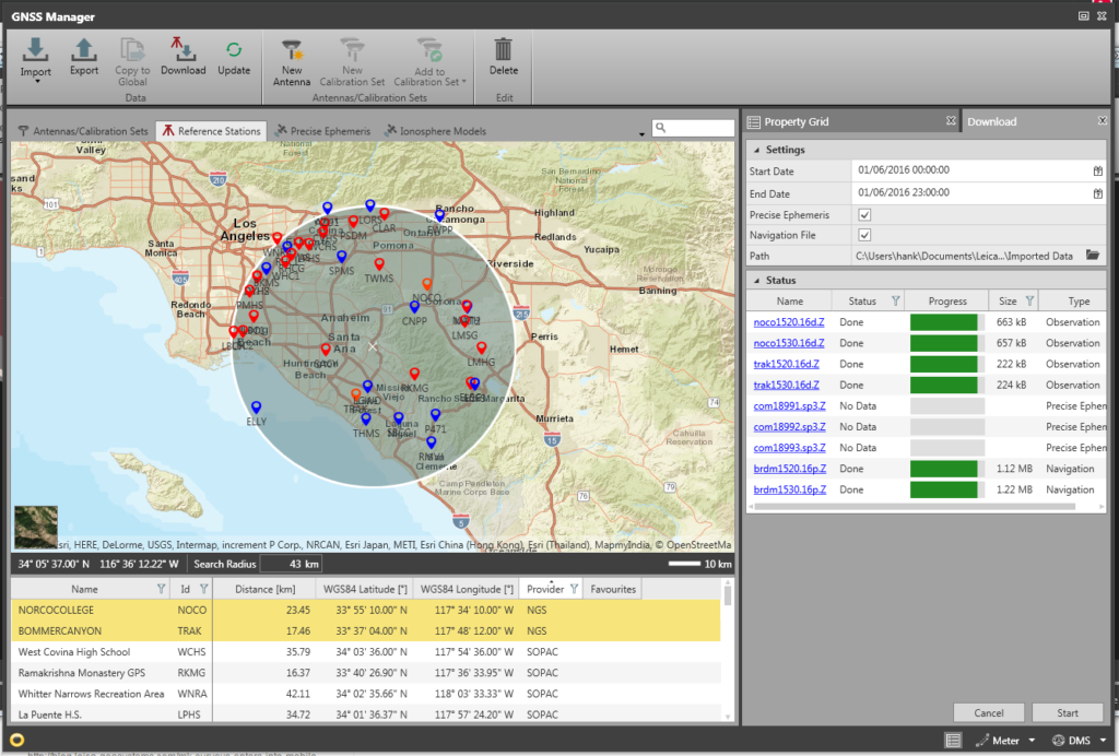
- Access coordinates systems available in localisation tools and satellite prediction for planning and schedule of field works.
- Send all necessary files to the field crews with connecting tools.
-
Data process and report on results
Tip: Look for office software that helps you to quality control (network adjust) and confirm.
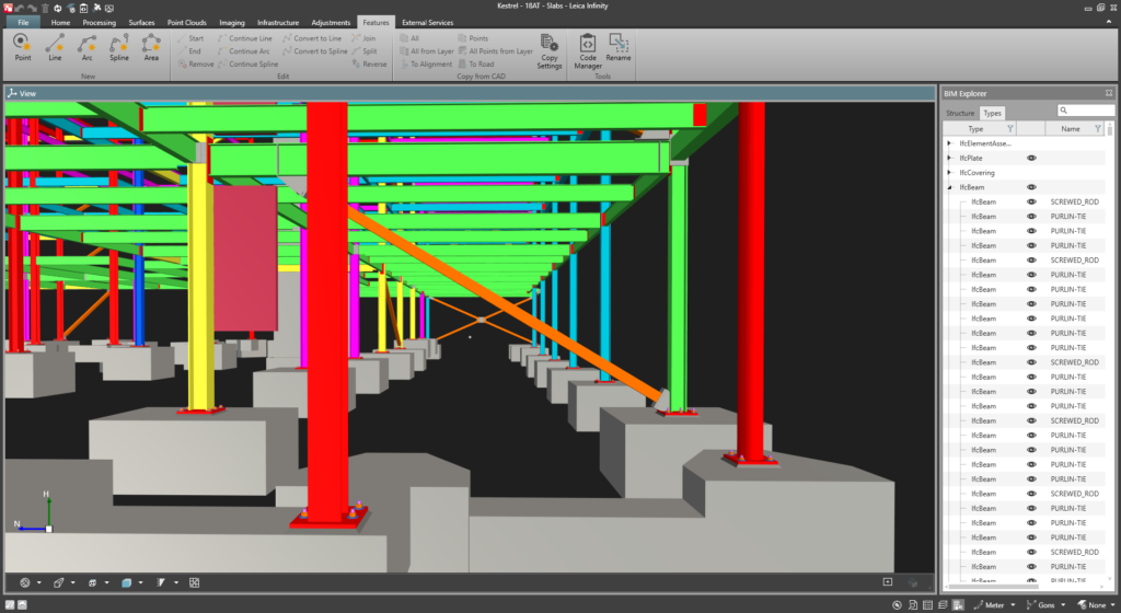
After collection, data processing allows surveyors to turn data into information and unlock numerous applications. Inspection, accuracy checks, measurement quality, standard deviations, volume computations, DTMs, surfaces, feature creation or extraction, are just some of the tasks that office surveying software can support. But data is only valuable if you know you can trust the accuracy of the data matches the project requirements.
Easily differentiating the fieldwork between survey and stakeout applications can help to save you time and make reporting easier and efficient.
When doing data processing in the office, field problems might not always be visible. Reports are helpful to see data in detail, perform quality checks, check with the design, and share progress between your team or clients.
Surveying office software can also help you keep all the details from sensor type, sensor FW, and job user to identify which imported job data was the source for an error that affected fieldwork and be sure you are having the right tolerance checks on data imports.
Infinite benefits:
Infinity is an easy to use tool for data processing, reporting and viewing results. Other benefits include:
- Import and process terrestrial data, including precise heights along with GNSS triple-frequency multi-constellation data.
- Derive point clouds, DTMs and orthophotos from images collected with a UAV or Leica GS18 I.
- Generate reports, document and QC your project for complete traceability.
- Identify instrument serial number and user which was a source of measurement uncertainty.
- Create surfaces and volume calculations from point clouds.
- Compare surfaces and generate out of tolerance differences.
-
Share and deliver
Tip: Look for a surveying office software that helps you to keep clients and teams informed and archive completed work packages.
Data sharing is important to keep everyone up to date. When data can be shared directly to or through cloud services, you can easily distribute the latest data to users and machines directly without extra effort.
When selecting an office surveying software, look for a solution that allows you to manage and share your data in various formats and from numerous segments through one platform.
Infinite benefits:
- Transfer data efficiently with Leica Exchange and Leica ConX data services.
- Use, for example, Autodesk BIM 360 or Esri ArcGIS integration for import and export.
- Provide deliverables in numerous formats.
Read how businesses are taking full advantage of Infinity or watch the webinar “10 key features of Leica Infinity survey software.”
Discover the benefits of Infinity.