We’ve all heard the expression ‘a picture paints a thousand words’. It takes us back to a time when an artist could spend days, weeks, or even years working on an image so we might admire the scenery or a landscape in the future. In essence, it provides us with a snapshot in time. But what might this expression mean in today’s digital and technology-driven world?
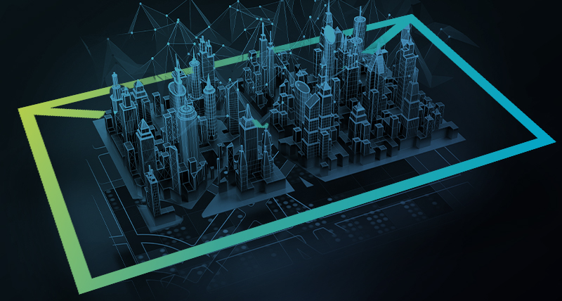
Today, we need detailed images of the surrounding landscape, not necessarily to admire the view, but so we can turn that data into useful insights. Thanks to 3D laser scanning and reality capture technology from Leica Geosystems we’re able to create accurate images of what we can and can’t see around us.
We’ll explain what the latest Leica TruView update means for users, why interoperability and converging technologies are changing the landscape for the better, and what the future might hold.
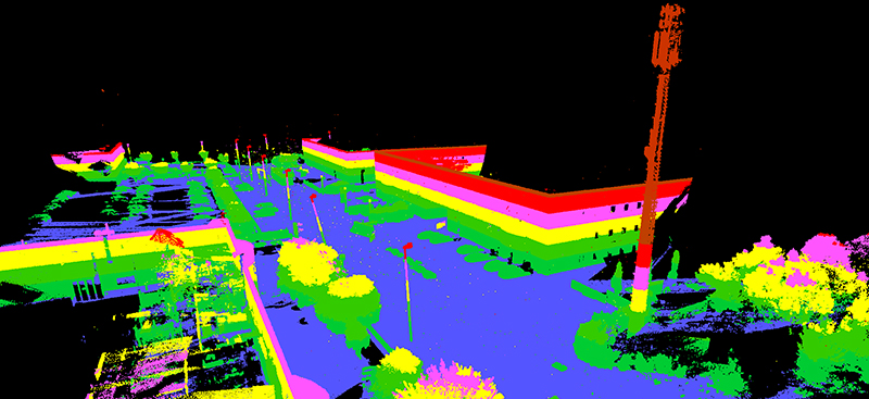
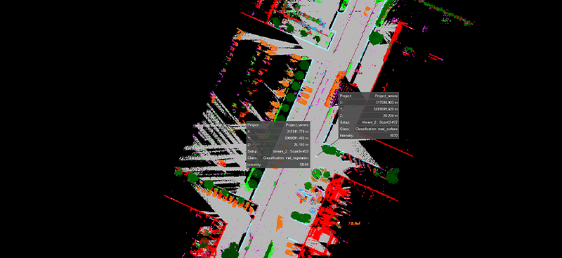
Render by elevation Leica TruView.
TruView: Redefine the way you see the world around you
Using Leica Geosystems’ 3D laser scanning solutions to generate images of the world around us is not new. But what is new is the evolution of this technology, which has resulted in lightning-fast snapshots being collected, analysed, and processed so professional users around the world can create accurate 3D models for town planning, maintenance, and more.
It means highways can be maintained remotely, underground sewage systems can be monitored, and the sustainable cities of the future can be built to last. This is partly why the industry is becoming reliant on accurate real-time data – it informs decision-making that enhances our everyday lives, whether we’re aware of it or not.
Leica Geosystems’ TruView technology is evolving to bring together standalone elements of reality capture, so data from Mobile Mapping Systems (MMS) and Terrestrial Laser Scanning (TLS) solutions can be viewed on one platform, to enhance point cloud data sharing and model designs.
But that’s not all. Today’s technology is more agile, responsive, mobile, and user-friendly than ever before. All these factors are driving industry efficiency while bringing technologies together and enabling cross-platform data sharing. It is this convergence and integration that is taking laser scanning technology to the next level.
For instance, TruView was developed to enable users to view and share reality capture data easily. This means project managers around the world can organise virtual site visits and conduct inspections from anywhere. The collaborative point cloud data sharing solution has gone from strength to strength and has been further enhanced after receiving a major release.
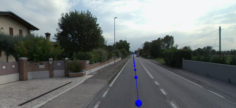
Mobile navigation within Leica TruView
What’s new with TruView?
The highlight of the 2022.1 release is the integration of MMS features-giving users the ability to fully fuse data from all of their reality capture sensors. TruView now has the capacity to explore MMS and TLS data and features typically associated with the Leica Pegasus: WebViewer. This is an important update because it signifies the next evolution within laser scanning software is already underway.
In the past, data collected from different sources has been processed and ultimately viewed in separate products because there haven’t been viewing platforms in place which supported the needs of both TLS and MMS users. The new TruView release provides a unified platform for viewing while paving the way for further integration with reality capture solutions in the future.
Users can explore projects using the traditional navigation tools, and even simulate driving along the vehicle path, clicking anywhere on the track. There’s an option to clip MMS data by time in addition to clipping it geometrically – both can be applied simultaneously. The data rendering element has also been updated to enhance the analysis process.
In the not-too-distant future, TruView will offer users the flexibility to review their data and create queries while it’s syncing. GeoTag handling and visibility will be improved to give users more control and enhanced rendering options. And project managers will be able to streamline their work by removing files that are no longer needed to maintain the security and integrity of assets associated with a project.
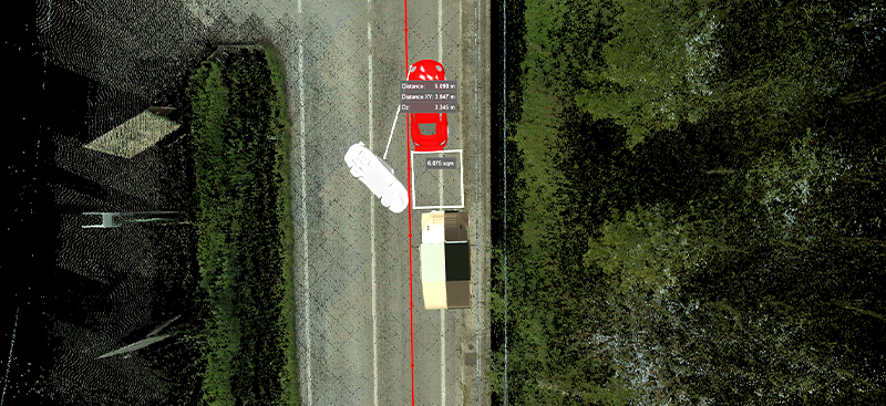
Render point cloud by class.
The future? It’s collaborative
Cross-platform integration is key because bringing different technologies together is arguably the only way to create hyperrealism in Virtual Reality (VR). Users of 3D laser scanning technologies are increasingly interested in realism to create an immersive experience. In the future, this could be for remote enterprise asset management, virtual crime scene investigation, or online construction site visits for trainees and maintenance teams.
For TruView users, the convergence of technologies has already begun. Therefore, they can now see separate options for visualising terrestrial and mobile data, which could include the new Leica Pegasus TRK, which utilises advanced next gen intelligent and autonomous technology for powerful yet user-friendly mobile mapping, Pegasus: Two Ultimate, Leica BLK2GO, Leica BLK2FLY, and Leica BLK ARC. As a collaborative viewing tool, TruView enables users to integrate other technologies and ecosystems. This opens up possibilities for the user as we continue to add support for data and features from other products in our ecosystem such as Leica Cyclone ENTERPRISE, Leica Cyclone 3DR, Cyclone FIELD 360, and more.
This integration will only increase in the future as it enhances the user experience by bringing together different point cloud datasets in one place. TruView will continue to play a role in VR now that the industry has embraced VR and is reaping the rewards such as increased efficiency, time savings, better planning, reduced costs, proactive maintenance, and enhanced health and safety; and new opportunities are being realised every day.
While this release is significant and will make a difference to TruView users, it is just the beginning. For example, in the not-too-distant future, MMS data and TLS data will be able to co-exist simultaneously, when using software such as Leica Cyclone REGISTER 360 PLUS, and be used across the entire platform as technologies continue to converge and integrate. And with autonomy just around the corner, the possibilities for TruView are endless.
MMS with models in Leica TruView.
Will this change last?
Technology is constantly evolving to overcome the challenges we could never have imagined, and this is likely to continue. But that’s not all, technology is driving efficiency. Business leaders rely on accurate, reliable, readily available data that can be collected as easily as possible. They’re making data-driven decisions, and this trend isn’t going to change.
It will become even more important in the future, which is why the latest TruView release focuses on usability and user experience, integration, and collaboration. Leica Geosystems prioritises transformational technologies to improve our lives.
Jamie Drisdelle, Product Engineer
Leica TruView
To learn more about TruView, contact us for a demonstration or evaluation. Subscribe to our quarterly newsletter to receive the latest reality capture news directly to your inbox.