Rail maintenance and refurbishment should not be taken too lightly. Both require exact analysis of the track environment, accuracy in the operating procedures of all parties involved, and highly efficient processes. Governments spend large amounts to improve rail networks as numbers of commuters rise with population growth and networks are struggling to sustain rail infrastructure at a level that ensures steady-state service. With safety and reliability as their priority, rail operators are looking for technology to help them work smarter and more efficiently.
Today’s rail operators don’t find themselves short on data – rather, they’re drowning in it. With information coming from track inspections, ground penetrating radar, rail measurements, surveys and more the necessity to shift from traditional models to a results-driven technology focusing on retention and performance is growing.
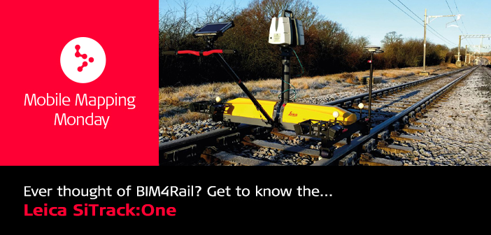
For systematic and holistic analysis of the data so that rail maintenance can be performed effectively, Leica Geosystems has created SiTrack:One, a rail track capture and measurement system that  incorporates the Leica ScanStation P40 to generate 3D point clouds. With no start-and-stop needed and the calibration done on site easily and accurately, the solution enables users to capture their complete rail environment. The system locates itself automatically via GNSS or with two sophisticated laser Distance Measurement Instruments (DMI) and an Inertial Measurement Unit (IMU) in GNSS-denied areas like underground railway tunnels or subway networks.
In challenging and evolving rail environments, SiTrack:One reduces the time surveying personnel spends on the tracks at high risk and minimises train outages whilst collecting synchronised engineering, survey-grade 3D point clouds for accurate as-built drawings. The system works with Leica SiRail software suite enabling data synchronisation, post-processing and batch feature extraction.
Consorcio IUYET is a mexican civil engineering services company with 40 years of experience. The firm uses the Leica SiTrack:One, a rail track capture and measurement system that incorporates the Leica P40 ScanStation to generate 3D point clouds. With no start-and-stop needed and the calibration done on site, the solution enables users to capture their complete rail environment, even in GNSS-denied areas like underground railway tunnels or subway networks.
Allan Barrow, managing director of ABA Surveying Ltd, in his recent article ‘BIM Level 2: What will it mean for you?’ on Rail Technology Magazine, discussed the significance of BIM in the rail environment. Moving from Building Information Management to a more holistic approach of Better Information Management fhe highlighted the importance of having geometrical data in 3D, as well as the project data freely available to all parties through the implementation of common data environment for all government construction projects.
 Moreover, he emphasised the value of solutions such as the Leica SiTrack:One: “More and more we shall see “all in one” permanent way surveying equipment like the Leica SiTrack:One. This is being tested by ABA for Network Rail approval at all Grip stages. The SiTrack:One is a track measurement device that is able to locate itself using on-board systems that include GNSS, INS (inertial navigation system) and a non-contact optical laser odometer (DMU).”
Before the end of 2016, Leica Geosystems hosted the Non-stop 3D Rail Capture with SiTrack:One webinar. Stuart Woods, Vice President for Mobile Mapping at Leica Geosystems and Nina Sandhop, Product Marketing Manager for SiTrack:One at Leica Geosystems, shared insightful information on the new advances in complete as-built 3D capture for rail clearancing, track gauging, rail head wear, catenary position, platform gauging, and platform slope measurement.


