


Surveying is a profession rooted in tradition while expansive enough to adapt to innovations. As technology advances, surveyors collect more data faster than ever and apply it to an expanding range of projects that depend on the utmost accuracy.
This is why surveyors are critical for data capture and management, including quality assurance, processing, and analysis – all aspects that form the bedrock of successful projects from construction to urban planning.
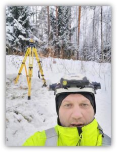
Sergei Jepifanov, a seasoned surveyor in Finland who has shifted from field warrior to 3D data prep and processing pro, exemplifies this journey. Below, he shares his experiences and offers perspectives on pressing topics like the digital future and AI integrations.
Sergei’s Insider Takeaways:
- Rapidly advancing technology is evolving the surveyor’s role, making data management a critical part of the job.
- New avenues for data collection mean new applications, like digital twins and smart cities, expanding ways surveyors contribute to our data-driven world.
- Embracing automation and AI might seem daunting, but like other technological leaps the industry has seen, it presents opportunities for surveyors to increase productivity for overall gains.
A journey into surveying
“When I first started studying at the Tallinn TTK University of Applied Sciences in Estonia, I chose the construction field. However, after the first year, I realized I liked surveying more than building or road construction.
While surveying principles are easy, mastering the technology is difficult, and I liked this challenge. Surveying requires a lot of knowledge and skills, but it offers a big future and as a surveyor, the world is open to you.
As part of our studies, we had to complete practical lessons at a company. I found one in Tallinn focused on surveying and have worked in the field ever since. After finishing my education, I found a job with Vitomittaus, Oy, a surveying consultancy company in Southwest Finland, where I have worked for 8 years, primarily in construction surveying.
I clearly remember my first construction site: the Clarion Hotel in Helsinki, with two high-rise towers. For the next five years, I worked only on construction sites, including shipping ports in Sweden and Norway.”
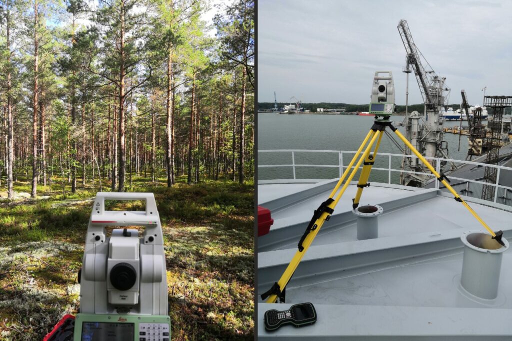
Sergei’s survey experience extends across sites and applications, like this traverse in a Finnish forest (left) and an oil tank inspection for deformations (right), both with the Leica TS16 robotic total station.
From field work to data prep and processing
“I earned my master’s degree in geodesy from the Estonian University of Life Sciences in 2024, and alongside my education, I’ve also expanded my technology specialisations.
Currently, I am involved in laser scanning, point cloud processing, GNSS processing, and 3D model creation from point clouds captured through static laser scanning. For mobile and UAV scanning projects, I use point vectorization to extract data from point clouds, such as data about roads, piles, powerlines, and buildings.
If the data is correct, all the necessary information can be extracted from the point clouds, making pre- and post-processing very important. So, I’ve moved from mainly working in the field to spending more time preparing the data.
For example, I was involved in a bridge construction project, the Pakurla Bridge in Paimio. The bridge’s width increased from 10,5 metres to 13 metres and the total length of the bridge from 195 metres to 220 metres. It had various elevations, structures, and slopes, making it a complex project. I used a 3D model uploaded into Leica Captivate to make all the measurements with a Leica TS16. Being able to use a 3D model instead of 2D drawings in this case made the marking much easier.”
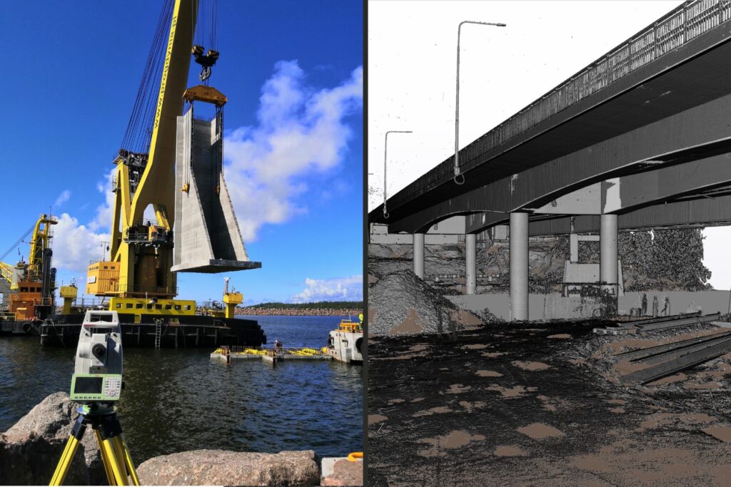
Work on the Pakurla Bridge: the installation of a 350 ton concrete element (left) and a bridge inspection using laser scanning (right).
The digital future
“I think the future of surveying is in 3D systems and modelling. I investigated the technology and equipment used in a project in Singapore for a 3D digital twin city, and I see similar projects starting in Helsinki. Digital twins of entire cities are the future.
Because I work with point cloud processing, I’m concerned that artificial intelligence may cause many people to lose their jobs since it makes work very fast. But technology also opens new ways.
If we look into the past 40 years, making simple measurements on a major project would take about 5 people, but today, the robotic total station makes the same measurements possible with one person.
Or, for example, preparing for excavations. When I first started, we had to measure and mark surfaces. Now, the excavators have GNSS and displays so operators can see how much they need to cut or fill to get the right surface. The work shifts for surveyors to make accurate models for machine control.
So, there is no need to fear innovation. Just go forward, adopt, and always learn something new.”
For surveyors looking to stay ahead in this ever-changing industry, Leica Geosystems offers cutting-edge solutions – from total stations with 3D-enabled field software like Leica Captivate to mobile and terrestrial laser scanners and software – that empower future-ready surveying. Learn more about our range of surveying solutions here.