


Projects in plant environments can be challenging as they typically require delivering the highest quality under schedule and budget constraints while assuring the safety of operators and contractors.
As a contractor working in a plant environment, you need to make sure the job is on time and can’t go above a specific budget. If an element of a plant is shut down, you regularly need to make sure that data collection and retrofits are completed in a specific time frame, and that you have the best possible quality of data at the point of data capture, so designs fit accurately.
Manually made measurements can be inaccurate, time consuming and information can be easily missed or incomplete, making it necessary to revisit sites.
Reality capture technology can be deployed to safely, quickly and accurately visualise any site in a 3D digital model combining measurements and imagery. Whether for retrofit or refit, clash detection analysis or as-built scan to check installations are as intended, this technology is being increasingly adopted in several plant environments, such as:
- Offshore plants
- Oil refineries
- Power Generation
- Food manufacturing
- Facilities management and assets management
This blog outlines how to create deliverables with reality capture technology, helping you to minimise shutdowns, make sure the redesign will accurately fit and overcome the challenges mentioned above.
5 steps from “Field to Finish” with reality capture
Step 1: Reality capture
Data can be captured with any reality capture device, including Leica ScanStation P-Series, Leica BLK360, Leica BLK2GO, Leica RTC360, UAV systems and Mobile Mapping platforms. All of these solutions generate rich, accurate, actionable data sets that can be used in downstream software.
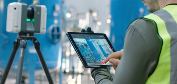
Due to its speed, size and portability, the RTC360 laser scanner is ready to be taken anywhere on site – it is easy-to-use, with one-button operation, and allows users to complete many setups in short period of time. Accompanied by the Cyclone FIELD 360 app, users can immediately check and view a 3D representation of their captured scan data on supported iOS and Android mobile devices and tablets, as well as adding geotags anywhere in the scan data with onsite images, videos, voice memos or text annotations, to make their project data more complete in the field. Thanks to the Visual Inertial System (VIS), users can track the relative position of the laser scanner in real time as it is moved between different set ups. This simplifies the entire registration process as the setups are easily pre-registered directly in the field, and user interaction during the registration process in the office to optimise the data is minimal.
Step 2: Data prep using Cyclone REGISTER 360
After capture, raw data is processed for tighter registration in Leica Cyclone REGISTER 360. To get started, you just need to:
- Create a new project within Cyclone REGISTER 360
- Drag and drop raw files directly from the USB storage device
- Click “import” and begin the process of registering data
An LGS file published from Cyclone REGISTER 360 can be consumed in Leica CloudWorx products, across a whole range of different solutions, such as CADWorx, Revit, Navisworks, BricsCAD, and AutoCAD.
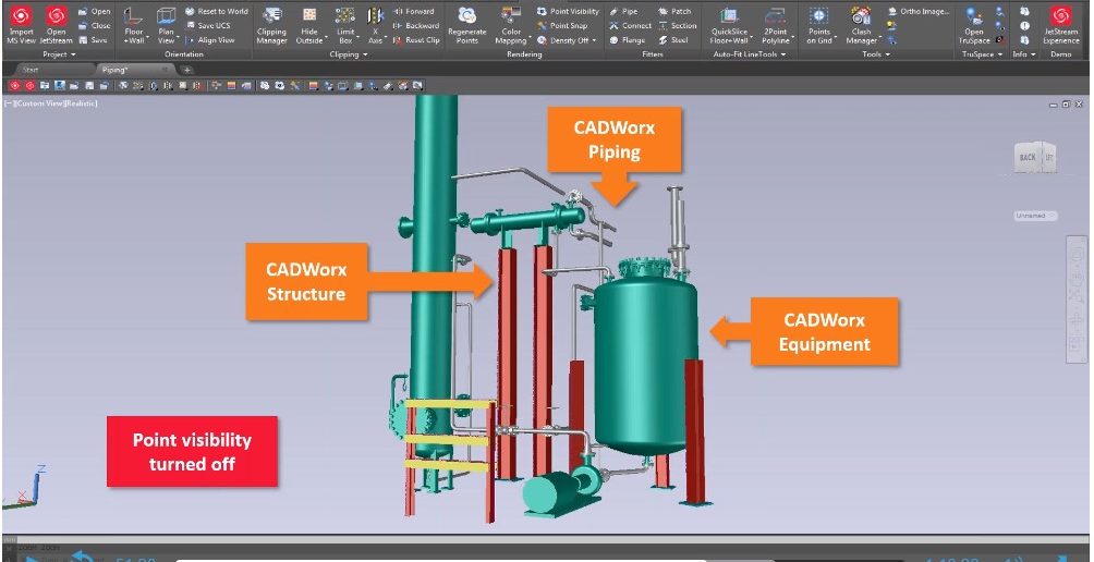
Step 3: As-built modelling and design
The LGS digital reality files used in the CloudWorx + CADWorx solution can be used to help deliver isometric and orthographic outputs required by operators and contractors.
Using CloudWorx and CADWorx plant professional software users can get a fully intelligent, specification-based, as-built model from which high-quality, accurate deliverables can be produced. The software allows experts to create new designs and models for plant upgrades or maintenance and support plant documentation.
Modelling for plant maintenance can be used for:
- Inspection/fitness-for-service
- Replacing parts (such as a corroded pipe spool)
- Asset registers and site documentation
Modelling for plant upgrades can be used for:
- Retrofit/revamp/turnarounds
- Installs of new equipment (such as piping and steelwork)
- Model and clash analysis against a point cloud
Working with an existing point cloud and a 3D model that mirrors exactly the plant environment, operators can introduce or repair new elements – testing it digitally first. For plant upgrade projects, new equipment and parts can be retrofitted. To avoid problems during construction, the overall pipe route needs to fit into the existing vessel and be 100% clash-free.
CADWorx produces complete digital information to support plant owners in their mission to digitise these facilities. It features several productivity tools to speed-up design and make design revisions easier. Saving not only time but also avoiding unnecessary remodelling and rework.
Step 4: As-built validation and handover
The final stage of the project is to validate that the upgraded facility post-construction accurately reflects the design documentation. This final set of deliverables can be handed over to the client, and are then used to operate and maintain the facility to help the plant owner/operator achieve regulatory compliance.
Step 5: Visualisation/Collaboration
Beyond handing over isometric and spool drawings to the client, there are lightweight point cloud viewing tools available, like Leica JetStream Viewer, allowing customers to navigate and visualise entire sites on their desktop. JetStream Viewer is an additional tool to make sure designs are according to specifications and users can check and measure the point cloud.
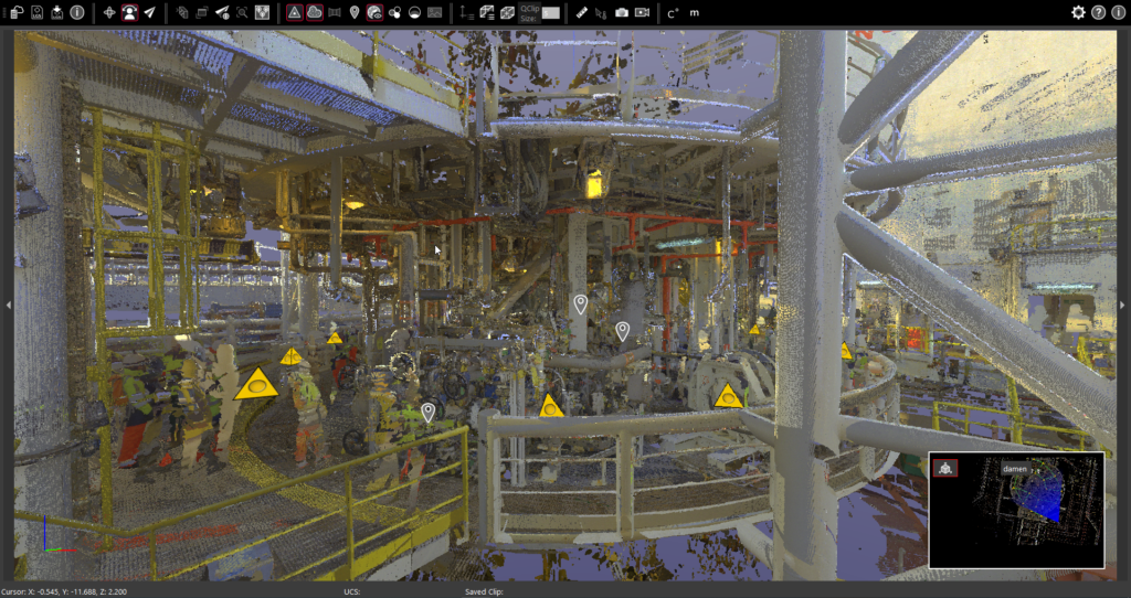
JetStream Viewer is a free-of-charge tool with no install required. It reads data hosted on a JetStream server or a local LGS file. Clients can view progress and fly-through the point cloud, jump to scan positions, take measurements, use clip boxes, generate mark-ups and more.
Watch “Utilising point cloud data to support the efficient execution of industrial surveying projects” webinar to learn more about the workflow and leverage your plant projects.

By Renata Barradas, Communications Manager at Hexagon Geosystems