Do I always need a flight plan?
Every mapping project requires flight planning. What factors need to be taken into account? To gain insight, we consulted Stefan Drieling, the flight planning lead at geoplana, Klaus Neumann sales manager at Leica Geosystems and Jacques Markram, the product manager for Leica MissionPro at Leica Geosystems.

What information is important for flight planning?
SD: The information that geoplana customers provide us for the project: ground resolution (GSD), the overlap (e.g. true ortho or orthophoto) and the area to be flown (perimeter). A DTM is already stored in Leica MissionPro. Based on all these factors, the software calculates a proposed flight plan. Depending on the topography, it may be necessary to make further adjustments. For example, if the customer requires a different GSD in the city centre compared to the forested surroundings. Or in the case of significant differences in altitude in mountainous areas.
JM: The flight planner enters the settings such as ground resolution (GSD), the overlap that is needed to deliver specific products, for example, true ortho or orthophoto and the area that is required for the project. Leica MissionPro combines the entered settings with the selected Leica Geosystems airborne system and the DTM in the area to create a flight plan that will deliver the images needed to complete the project successfully.
What information is determined during flight planning?
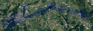
SD: The camera’s trigger points and the position of the flight strips. This information is transferred into the pilot’s flight software.
JM: Leica MissionPro calculates the flight lines (flight strips) and the camera events (trigger points) along the flight lines for systems with only a imagery sensor. For systems that include a LiDAR Unit, additional LiDAR settings are calculated for every flight line. These additional LiDAR settings ensure the best-quality LiDAR data.

Who is responsible for the flight planning at geoplana? Do you need any prior knowledge? And if so, what kind?
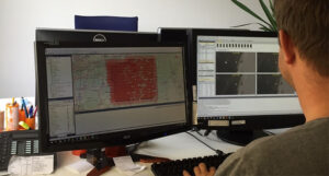
SD: At geoplana, Stefan Drieling and Ruth Maier are the flight planning specialists. They need a good geographical understanding and a lot of practical experience.
JM: Leica MissionPro generates optimal flight plans tailored to your specifications, aircraft, and terrain. The software offers additional tools that help the flight planner make the flight plan more effective. As you gain more experience with flight planning and Leica MissionPro, you’re able to optimise your flight planning with the additional tools that the software is offering.
KN: Flying costs are a large part of the total project cost. Mission planning software can help to get a good understanding of it, and experienced users can reduce flying time by optimising the flight plan. The MissionPro software has features which help our customers with that task.
What software is used for flight planning?
SD: We use the Leica MissionPro flight planning software, which is optimised for our Leica Geosystems airborne cameras.
JM: Leica MissionPro is the comprehensive planning solution for all Leica Geosystems airborne sensors across multiple product generations. The advanced computation algorithms simplify and speed up mission planning. The software facilitates the creation of efficient flight plans by intuitively selecting areas, sensors, and acquisition parameters. Users can promptly and comprehensively evaluate missions after flight, irrespective of project scale, conduct flight analyses, run quality control, generate reports, and oversee project management tasks.
KN: MissionPro software includes a seamless interface to the HxMap software which help our customers to streamline the overall production workflow. The project database will be generated with flight planning and will be used throughout the complete production workflow. This avoids unnecessary file copy or format transfer and therefore saves production costs.
How far in advance is the flight planned?
SD: In principle, planning a flight is possible at very short notice. More lead time is needed for flights near airports or with a GSD of 20 cm or less. In these cases, approval from air traffic control is required before the flight. This must be reconfirmed on the day of the flight, and adjustments may be necessary at very short notice.
JM: Flight planning is typically one of the initial steps in a project. It provides a clear estimate of the project’s costs and helps obtain the necessary approvals and permits early on. With Leica MissionPro, planners can quickly and directly make adjustments before the flight if any changes are needed.
What happens to the finished flight plan?
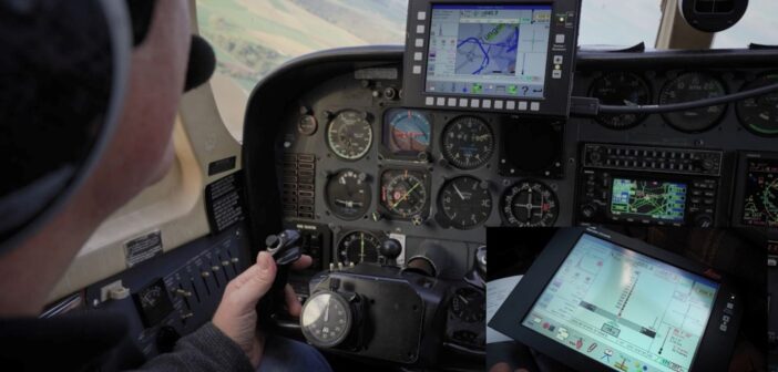
SD: The flight plan is passed on to our pilots and imported into the Leica FlightPro flight management system. This way, the camera automatically receives trigger impulses while the pilot flies precisely on the calculated flight path.

Can the pilot spontaneously deviate from the flight plan? When does this make sense? And what are the consequences?
SD: In principle, deviating from the flight plan makes no sense because the flight planning is optimised for the project. But it may occur that the flight has to be suddenly interrupted based on instructions from air traffic control (e.g. due to high air traffic near the airport). In this case, the flight planning software allows us to resume the flight at a later stage, exactly where it was interrupted. Or it may be necessary to adjust the flight plan at short notice for projects with a high-flying due to air traffic control restrictions or changes in air pressure.
JM: It’s not recommended to change the flight plan throughout the flight. The flight planner in the office has a better understanding of the project and how to plan it as effectively as possible with all constraints. Our office mantra is: “Plan the flight and fly the plan.” Nonetheless, the software is designed to allow interruptions in flight lines from the local air traffic control and makes it easy for pilots to refly those interrupted and not yet flown flight lines if needed.
Do you also need flight planning for drones?
SD: Yes. The difference is that the drone flies the project autonomously, and the pilot only has to monitor the flight.
What are the main challenges of flight planning?
SD: Balancing the optimal implementation of the customer’s requirements with economic efficiency. Flight planning requires a lot of experience, especially in demanding terrain with large differences in altitude.
JM: Some of the challenges that flight planners face are areas with large terrain variations, very strict requirements, flying altitude restrictions, limited time windows when the project can be flown and atmospheric conditions such as clouds and high humidity.
While Leica MissionPro’s flight planning features enable planners to develop flight plans and meet project requirements, experienced flight planners like Stefan Drieling and Ruth Maier can leverage additional tools within Leica MissionPro to enhance the plan further, optimising efficiency that save time and money.


