


“Bizarre”. Surveyor Danny van Remmerden, from RPS consultancy and engineering agency, searches for the right word when he walks through Amsterdam’s popular Kalverstraat on his own. On behalf of a property management company, he captures a 3D scan of various retail properties in an unreal setting. “You can hear a pin drop in the middle of the day here. A ghost town? Yes, you could describe it that way. Due to the quarantine/stay-at-home orders for COVID-19 all shops are closed, except for two small shops. Nobody is on the street. Every now and then you come across a police car, construction van or garbage truck and that is about it.”
Danny van Remmerden is taking this time where streets are deserted to capture the shopping streets of Amsterdam.
Danny van Remmerden, a Dutch land surveyor from RPS, captured on behalf of the property manager a 3D scan of various retail properties in the Kalverstraat, Heiligeweg and Leidsestraat. RPS, established as Rural Planning Services, is a global business service provider, inspecting, analysing and advising the built-up and rural environment. The company relies on Terrestrial Laser Scanning (TLS) to capture retail properties in city centres and monitor whether the buildings have been damaged by any foundation problems of wooden piles in the follow-up phase. The current situation has enabled Danny to capture the facades of the buildings without any obstacles.
Below are five reasons why RPS relies on TLS to capture retail properties in city centres.
1. Create 3D models to design and manage buildings
Surveyors have been using 3D laser scanning technology for decades to capture reality in a digital point cloud accurately. This point cloud is then converted into a 3D model that customers can use to start their work, such as in the design or management of buildings and structures.
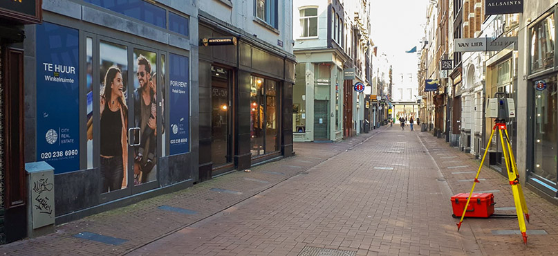
Snapshots while scanning half an hour on Heiligeweg, Amsterdam.
2. Scan facades and entire environments
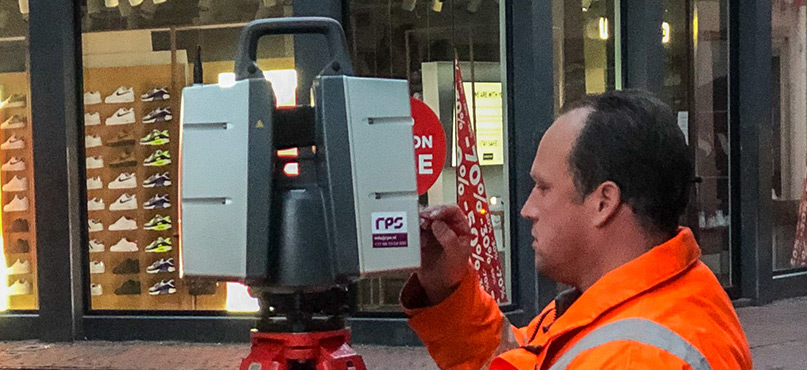
RPS also relies on laser scanning for its real estate projects. Danny explains how he uses laser scanning for retail properties. “With a high-end 3D laser scanner, I scanned not only the facades of the retail premises, but also the entire environment. This goes all the way around in 360 degrees to the millimetre.”
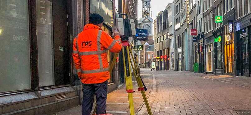
The land surveyor from RPS scanned the facades from Amsterdam’s popular Kalverstraat from the road in several configurations with a high-point density and registered all sides.
Surveyor Mark Mulder sets up the scanner in the unusually-deserted streets of Amsterdam
Where the surveyor normally experiences noise on his screen during 3D laser scanning, he now has a completely clean view. “I never experience that for such projects. Normally there are always pedestrians or cyclists who disturb the image. Not now. The result of the scan produces an almost identical image as that of the regular photo.”
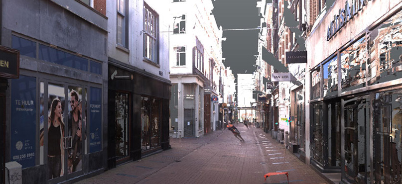
The result of the scan. The unfiltered image shows only one movement has detected in the street during the time of capture.
3. Measure anything through time
At the office, the captured scan data of the buildings are converted into a 3D point cloud with Leica Cyclone and then into 3D models and floorplans with CloudWorx. From determining distances, height differences and inclines to subsidence and cracks, the processed data forms the basis for the follow-up work for various disciplines. “By doing the same thing next year, we can visualise the changes from the baseline measurement in a colour gradient. This makes the deformation of the facade visible in 3D at a glance,” says Danny.
4. Time saving
PRS achieves significant time savings using 3D laser scanning technology. From this risk-driven approach, the consultant has to enter only once for the baseline measurement. “Using the 3D laser scan, the re-inspections can be repeated from the office in the following years. So you no longer have to bother tenants. The repeat measurements indicate whether and if so, deterioration has taken place and to what extent,” explains Danny.
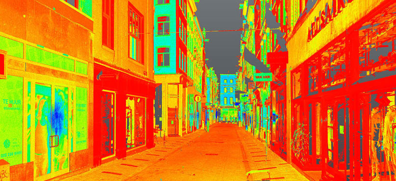
More variants to present the scan. Here with a colourised reflection value.
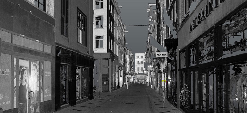
Presentation with a black/white reflection value.
5. Discover applications that translate into services
By integrating laser scanning into its processes, RPS has reduced project duration and cycle time of specific workflows by enhancing collaboration and coordination and reducing errors and omissions with accurate documentation. The multiple applications of laser scanning enable RPS to offer new services and reduce costs and waste.
Later this year, the documentation of retail properties will be expanded by RPS to carry out an indicative floor levelling on the first floor of retail properties in the streets of Amsterdam. Using laser scanning, the buildings will also be assessed and recorded from the inside.
Learn more about the Leica ScanStation Series
A version of this blog was first published on RPS website.
This blog was created in consultation with RPS. For questions about their services in the Netherlands, contact Wessel.Sterenberg@rps.nl or Dave.van.Drie@rps.nl