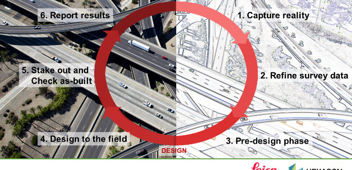
Six steps of a typical surveying workflow
This video takes you through six steps of a typical surveying workflow – from the initial capturing of reality to the final as-built check and reporting and covers the following steps:
- Initial measuring of data using coding & linework, measure foresight, scanning and imaging using Leica Captivate
- Tidying, consolidating and adjusting the measured data within Leica Infinity
- Importing the measured data into two popular CAD packages:
• AutoDesk Civil 3D
• Bentley InRoads - The exporting of design data (in this case a road alignment), from the CAD packages to Leica Captivate
- Staking out the design data and doing as-built checks with the Inspect Surfaces app using Leica Captivate
- Final reporting of results from Leica Captivate
Note – Gorka Santamaria gave a presentation called “Good Practices for an efficient Data Flow between Field and Office”. As the feedback for that presentation was very good, we have now made this presentation into a video. the presentation at Hexagon Live was about 50 minutes long – this video has been edited and shortened to about 35 minutes. So make sure you have enough time to sit back and watch the video – hopefully you will find it as useful as the attendees at Hexagon Live.
Discover the benefits of Leica Captivate and Leica Infinity.

Gorka Santamaria, application engineer at Leica Geosystems

Paul Dainty, application engineer at Leica Geosystems


