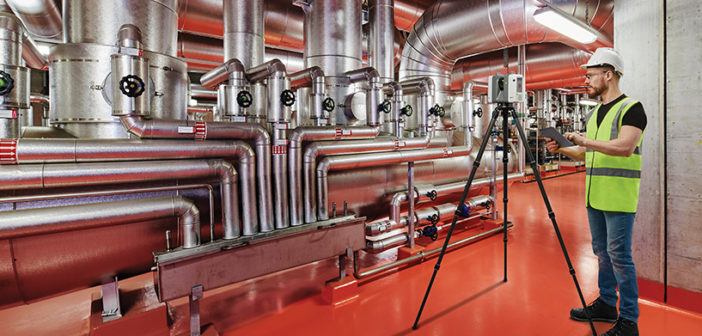
Many industrial settings present inhospitable environments where the health and safety of employees and site visitors is paramount. Hazards including temperature, corrosive materials, moving machinery and heavy objects are abundant, and it is the responsibility of site management to ensure not only all those on site are safe but also those in the immediate surroundings.
The challenge is that these sites can be large and complex, with networks of pipes, tunnels, storage vessels and other structures that have been extended and adapted over time to meet production.
This presents plant managers with a problem: how can you keep track of a structure and ensure the safety of those moving through it? The answer is 3D reality capture.
Site safety is enhanced through detailed visibility and accuracy
Industrial and Plant Applications
- Site visualisation for safety training
- As-built documentation for maintenance
- Improved management efficiency through site visibility
- Accurate measurements for faster design of extensions
- Enhanced planning of works to avoid disruption
- Delays are minimised through fast, detailed and accurate 360° scanning
Digitising Inhospitable Environments with 3D Reality Capture
3D reality capture involves the creation of an accurate and complete 3D digital environment that replicates the as-built structure of a plant or industrial site. Combining laser scanning with photographic imagery, users can create a complete 3D representation of their site, with measurement accurate to the millimetre and 360° HDR imagery ready to be navigated and explored in every detail.
New laser scanning and software solutions empower plant management with easy-to-use, portable systems that, at the touch of a button and in under two minutes, scan an entire area creating a digital environment. Automated software stitches scans together to create a single model and verifies accuracy and validity of data.
An entire site can be scanned quickly and efficiently, creating an as-built model that exactly matches the site. This can then be explored and used by management, designers, and health and safety teams through HDR imagery or point clouds without ever needing to physically access an inhospitable site.
Enables efficient design and planning, minimising disruption and delays
Efficiency, Safety and Complete Visibility
This technology offers a wide range of benefits to plant managers, piping designers, maintenance crews and mechanical engineers:
Efficient Management
Having a complete 3D model of your site can improve operational efficiency through optimisation of production routes, management of maintenance regimes and positioning of personnel. Knowing what is where without accessing the site means more time spent managing and organising efficient production and less time spent navigating the site.
Better Design
The design and build of extensions or additions to industrial sites and plants can be complex; from the initial design accuracy required to the access needed by contractors, mistakes and delays may have costly results.The use of a 3D model enables designers to accurately create additions without needing to access the site, using measurements that are millimetre accurate and a model that is as-built. This allows them to visualise the new area in situ, ensuring designs work and construction will be accurate. The model can then be used to plan construction and mapping routes for contractors that minimise site disruption and during-construction scans can be taken for quality assurance, checking actual build to the design-intent. This not only makes sure additions are built correctly but also ensures build issues are rectified quickly.
Improved Safety
Using the model, a 3D map of the site can be created highlighting danger zones, safe areas and escape routes, which can be used to train both employees and visitors to the site. Offering an immersive experience means safety officers can clearly highlight risks and procedures visually to staff and visitors before they enter risk areas, improving safety for all. An example is the use of tablets to guide maintenance contractors around a site, taking them through safe areas, highlighting high-risk areas and identifying the exact part of the site that requires maintenance, down to an individual pipe or valve.
To learn more about 3D reality capture solutions, the new Leica RTC360 and how they can improve plant safety and design, contact Leica Geosystems at leica-geosystems.com


