Whenever a product is launched, it needs to be introduced in regional markets. However, before a region introduces a product to the market, each regional team needs to understand the benefits and uses. To introduce the Pegasus:Backpack, an award-winning wearable reality capture sensor platform into the market, the Leica Geosystems office in Mexico City required a training to be able to operate with the equipment, do a demo, understand the applications, and ideally, do the first local support in the future.
As an R&D manager, I am typically not involved in training or demo activities. However, the opportunity to train peers allows to me to better understand user necessities. Having a direct communication and interface with the end users allows to me to learn from their needs, and transfer information to them in a more complete way avoiding that information gets lost as it passes form one person to another.
Welcomed with tremendous engagement and hospitality by my colleagues in Mexico City, Luis Manriquez and Cinthia Salinas, we started the Pegasus:Backpack training. On the first day of training everyone wanted to do the same first exercise – scan the office!
We switched the Pegasus:Backpack on to capture the Leica Geosystems office at the 9th floor of the building, then we processed the data automatically to see what you can have with minimum skills. My colleagues were captivated with the results we had from this first exercise and realized that the worst case of the precision was 3cm in the point cloud.


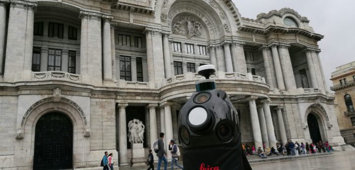
For our mission in the second day, we decided to capture a shopping mall and the surrounding streets of the impressive World Trade Centre building of Mexico. For the third day, we decided to capture the square in the front of “Palacio de Bellas Artes” and its underground parking. We also walked the streets next to “Templo Mayor” and Mexico City’s main cathedral.


During the training they experienced themselves how the SLAM works in combination with the GNSS and the IMU in a fashion way in every environment. All the data was processed and ready the day after. This is what we got at the end of each day for all scanned locations:
• a set of panorama pictures collected for every meter
• a point cloud for AutoCAD
• orthoimages of the scanned locations in case they want to extract a plan in AutoCAD
• two engineers trained on how to do it (and this is the most important part)

Rather than just explaining the options and commands of the software and the instrument, I organized the training into “learning targets” and plan a schedule accordingly. The targets for this mission where the following:
• be familiar with the instrument
• be able to collect an indoor only mission
• be able to collect an outdoor and mixed (outdoor/indoor) mission
• understand data collection strategies and best practices
• install the software and license it
• process an indoor-only mission
• process a generic mission
• filter the data and produce standard deliverables (from HPC to LAS, to ReCap for the point cloud, plus the images)
This approach allowed to me to have them focused in the concepts and the logic more than in the single functions. Once I know they are familiar with the product and they understand the logic behind, I can always support them remotely for any single tool available in the software.
The learning targets were also reached thanks to the boundless enthusiasm and professionalism of my Leica colleagues Luis and Cinthia. After the three-day-mission, my colleagues learn how to use Leica’s new mobile reality capture and mapping solution and were impressed by the multiple applications that the Pegasus:Backpack can be used for.
Written by Aldo Facchin
R&D Manager – Mobile Mapping
Geosoft S.R.L. – Part of Leica Geosystems AG


