


Like many sectors, public safety is in the middle of a period of digital transformation. Since the technology first began to be adopted two decades ago, digital geospatial tools such as 3D laser scanners have been redefining the way police departments, private investigators, security companies, and firefighting units approach forensic investigation and public safety mapping.
In the past, digitisation often meant adopting a single tool or improving part of the public safety workflow, whether collecting evidence at a scene or processing data back at the office. However, things are changing. It’s now possible to digitise the entire forensic mapping workflow, from arrival at the crime or collision scene all the way to the courtroom.
Let’s look at each stage of the forensic mapping workflow and how digital technology can improve the safety and speed of evidence gathering, save time and deliver more accurate results.
At the scene
 The longer you spend at a scene, the greater your exposure to risk. Public safety professionals face a litany of risks when arriving at a crime, collision or major incident scene; from biohazards to passing traffic to assailants. Therefore, the safety of investigators often relies on their ability to capture data quickly and accurately.
Traditional, manual tools for the job such as tape measures or cameras with theodolites offer a degree of accuracy but involve painstaking set-up and measurement processes.
For example, although a traditional theodolite can make accurate measurements, it’s limited by its ability to only capture the points and measurements you choose. Making collecting data a time-consuming process that’s open to human error. Not ideal if you’re at a crash site in the middle of a busy intersection and need to move through a scene quickly without compromising accuracy.
A fully-digitised workflow can overcome many of these problems. A total station combining GNSS scene data with mobile mapping point cloud data can reduce the time collection of evidence takes from hours to minutes. ‘Point and capture’ 3D laser scanners also capture the whole scene rapidly, including all data points, so you can be sure everything is captured with millimetre accuracy — even points that didn’t initially seem like vital evidence.
These digital tools not only make the collection of evidence safer for investigators, but they also minimise disruption for the general public by allowing faster reopening of crime scenes. Digital technologies also allow public safety departments and units to move more quickly from scene to scene.
Back in the office
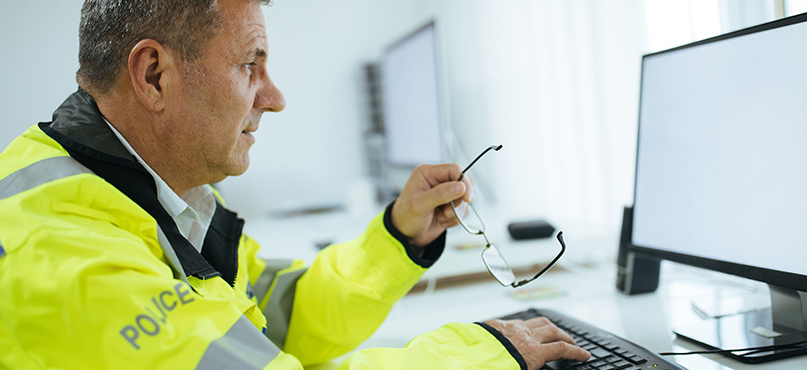 Clear visualisations and access to all the evidence are vital in case building and determining culpability. To build a clear, nuanced picture of a case, investigators need to be able to explore a scene from multiple angles and fully immerse themselves in it.
Digital scene documentation and mapping allow you to analyse the scene to a level of detail that just isn’t possible with manually recorded measurements, targeted point collection or hand-drawn sketches.
Tools like 3D laser scanners can be used to gather evidence in a variety of formats from video and photogrammetric imagery to point cloud data. These digital datasets can then be consolidated in reconstruction software to form immersive 360-degree, 3D experience, allowing investigators to view the scene in its entirety.
A full digital reconstruction of the scene has two key benefits:
- Firstly, with clear visibility of every data point, investigators have all the facts. Overhead and side views of the scene can be checked for additional evidence and points can be analysed in millimetre detail, ensuring you don’t miss any key evidence, no matter how insignificant it may have seemed on site (minimising human error).
- Secondly, a full reconstruction can be used to help witness memory. Small details can often clarify the incident for participants, and often all that’s needed is an accurate recreation of the scene even days or months after the event happened.
In the courtroom
 Finally, once the evidence is gathered and a case made, digitisation has an important role to play in any hearing or trial. To fully grasp the complexity of cases like traffic incidents or major events, all involved parties need to experience the scene in as much detail as possible.
Digitisation allows you to move beyond presenting evidence in traditional formats and, instead, provide detailed and informative diagrams, illustrations, animations and fly-throughs. Using immersive, compelling visualisations can help to better understand the evidence,
Fast and accurate scene documentation, investigator safety and compelling visualisations are just some of the benefits of digital scene documentation and mapping. Whether looking to move beyond manual methods or improve your delivery in the courtroom, today’s software and tools make digitisation simple.
Find out how Leica Geosystems solutions can help improve the way you capture and present crash or crime scene data
Contact us to learn more about our 3D laser scanning solutions
Contact our Forensic Mapping Experts