 Road pavement surface layer thicknesses are critical for allowing road engineers to generate a more reliable and accurate interpretation and analysis of pavement conditions, but during construction, they also defined the amount of asphalt a construction company will invoice a highway agency. A series of research projects have been carried out to evaluate road performances and estimate the parameters that affect the road safety and road construction. Kinematic laser scanning technology was found to be very effective in this characterisation.
Kinematic products such as the Leica ProScan mobile platform can be used to obtain information on a surface layer of road pavement through a single measurement and produce consistent and representative data.
Optimising and developing a highway
Pavement quality is a main concern for transportation engineers, where the layer thickness and consistency are the key parameters related to the proper pavement conditions. The Leica ProScan mobile laser scanning platform is an effective non-destructive technology to provide comprehensive information on the surface and subsurface pavement condition while evaluating the layer  thickness.
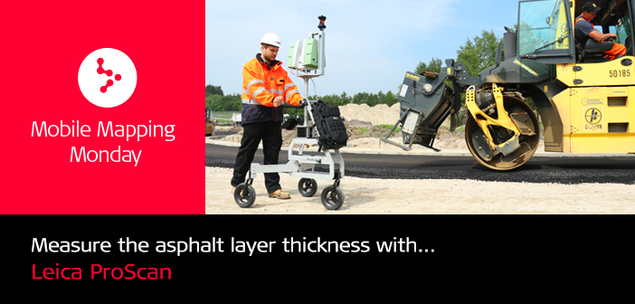
The solution was recently deployed by Dr. Hesse und Partner Ingenieure, an engineering and surveying firm, to scan three asphalt layers during a road pavement process in order to collect the correct volume data of the asphalt and calculate the precise layer thicknesses. The objective was to check the numbers provided by the paving company while validating the invoiced amounts of asphalt.
The Leica ProScan – lightweight, flexible and able to provide high accuracy data – was the only suitable scanning system since additional vehicles were not allowed to cross the freshly paved road.
The accuracy requirements were set to 3 mm and the allowed scanning time was a couple of hours per kilometre. The desired accuracy was achieved by tracking the ProScan trolley with a total station.
The Leica ProScan was able to deliver a complete surface model of three layers – base, first layer, and asphalt layer – with very high point density, and considerably reduction in data capturing time on site.
 With benefits such as fast, near-continuous field coverage and low implementation cost, the Leica ProScan delivered significant productivity gains; the road construction company recognised a positive ROI by deploying this innovate mobile laser scanning solution.
The solution
The ProScan trolley was specifically developed for kinematic data capturing workflows. It combines the latest advancements in measurement system integration, software GUI designs, and data processing technologies to capture reality in 3D.
Its unmatched performance sets new standards in laser scanning productivity and time-to-results by decreasing up to 90% of the time spent in the field with point accuracies of a few millimetres for scanning ranges up to 15 metres.
The Leica ProScan can successfully scan a wide range of road pavements and estimate the layer thickness.


