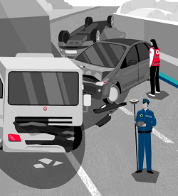
A crash scene is always a potential crime scene but making a case for civil or criminal liability often depends on the work of a crash scene investigator. Their job is to develop a hypothesis about what happened and support it with solid physical evidence. Easier said than done: the light may be fading, or a storm could be brewing as you document the evidence. Furthermore, every approaching motorist is a potential threat especially if that motorist is tired and irritated by the accident tailback. The faster you work and the quicker the scene is cleared, the safer and the better it is for everyone.
Under such time pressure, investigators can’t afford to commit to a single hypothesis yet. They need to capture the evidence comprehensively and in a way that will allow different hypotheses to be examined as the case proceeds. One thing is certain, as soon as the tow truck rolls into action, the only evidence you have is what you have measured and documented. That is why a validated methodology, and the use of best-in-class equipment is so important.
Traditionally crash scene investigation methods involved taking photos and using tape measures to record the positions of the vehicles, and capture the damage to the involved cars, debris and marks on the road. This approach was soon complemented by photogrammetry, where a stereo camera allowed the creation of 3D photos that yielded information about depth and distance.
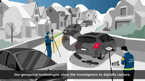
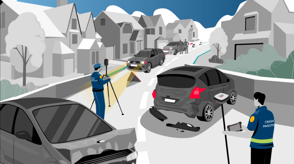
Meanwhile, the automated distance and angular measuring tools known as Total Stations, invented already 50 years ago originally for surveying purposes were enhanced with automation features and became productive options for police investigators documenting medium to large crash scenes. Our latest addition to this solution, the AP20 AutoPole is a smart system for the robotic total stations, that removes the last analogue steps in your digital investigation workflow.
In the past 30 years systems based on global satellite navigation systems (GNSS) emerged as the standard for geolocation and smart antenna systems combined with motion sensors resulted in the emergence of highly intelligent and accurate point-to-point measuring systems. Today, accident investigators use the GS18I and other GNSS systems to map and document evidence and diagram scenes without the need to stop to level the pole or even needing to reach the point with the pole tip.
Finally, with the arrival of laser scanners, 3D Forensic Digital Twins of scenes can now be created in minutes and used to revisit the collision scene a long time after it occurred. And demonstrate accurate and comprehensive data and virtual fly-throughs to support a hypothesis in the courtroom as needed.
At Leica Geosystems, we offer a wide portfolio of crash investigation solutions based on state-of-the-art photogrammetry, automated distance measurements, GNSS and 3D laser scanning technologies. This allows us to serve users from different backgrounds and cater to the full range of needs and budgets. The different types of solutions are briefly shown below in order of increasing sophistication.
Our portfolio for crash scene investigations and collision reconstruction:
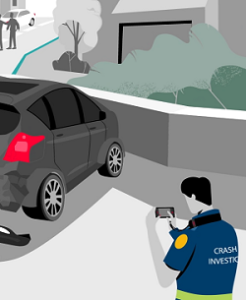
- COMPACT HANDHELD PHOTOGRAMMETRY
Flexible and easy solution for photos and precise 3D measurements
BLK3D all-in-one photogrammetry solution
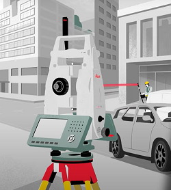
- AUTOMATED TOTAL STATIONS
Automated solutions for greater productivity when documenting medium-sized scenes
Total Stations and AP20 AutoPole
- PRECISION GEOLOCATION FOR POINT-TO-POINT MEASUREMENTS
Versatile, survey-grade positioning system that overcomes visual obstructions
GS18 series GNSS smart antenna rovers
- COMPREHENSIVE AND IMMERSIVE 3D DOCUMENTATION
Fast, agile, and precise crash scene documentation and forensic mapping for court-ready deliverables.
RTC360 3D laser scanner
For more information please contact our Public Safety experts or visit our Public Safety, Security and Forensics website.
Watch our crash and collision investigation video to learn about our solutions!