


Whether capturing the 3D geometry of civil infrastructure, creating an as-built representation of a large industrial site or generating 3D data for integration into Building Information Modelling (BIM), you need a laser scanner that’s up to the task.
But, what does it look like in practice? Of course, not all long-range laser scanners were created as equal, so, what are the key questions you should be asking to narrow down the options? Here’s our six-point checklist to help you pick the right laser scanner for your needs.
-
How quickly can you scan large amounts of data?
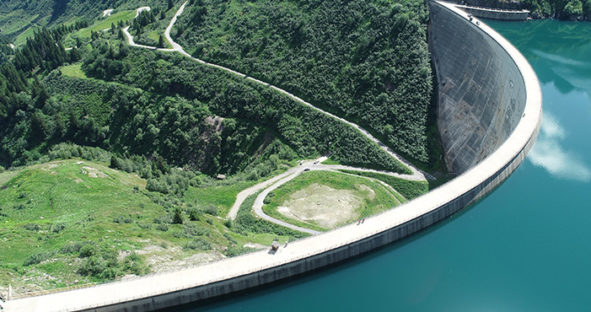 Improving productivity is vital to any surveying business. The faster you can get to a site and capture everything you need, the faster you can get to the next job. However, accurately scanning large-scale civil infrastructure such as dams, reservoirs or industrial sites doesn’t often lend itself to speed, unless you use the right equipment. Long-range laser scanners such as the Leica ScanStation P-Series are capable of scanning at speeds of up to one million points per second making short work of everything from a small bridge to a 200m-high hydroelectric dam.
-
How accurate is it?
Of course, all survey-grade laser scanners are accurate. But even among such impressive equipment, accuracy can vary. In infrastructure construction projects, accuracy requirements can be rigorous. Often deviation in position can’t be any more than a few millimetres relative to the original plans.
When every millimetre counts, you need to be sure the equipment you’re using is capable of measuring in minute detail. So look for equipment that combines angular accuracy with survey-grade dual-axis compensation and offer low-range noise. Equipment with these features will allow you to create ultra-detailed 3D point clouds with the assurance that the data is accurate to the millimetre.
-
Can it handle tough environmental conditions?
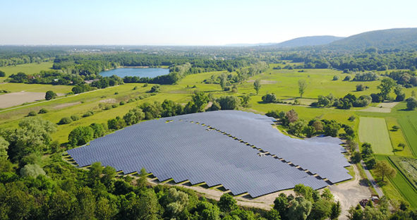 Large infrastructure demands space and as a result, it’s often to be found in the most inhospitable places. For example, consider where dams, solar energy farms and substations are usually located.
This means that the equipment you use to scan this infrastructure needs to be as tough as the surroundings they’re operating. A long-range laser scanner will be little use if your task is to capture a solar farm in the Nevada desert accurately and it’s not dustproof or able to tolerate high temperatures.
The ScanStation P-Series range performs even under the harshest environmental conditions, such as under extreme temperatures ranging from -20°C to + 50°C. What’s more, it complies with IP54 ratings for dust and water resistance. So no matter the terrain, you can be sure the laser scanner won’t let you down.
-
How simple is setup?
As we’ve already mentioned, capturing large industrial and infrastructure sites doesn’t lend itself to speed. One of the reasons for this is often the time-consuming setup processes. Many long-range laser scanners have cumbersome setup processes involving complex calibration.
Picking a laser scanner that’s simple and fast to set up, such as the ScanStation P-Series, can work wonders for your productivity. Not only does this allow you to complete complex projects faster, but it also means you can increase the work you take on, making for a better bottom line without increasing staff numbers.
-
Does it offer truly ‘long-range’ scanning?
 Sometimes the only way to be safe is to scan the site from as far away as possible. Maybe the structure is unsafe, or perhaps it’s just very difficult to access — such as a dam wall or bridge in the middle of a deep gorge. In these scenarios, a range of several hundred metres is not enough. To stay safe, you need more.
A truly long-range laser scanner solution will offer you a range measured in kilometres. For example, the ScanStation P50 has an unsurpassed range up to 1km, allowing you to scan from a distance that you can be sure is safe.
-
Does it offer a ‘complete’ scanning solution?
Picking the right product is about much more than the equipment itself. The best options will also include software, regular servicing options, training and ongoing support.
The ScanStation P50 offers a complete laser scanning solution, including training and customer support. Captured 3D scan data can be processed in the industry’s leading 3D point cloud software suite, which consists of Leica Cyclone stand-alone software, Leica JetStream, Leica CloudWorx plug-in tools for CAD systems and the cost-free Leica TruView.
- The widest set of work process options for 3D laser scanning projects available, through the Cyclone market-leading point cloud processing software
- Easy integration of point cloud data into the CAD platform of your choice with JetStream and CloudWorx
- Complete collaboration and easy access to point cloud data for anyone in your project ecosystem, with TruView
Choosing the right long-range laser scanner for your needs can be tricky, and there’s no one-size-fits-all solution. However, a versatile tool like the ScanStation P50 is an excellent option for most surveying businesses. With a simple setup, unsurpassed range and accuracy, and some of the industry’s leading point cloud processing software, it’s up to any task you set it.
Contact us to learn more about the Leica ScanStation P-Series
Read the previous Leica ScanStation Blog – Seeing the world as our ancestors did; how 3D terrestrial laser scanners can provide a window into our past