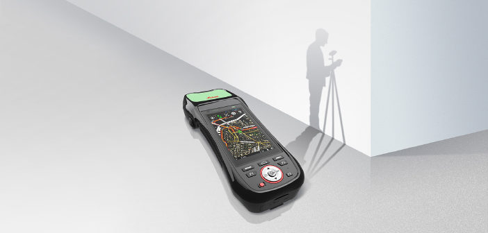
Today is International GIS Day, and Leica Geosystems celebrates with the idea of opening up geospatial data to all.
A free Geocache course at a college in the United States. An open workshop to learn how to map hazardous risks in Australia. A guided field trip for school children in Chile.
These are just a few of the ways International GIS Day, celebrated each year in November, is being recognised today. This global event “provides an international forum for users of geographic information systems (GIS) technology to demonstrate real-world applications that are making a difference in our society.”
In the past 16 years since the first GIS Day was held, access to spatial and geographic data has been becoming more and more open.
Democratising GIS
The idea of opening up data to more and more people has been a growing narrative in not only our industry but across many platforms. Better access to information is making our society smarter and safer. From homework help to battling cybercrime, the democratisation of data is a powerful concept to shape our world for a better future.
With any other source of data, the incoming data plays an important role. There is a continuous trend towards a bigger focus on a simple data collection process that is not only done by surveyors, also many other specialists like utility inspectors are now responsible for the data collection process.
 With this concept in mind, we are seeing the shared effects in GIS across the globe. Cities are able to provide better basic services for citizens when they understand and can reliably trust where their assets are. Citizens are able to find their ways more easily through these cities with GPS. Governments can better access needs of a region when cities share information with other cities.
GIS managers need to ensure that the information they collect and maintain is accurate, supporting them to collect and maintain authoritative GIS data. Essential is a boost in the accuracy of data collection for better authoritative data. All of those efforts improve emergency response time and ensure safety of field crews.
At Leica Geosystems, we are committed to the idea of opening up data for improved access and results. We started with our Hexagon Imagery Program and we’ve continued with our recent release of the Leica Zeno 20. This handheld data collector, with its easy and intuitive features, is leading the democratisation of GIS for all. No longer is the understanding or benefits solely contained to GIS professionals nor it is required to ensure a high-accuracy data collection process can be done by a surveyor only. Now, non-GIS and non-survey professionals can collect, analyse and use any GIS to better understand and interact with the world around them.
Furthering this idea, our newly-formed partnership with Esri to create the ZenoCollector, the Leica Zeno 20 using Collector for ArcGIS as its main user interface and comes bundled with an ArcGIS Online leading to a real-time GIS, is increasingly providing more open access to data. ArcGIS Online connects ZenoCollector to the ArcGIS platform, automatically synching field changes to enterprise information and giving everyone access to the latest data gathered in the field. Collector for ArcGIS puts mapping in the hands of your field work force to improve the accuracy and currency of your spatial data and make more timely, accurate and informed decisions.
Where open access leads
As we continue on this journey of democratising geospatial data, there is an exciting future ahead for our industry. Open access to data allows:
• Increased collaboration and understanding among stakeholders
• Knowledge sharing for better outcomes
• More affordable methods of asset collection and management
• Quicker and more informed decision making
• Improved resources for all
Democratising GIS, opening up access to geospatial data, and giving more and more people an opportunity to collaborate, improve and ad-vance their communities is where we’re going. Come along with us and spend International GIS Day learning how you can better shape the world around you.

Johannes Hotz is a senior product manager with Leica Geosystems. He oversees the Leica Zeno portfolio. Hotz is also in charge of Asset Collection Segment in EMEA.


