


Emerging technologies in data visualisation open new horizons for many industries including surveying, civil engineering, and construction. Visualisation in any type of construction or engineering project is central in providing customers, managers, and contractors a comprehensive overview on the workflow prior, during and after the realisation of the project.
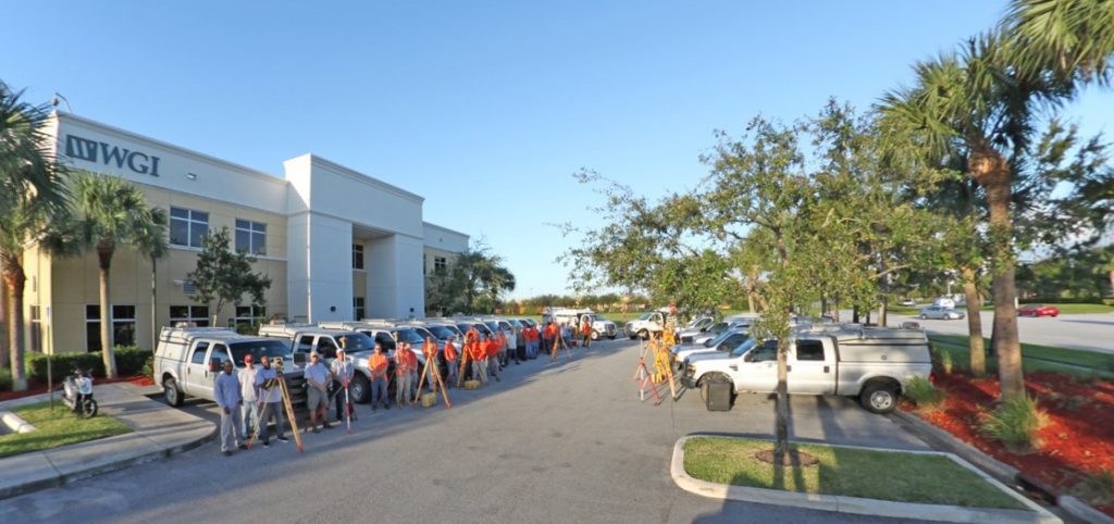
With the Internet of Things shaping the industries of the future, gathering, managing, and mining geospatial data has never been more vital. Anticipating this change, the Wantman Group, Inc. (WGI), a national design firm in the public and private infrastructure markets, based in the United States and founded in 1972, has expanded its services to include high end geospatial smart technologies in its portfolio to provide innovative solutions for its customers.
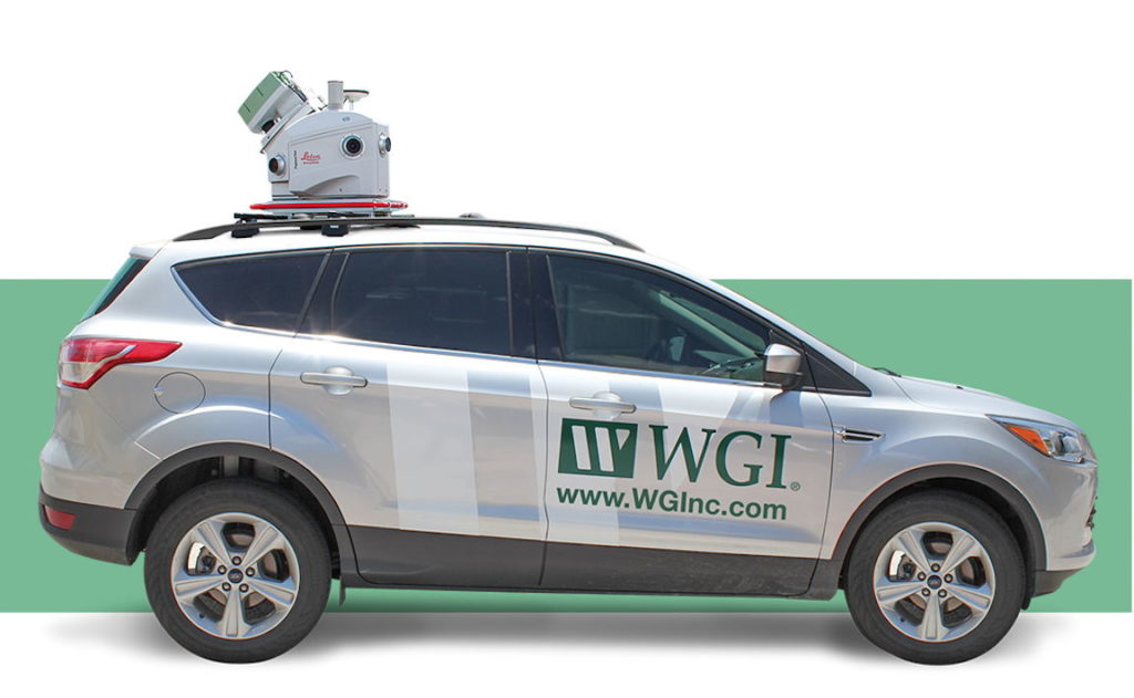
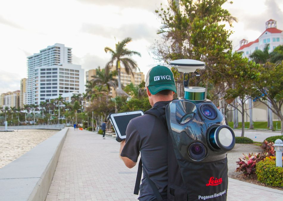
Among the newest technologies hitting the infrastructure design market, LiDAR has allowed WGI to collect millions of real-time 3D data points to complete an accurate, high-quality model of the physical environment. Depending on the situation, WGI uses aerial, mobile, or terrestrial LiDAR to collect precise geospatial digital twins, in order to create 3D models for different applications. To increase the efficiency and speed of data collection for its projects, WGI deploys the Leica Pegasus:Two, a vehicle-based mobile sensor platform, the Leica Pegasus:Backpack, a wearable reality capture sensor platform, and the Leica BLK360, a compact imaging laser scanner.
Providing a full spectrum of services
WGI offers a comprehensive range of services for different applications – from planning to execution – including:
- Civil Engineering
- Surveying and Mapping
- Transportation
- Engineering
- Structural Engineering
- Parking Solutions
- Environmental sciences and water resources
- Architecture, landscape and land planning
- Subsurface Utility.
Accurate and contextual visualisations are vital at all phases of a project, enabling customers to understand building forms and spaces. From 3D models to animated fly-throughs and 360-degree virtual reality solutions, WGI believes these cutting-edge technologies allow the industry to progress into the future.
Utilising multiple LiDAR capturing platforms
The One Watermark Place, West Palm Beach, Florida, offers the feel of a tropical paradise featuring luxury condos from around 4,000 to 9,800 square feet each, including on-site amenities such as tennis courts and swimming pools.
One Watermark Place approached WGI to carry out a full topographic survey and produce AutoCAD deliverables including the landscape, hardscape features, and mechanical, electrical and plumbing (MEP) elements.
Beside the customer’s short deadline, the team encountered several challenges on site. Firstly, the site consisted of many different, complex features, that all had to be captured together:
- Parking garage
- Lush landscaping
- Multiple pools and recreational facilities
- All paving and paver types.
In addition, the residents were not exposed to the information that surveyors would spend significant time on-site.
To overcome these challenges and keep to pace to minimise time on-site, the team used the Pegasus:Two and the Pegasus:Backpack to rapidly collect data of the landscape and hardscape designs. For the areas the Pegasus:Two could not access, the team used the Pegasus:Backpack, walking through overlapping routes to eliminate all shadowed areas. The scanning of MEP facilities required a highly efficient lightweight solution, thus WGI used the BLK360 to scan the MEP and retrofitting design.
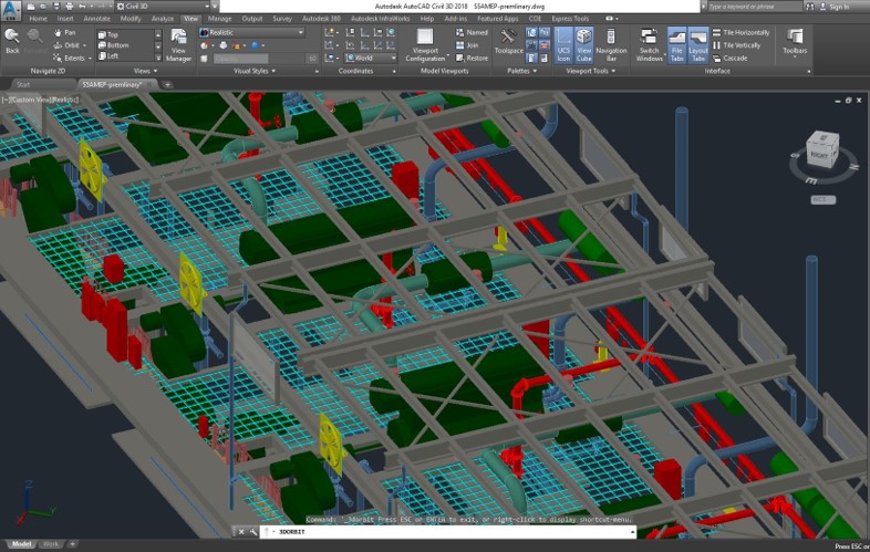
Merging the different point clouds collected with the three solutions, WGI provided the customer a detailed overview of the building and the facilities. Thanks to the product bundle of Leica Geosystems mobile mapping and scanning solutions, WGI was able to deliver the data in time and with the highest accuracy.