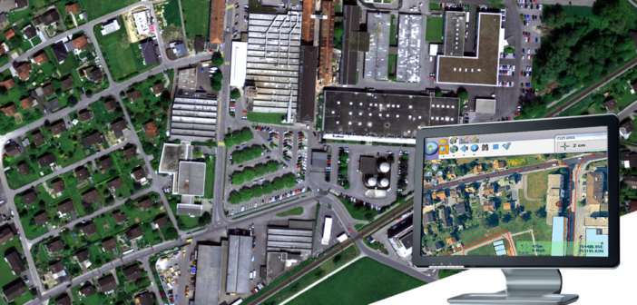
As technology moves forward, it often goes from being a concept, to a product or service, to being tailored to the needs of different industries. Geographic Information Systems (GIS) is no different. Advanced technology should be simple to operate and GIS can be a friendly tool for real estate professionals and the professionals in their network.
As we know, it can be a long and tedious process for a seller to attract the right buyer and close on a deal. Agents can improve and potentially shorten this process with advanced GIS software. GIS meets many needs of potential buyers and can help sellers get important documentation of a property they own. This inclusive technology can improve the efficiency of agents and those they serve.
Get the data you need
Why manually look for records and cataloged paper documents? GIS allows individuals to look for documents electronically online. Some large counties provide a tax parcel inquiry tool to make it easy to find and review relevant documents applying to a property or parcel.
Individuals who have come into property but may need a sales history or record of ownership would benefit from the assistance of an agent familiar with this technology that allows them to comfortably access important documents from any location with WiFi.
Improved market analysis
Agents need the latest information at their fingertips. It is possible to use GIS to make it easier to analyse comparative sales in a specific area. This applies to both valuation and real estate sales.
Compared to real estate software that may offer geospatial technology, robust GIS software is customisable. Agents can benefit from the ability to have more flexible parameters for querying data. In such a case, Multiple Listing Service (MLS) data may be imported into the advanced GIS software program and the agent can set the parameters desired. This results in improved results for agents.
Another benefit is the ability to bring in augmented reality. As Leica Geosystems recently announced its new offering in partnership with Matterport, real estate agents can provide potential buyers with accurate 3D walkthroughs of any property.
Advanced spatial analysis
Know the area around the location. GIS provide an advanced level of spatial analysis. In this way, agents and sellers can highlight important characteristics of a property. One such area of interest may be the path to schools or workplaces. The software provides more accurate estimates of commuting paths. Buyers appreciate the information and many weigh commute times to work or a child’s school when buying a home.
Buying a new home, particularly in a competitive real estate market, can be a very stressful experience when taking all buyer needs into consideration. As such, buyers often are looking to reduce the time they spend commuting when buying a home and spend that extra time with family or on individual pursuits. A home close to desired locations can
- Reduce the stress that occurs with long periods stuck in traffic
- Decrease the wear and tear on vehicles
- Provide homeowners with a few more precious hours every day.
An additional asset of GIS capabilities is that prospective buyers or investors get a bird’s eye view of the property. Potential buyers can overlay the property with aerial photography of shopping access, schools districts and utility services. Much of this can be done online and those looking to buy a piece of real estate or are looking to invest in new construction will appreciate the convenience of this application.
Buyers can use the technology to educate themselves and come to agents at a stage closer to purchase. This can reduce the need for agents to provide answers to basic questions and reduce the preliminary back and forth often inherent to the initial stage of inquiry and home purchases.
GIS technology disrupts the real estate industry
There is much to appreciate about this software that gives more insight to agents and buyers. Such technology improves accessibility to documents and data that can speed up the home-buying process and educate all parties involved in a transaction.
When a given technology can improve customer service and assist in the buying and selling of property, while reducing stress for agents, it is definitely an area to incorporate further into the industry. To learn more about Leica Geosystems GIS solutions, click here.

Greg Geilman is a Los Angeles native for more than 40 years and owner of South Bay Residential. From construction to marketing, Greg believes the real estate industry is ripe for disruption as technology becomes more affordable and accessible for businesses and their clientele.


