


Across industries, professionals are embracing artificial intelligence (AI) in their daily work and replacing time-consuming tasks and challenging processes with innovative tools. This trend extends to the use of reality capture software for outdoor and indoor applications.
Leica Cyclone 3DR is a next-generation software solution that combines AI with the accuracy and efficiency of reality capture technology to help users deliver 3D results for many applications. The recently released 2021.2 version Cyclone 3DR provides new classification features, including Auto-Classification, intelligent filtering and more, that streamline field workflows and help users prepare point cloud deliverables in widely compatible formats.
Data classification with a one-click process built on machine learning
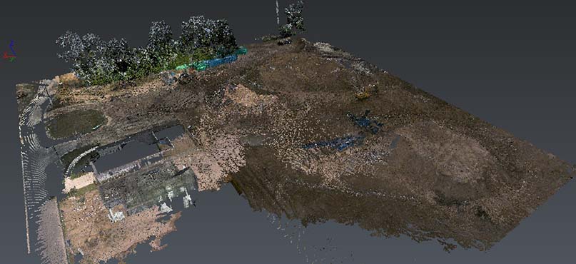
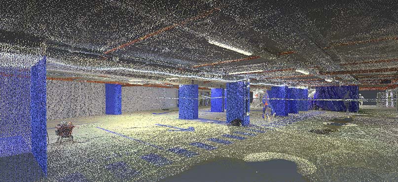
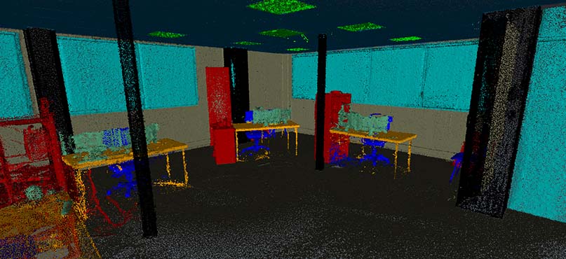
Cleaning and segmenting point clouds is a frequent first step when post-processing data is captured with 3D laser scanners. Assigning each point a classification that identifies the type of object scanned – relating the point to its real-world context – is essential to prepare the data for deliverable creation. Cyclone 3DR was designed with automatic tools supplemented with manual commands to facilitate this preparation step better.
The manual commands, including the Clean/Separate feature, are intuitive and help users work with complex scan data to deliver results for advanced applications. Various automatic tools, like Tunnel-Cleaning and Moving Object Detection, and smart filtering features for ground points, walls and floors, streamline complicated cleaning and segmentation tasks.
Additionally, a new auto-classification algorithm trained with large amounts of terrestrial scan data enables Cyclone 3DR to intelligently classify scan data with great accuracy and precision–saving time that can be allocated to other tasks.
 Manage point cloud classification easily
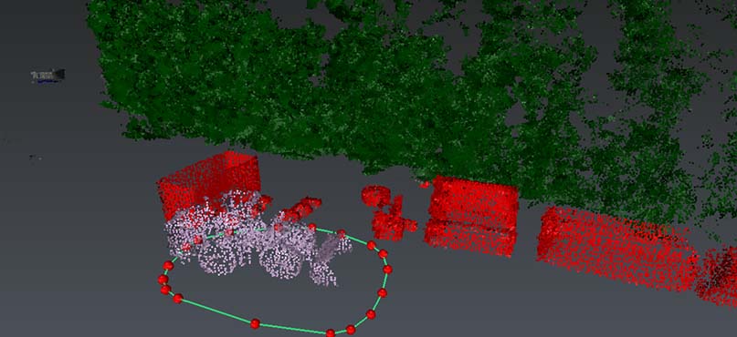
While fully intelligent data is an asset, its value sits in the accuracy of its classification, thus the user must be able to manage the classifications directly. Each point cloud can support 256 classes in Cyclone 3DR, including industry-standard ASPRS classes (vegetation, roads, rails, bridges etc.,) plus custom classes that the user can define. With so much variation, simple tools for managing the massive amount of point cloud metadata are invaluable.
Cyclone 3DR addresses this data management issue with a Manual-Classification command that allows users to modify, adjust, complete and check the classification of every imported point cloud within the product following automatic classification. Additionally, the user-friendly Settings Management command manages the visualisation of classified point clouds, the names of the classes and the creation and editing of user-defined classes for specific and frequent applications.
This combination of an automated process, modified with manual options, creates flexibility so that users across experience levels can benefit from reality capture data in outdoor applications.
 Optimise laser scanning processing jobs
Once the data is classified and intelligent, users can finish their workflow with a variety of capabilities within Cyclone 3DR.
This includes:
- Meshing and texturing, with advanced features and smart automatic tools for digital reality applications
- Modelling, with feature-extraction, reverse engineering, and industry-focused commands for any application from manufacturing, BIM or surveying
- Analysis, with simple comparison tools, measurement commands and advanced inspection solutions to deliver analysis reports
Within different industries, some parts of the point cloud will be more relevant to create final deliverables. Cyclone 3DR’s new feature, Explode by class, allows users to temporarily isolate the classes related to specific job needs. For example, digital terrain models of an area, 3D modelling of a building, road or construction site inspections, or the meshing and texturing of a cliff or landscape. This enables focus on the data within an area of interest for individual tasks, further optimising the workflow.
 Share standard-based classified results
In addition to creating optimised deliverables from Cyclone 3DR’s classification capabilities, it is important to be able to share the complete classified project for use in third-party solutions. Having finished the classification workflow, users can remerge multiple classified point clouds to produce a unique final point cloud containing all classes.
Classifications in Cyclone 3DR are based on ASPRS-certified standards and are supported by open-standard point cloud formats, like LAS and LAZ allowing them to be shared with third-party products or leveraged in other software that supports LAS and LAZ for rework or further refinement.
Cyclone 3DR provides complete automation of the classification process, allowing users to transform scanned data, optimise 3D results and share models through interoperable classified point cloud formats. With Cyclone 3DR, automation does not come at the cost of user control. Automation is paired with a range of manual management and editing functions to give users flexibility within their reality capture workflows.

Yannick Stenger
Product Manager Cyclone 3DR
Reality Capture Division
For more information on how AI-based software can improve your reality capture field workflows, visit the Leica Cyclone 3DR website.