


One of the main challenges of managing digital representations of buildings is ensuring that digital data is up to date with real-world conditions. Despite years of progress, it can still be cumbersome to maintain a closed feedback loop that feeds current laser scanning data into the Building Information Modelling (BIM) process. Thankfully, new approaches are carving a path towards making this process more autonomous.
At Leica Geosystems, we have developed platforms for the seamless integration of laser scanning data to increase the value of BIM. Here, Paul Burrows, Scanning Solutions Manager at Hexagon’s Geosystems Division, explains how BLK Autonomy, Leica BLK ARC and Leica BLK2FLY can be used to feed real-world data into closed-loop BIM processes.
BLK Autonomy: Integrating laser scanning data into the digital construction process
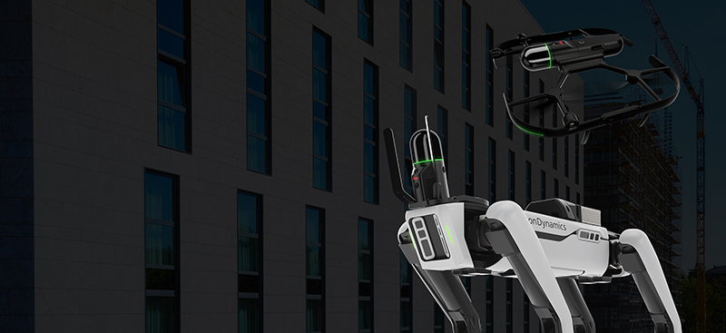
The more users can leverage autonomy, the faster they can deliver accurate results. Our BLK Autonomy fleet is a big step forward in helping construction companies automate the management of digital twins. It consists of robots and platforms with GrandSLAM technology, real-time laser scanning, artificial intelligence (AI) and machine learning-enabled data processing that requires no human intervention. Autonomy is how the robots, sensors, and software work together to eliminate as much physical work as possible.
The BLK ARC is an autonomous laser scanning robotic module that collects 3D data and image information and provides updated position information and improved robot navigation using GrandSLAM technology. This technology is a fusion of LiDAR SLAM from laser scan data, Visual SLAM from the cameras and an Inertial Measurement Unit (IMU) which when working together provide accurate positioning which feeds back into the carrier platform. It operates at 420,000 points per second with a full-dome LiDAR sensor and has a range of up to 25 metres, plus a multi-camera vision system. The BLK ARC user interface is browser-based enabling simple tablet control for every facet of the BLK ARC. Users can upload predefined scanning paths and plan static capture positions at fixed locations along a path or diverge from them if required at the touch of a button. Once everything is set-up, the device, atop it’s robotic carrier, will begin the mission. BLK ARC is autonomous, versatile & safe.
Autonomously collecting real-time data from a birds-eye view
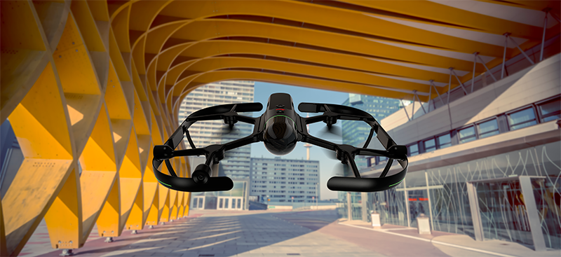
The BLK2FLY is the world’s first autonomous flying laser scanner. It is autonomous because it collects data by specifying a region for data collection via the BLK2FLY LiveApp interface and has three radar sensors for avoidance technology. It is very well suited to building surveys and construction applications as the BLK2FLY will always maintain a specific distance away from structures and other obstacles and collect the laser scanning information required.
It is not to be confused with a UAV (Unmanned Aerial Vehicles) that takes photos and converts them to photogrammetric meshes or point clouds – it’s a flying laser scanner that creates the point cloud in the air directly for consumption in other applications. Even better, users can merge all datasets from the BLK Autonomy fleet together using HxDR (Cloud approach) or Leica Cyclone REGISTER 360.(Desktop approach)
Managing the data collection cycle: creating autonomous workflows
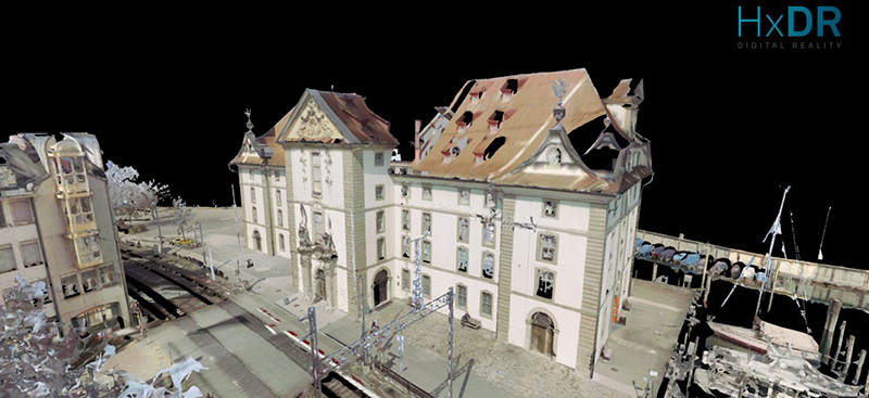
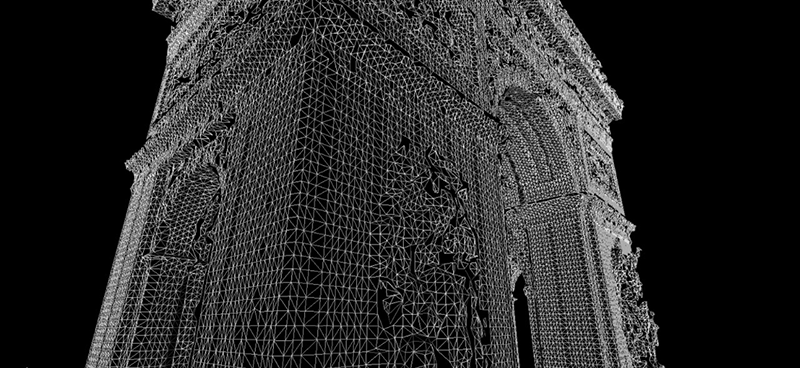
HxDR is Hexagon’s cloud-based digital reality storage, visualisation, and collaboration platform. It allows users to upload data directly from the sensors into the cloud from the BLK2GO, BLK ARC, and BLK2FLY. By uploading a point cloud to HxDR, users benefit from a cloud-first workflow that will automatically generate a lightweight mesh for use in other applications, provide super-speed access to the point cloud and any panoramas. Users can also download their data in a variety of industry formats. Users can generate BLK ARC path plans, report on deviations against design and produce high-resolution meshes in a desktop environment using Leica Cyclone 3DR.
Getting the most out of BIM data with a new shareable format
Building construction is one of Leica Geosystems’ most significant industries within the reality capture business. Laser scanning is an ideal tool for the sector because it’s all about mitigating risks, making sure the construction process goes smoothly and preventing money from being wasted.
We continually update and improve our 3D laser scanning solutions to increase efficiency and enable better ways of working. As part of these improvements, we now leverage the BIM Collaboration Format (BCF) from buildingSMART that allows users to share information between various BIM platforms for issue-tracking. As an example, users can go into Cyclone 3DR, specify an issue (such as a deviation or out of tolerance object) and add tags such as measurements or images, then create and export a BCF file. This will display 3D views of the issue, associated images, and enable tracking of any detected issues within a variety of 3rd party solutions. The BCF file format provides a closed-loop back into project management platforms, allowing stakeholders to see where the issues are, whom to assign them to and how to resolve them.
The BCF file format is an open standard and can be used with the BLK Autonomy fleet and software solutions to open new data flow possibilities.
Every professional can work seamlessly by integrating laser scans into the closed-loop process. With continuous progress monitoring, deviation reporting, and feedback using desktop and cloud-based solutions, you can be autonomous in your work. Our flagship BLK Autonomy fleet, coupled with our powerful software solutions, will enable you to efficiently manage your workflows on a day-to-day basis, not only now, but in the future.

Paul Burrows
Scanning Solutions Manager
Reality Capture Division
To embrace this technology and transform your business with autonomous laser scanning, visit our website. To receive the latest reality capture news directly to your inbox, subscribe to our quarterly newsletter.