


Precise positioning enables artistic corn maze creation
Have you ever heard of a positioning solution that makes you lost? A unique application of the Leica Zeno FLX100, along with Leica Zeno Mobile and HxGN SmartNet, used cm-level positioning to prepare a corn maze designed to do just that.
Design meets precision agriculture
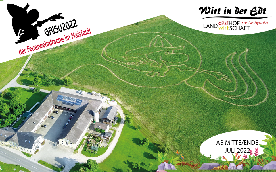
Many things make Erwin Radner’s agricultural tourism business in Schart, Austria, special for visitors of all ages – including a guesthouse with a restaurant, a store offering regional products, a large playground, and a seasonal corn maze. Inspired to make the latter an even more memorable experience, Radner decided to use design and positioning technology to help shape a traditional favourite in a new direction.
While many corn mazes dot the Austrian countryside each autumn, in the fall of 2021, only Radner’s stood out for its artistry from above and within – the aerial view of the labyrinth depicted a dragon firefighter dousing flames with fireman’s hose. Radner was able to take on this challenging design using a Leica Geosystems high-accuracy solution comprised of the Zeno FLX100 paired with Zeno Mobile software and HxGN SmartNet positioning services.
Preparing for the field with Zeno Mobile
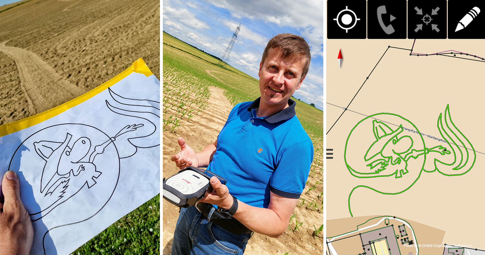
From design software to field application, Radner leveraged a range of technologies to prepare for his ambitious project. To begin, he drew the pattern and set the sizing in Adobe Illustrator, exported the template into Google Maps, and transferred the file into Zeno Mobile. Providing tools for data capture and management, Zeno Mobile is a GIS application that supports a range of data formats for import, from geospatial data to png and CAD files.
Radner used the data imported into Zeno Mobile to prepare for stakeout with the Zeno FLX100. The Zeno FLX100 is a compact, flexible smart antenna that can be attached to a surveying pole or used in a handheld tray that also accommodates tablets and smartphones.
Zeno Mobile allows users to pair the FLX100 with any smartphone or tablet, whether running iOS and Android. Additionally, HxGN SmartNet positioning services are fully integrated, enabling cm-level accuracy with RTK corrections.
“I wanted a system that was RTK-compatible on the one hand and as mobile as possible on the other – this is how I decided in favour of the Leica Zeno FLX100,” said Radner.
Easy stakeout for precise planting
Although the corn maze project was the first time Radner used the FLX100, a collection of training materials available via the myWorld customer portal and the Online Training Platform connected him with information needed to set up the device in the configurations required for his application.
“The simple navigation saves me tedious measurements of reference points,” Radner explained. “I measured the labyrinths in 2019 and 2020 manually, which cost a considerable expenditure of time.”
Using the stakeout feature in Leica Zeno Mobile, which provides navigation guidance to the desired points, he was able to quickly spray the points to mark for planting.
“With the exact RTK guide, it is now a real breeze to recreate a detailed template. I can define the paths in the field, mark them, and precisely plant the pattern,” said Radner.
Months later, time revealed the success of the positioning solution as the corn grew and the design came to life.
“I am very satisfied with the FLX100,” reflected Radner. “I can rely on it when I need it.”
Want to learn more about Zeno’s positioning solutions? Explore our range of GIS-tailored smart antennas, tablets, and software.