


1. Could you give more details on Ordnance Survey Ireland (OSI) and your role? What are OSI’s main responsibilities as the national mapping agency of Ireland?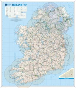
Our mission is to create, maintain and provide the states definitive mapping and geospatial information services to support citizens, business and policy makers. My role as General Manager of Surveying, Remote Sensing and Geodesy is to ensure the effective maintenance and currency of our geospatial data bases, Mapping, Imagery and Elevation and that we have in place the Geodetic Infrastructure and systems to support our platforms.
2. What are the main challenges you face for the creation of Dublin City and District Street Guide, the atlas of Dublin city, and the Complete Road Atlas of Ireland? How has Leica Geosystems’ technology helped you to overcome these challenges?
The way we generate our tourist and leisure information of street Atlases and similar products has recently changed. Historically, all our cartographic products were created separately, seven years ago, we migrated from the old way of collecting and maintaining data in to a single, topologically maintained object oriented digital database. This means that all our products including our tourist maps are derived from that single database. Our challenge is to keep the database up-to-date by ensuring that all the current infrastructural projects, buildings and real world objects are within it. In terms of data collection, we rely on multiple platforms, data collection processes and technologies including Leica Geosystems airborne, surveying and mapping systems, to achieve that.
3. How often do you revisit and revise maps and how does Leica Geosystems technology help you for such a demanding task?
In terms of revising the tourist and leisure maps, periodically, we generate cartographic products with data taken from the geospatial database. With the advantage of a single source of data that is updated nightly, our customers have access to on demand mapping available through our E-Commerce system. With the rapid evolution and advances in technology that are increasingly innovative and accurate, as an organisation, it’s important to keep up and invest in the latest technology and to take advantage of automation to drive efficiency. Technological innovations coming from different industry partners, such as Leica Geosystems have been instrumental in assisting us to maintain our geospatial information.
4. Can you give more details on the mapping techniques that you use? How important is the 3D data for the maps that you create?
There is a number of mapping techniques that we use, from traditional ground survey data capture to remote sensing and photogrammetric data capture. As an organisation we see the value of having three-dimensional data as opposed to just having the old-world view. 3D data is part of our new strategy and it is our ambition to go towards 3D and create 3D datasets. Our responsibility is to maintain not just two dimensional mapping but also our height/elevation information which is crucial for our products like Orthophotography, and derived information to assist in data analysis for example, flooding, and disaster management, and land cover mapping among others. Information as such enables better planning and decision-making processes.
5. How do you expect the airborne market to evolve over the coming years? What technological developments do you foresee in the near future to be an asset for your projects?
It’s really an interesting time for the airborne market in terms of the actual sensors that are being developed especially with the combination of multiple sensors within single Hybrid platforms. As an organisation we have historically used airborne systems for our data collection and will continue to do so. I also believe that the world will continue to leverage satellite imagery in particular for the rapid update of information for disaster management and land cover/land use. We recently have seen microsatellites being dispersed for capturing of imagery, in tandem with the explosion of drone technology.
5G will be a massive breakthrough changing the way we use technology. It is going to revolutionise not just mapping but our lives, the way we connect to each other. OSi have always been a technology driven organisation and we will continue to embrace innovation. Our goal is to always investigate and invest in new solutions that provide efficiencies.

Paul Kane
General Manager of Surveying, Remote Sensing and Geodesy
Ordnance Survey Ireland (OSI)