


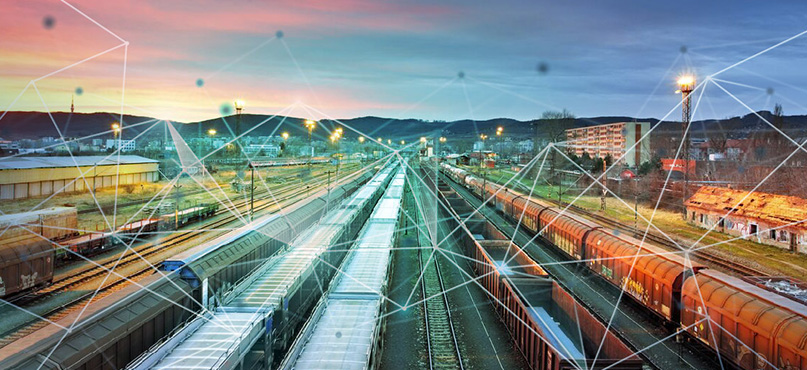
The railway is our passage to destinations near and far, connecting people, places and goods. Bolting through urban cities, lush countryside, mountain ranges and even under the sea, trains and their rail network have been built over hundreds of years to create one of the most sustainable solutions to transport on the planet when compared to road and air travel.
The requirement for passengers is simple; affordable, comfortable, frequent, reliable and safe rail travel. But when stepping out of the passenger seat and onto the rails as a surveyor, they see requirements through a different lens, focusing on safety, accuracy and efficiency. Although robust and well-built, decade-old tracks require maintenance, while new, ultra-fast trains require updated railroads. To consistently ensure safety regulations are met when designing, building and maintaining our railways, and all actions are completed accurately, surveying is the crucial ingredient.
Surveying technology is required to build a precise track for high-speed rail and a safe environment for trains to pass through, both on the track and through clearances, platforms and tunnels. In this blog, we take reality capture on the rails to demonstrate how rail projects’ safety, accuracy and efficiency can be enhanced through digitalisation, from capture and design to construction and building and, finally, to operation and maintenance.
Capture & Design for rail – from concept to reality
During the crucial concept stage of capture and design, technology empowers new ideas for the railway that, put simply, wouldn’t be possible without a surveyor. What’s more, capturing the railway can often be completed by different professionals for different reasons, even by individuals in the same company. Each group needs access to the railway, which is time-consuming and increases safety concerns. This is where reality capture comes in.
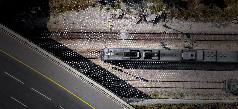
A reality capture solution is more than just a tool – it captures entire environments before infrastructure is even built, bridging workflows with sensors, services and software for project-wide collaboration. It ensures every stakeholder can have eyes on and contribute to the rail project design process remotely. Reality capture is a means of truly validating the initial design, for example, to verify the concrete formation before track slabs are installed.
A reality capture solution is entirely customisable to the surveyor’s project requirements, providing a high level of accuracy where it’s needed most. If they require speed, the Leica RTC360 3D laser scanner has a measuring range of up to 130 metres and a scanning rate of up to two million points per second. If they need long-range for scanning at a safe distance, the survey-grade Leica ScanStation P50 laser scanner offers the highest quality 3D data and HDR imaging.
Both solutions work seamlessly with the Leica Cyclone FIELD 360 app for pre-registering and aligning captured scans directly in the field. At the same time, Leica TruView Cloud enables professionals to share project data for design elements directly with stakeholders. Users can even integrate their desired third-party rail software, such as Civil 3D for Rail Design or OpenRail Designer which are just a few examples of various reality capture solutions accessible to the rail industry.
Regardless of the solution, a combination of reality capture sensors, software and services provides a complete workflow, which is critical to data-driven design plans for project success.
Construct & Build for rail – accurate, precise and safety-first solutions
The construct and build phase introduce new sensors, services and software that enable surveyors to meet build challenges in the digital construction world before they happen. Accurately calculating the volume of earthwork is one thing, but any excavation or structure near the railway can cause movement that damages infrastructure or impacts track geometry. Regular structural monitoring is a necessity due to significant safety implications associated with the risk of train derailments.
Datum Monitoring Ireland, a company specialising in remote monitoring of earthworks, structures and transport infrastructure, analysed the data of Dublin’s dual Luas light railway system using two Leica Nova MS60 MultiStations, the Leica LS15 digital level and the Leica GeoMoS monitoring solution. Using this combination, the team were able to supply an effective, accurate and reliable warning system that notified stakeholders in near-real time if a threshold exceeded specifications to ensure that public infrastructure and surrounding buildings remained undisturbed.
Reflecting on the MS60’s performance during continuous scanning of the tracks that enabled transit to continue uninterrupted, Mark Hodgen, director at LDG Datum, explains, “These instruments scanned the dual tramway continuously and hosted data directly onto a secure webpage for the relevant parties to review,” said Mark Hodgen, director at LDG Datum.
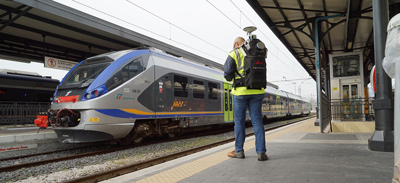
Once construction nears completion, it’s time to capture scenes for as-built documentation. Reality capture solutions allow users to freely walk about a railway structure, such as with the Leica Pegasus:Backpack mobile mapping solution or the handheld Leica BLK2GO imaging laser scanner. These solutions can be operated by experienced surveyors and trainees alike, and the Pegasus:Backpack is also great at capturing hard-to-see areas around the railway line, such as the top of embankments, with its prolonged range and wide field of view that eliminates shadows.
One of our mobile mapping solutions was also used to scan one of the world’s longest tunnels – the Gotthard Base Tunnel on the new rail link through the Swiss Alps – capturing the entire infrastructure of the newly constructed rails, signage, posts, electrical lines, and further installations and structural elements, for a complete database of 3D imagery and point clouds. Surveying engineers were saved from working on a dangerous construction site. The technology reduced effort, saved costs and time, and provided a rich dataset that all parties could use to conduct their work quickly and successfully.
To deliver an assortment of 3D deliverables and reports and perform clearance analysis in rail, Leica Cyclone 3DR is the office software for the job. It can automatically identify potential clearance checks between the point cloud of an environment and a rail carriage, allowing project users to make decisions rapidly and avoid damaging consequences.
Operate & Maintain rail – automatic detection at the scene
With design and construction complete, as-built documentation submitted and the track officially open, ongoing maintenance enables safety and efficiency. For railway tracks new or old, surveyors have the skills to report, assess and evaluate the state of the railway on an ongoing basis.
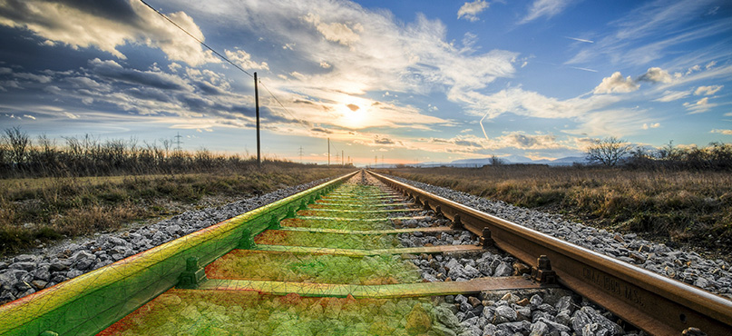
Inevitably, environmental influences like landslides, rockslides, and subsidence can cause damage to infrastructure, such as bridges and tunnels. Geodetic monitoring is ideal for continuous monitoring along railway tracks to keep trains and passengers safe from such threats ahead of time. Measurements from Leica Geosystems TPS and GNSS technology, combined with the GeoMoS monitoring software previously mentioned can alert users to critical observations via multiple messaging streams, providing stakeholders with plenty of time to react before disaster strikes.
Rail yards may be the most challenging assets of any rail system, whether passenger or freight. With the Leica BLK2FLY, an autonomous flying laser scanner with advanced obstacle avoidance, you can easily capture reality from the sky, be it a rail yard or bridge, without disturbing rail operations. Requiring no prior UAV experience, this flying laser scanner is operated by the BLK2FLY Live app. The collected 3D point cloud data is easily transferred to Leica Cyclone REGISTER 360 PLUS (BLK Edition) for post-processing, management and delivery.
As mentioned throughout, mapping railway tracks and their environments is a crucial aspect of each phase of rail development, especially for rail maintenance. Reality capture solutions such as the Leica Pegasus TRK Neo (a solution with advanced dynamic laser scanning and an expandable imagery system for recording, measuring and visualising rail tracks), accompanied by industry-leading software such as the Leica Cyclone family, are becoming ever more critical for maintaining the rail network. AI capabilities of today’s technology can detect changes, like vegetation growth over time that can impact tracks and damage overhead powerlines. Building a digital twin of entire rail infrastructures even allows users to perform clearance checks in the virtual world – relieving professionals from repeat visits to dangerous locations.
The heart of rail travel
Putting reality capture technology on the rails provides more than just a means of ensuring work is carried out easily, on time and in full. It’s about ensuring safety, accuracy and efficiency are at the heart of the work. Not just for passengers on the rails, but for surveyors and their stakeholders working on tracks for the good of our sustainable global transport network.
Thanks to the work carried out by surveyors and digitisation through new technology such as the examples we’ve provided in this blog, we can build a safer, more sustainable future for rail travel – one track at a time.
 Krasimir Matev
Industry Marketing Manager, Survey Solutions
Leica Geosystems
Click here to learn more about our rail-specific surveying solutions help you to capture, design, build, operate and maintain the rail tracks and network environment.