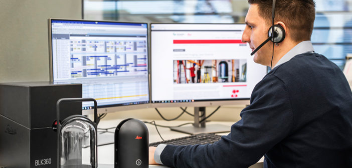
At Leica Geosystems we have a network of experienced professionals working in customer support services, ready to guide our customers through any problem, anywhere, anytime. As well as offering user-tailored on-site training we have online training for general knowledge about our solutions and email and phone support so you can call us from the field. Here we answer some of the questions we are most often asked about 3D laser scanning. Do you have a question about 3D laser scanning that isn’t answered here? Don’t hesitate to contact your local support team and ask one of our friendly experts.
 Is it safe to charge the batteries for my laser scanner before they are empty or low?
Yes. All new Leica Geosystems batteries are based on Li-Ion technology with intelligent charging technology. You can charge a Li-Ion battery at any time. Newer studies even show that charging batteries that are not fully discharged can even increase the number of charging cycles in a battery’s life.
How do you update 3D laser scanners with new firmware?
Firmware updates and firmware installers for all 3D laser scanners can be downloaded from myWorld, Leica Geosystems after-sales customer portal. For the Leica RTC360 and Leica ScanStation P-Series models you download the installer file onto a USB stick, attach the stick to your instrument and upload the firmware upgrade. This process is explained in full in your user manual. For Leica BLK360 and Leica BLK2GO imaging laser scanners, you connect your computer to the BLK’s WiFi and make the firmware update by visiting the update page on myWorld. A step by step guide is available on myWorld.
 What is VIS Technology and how does it work?
VIS stands for Visual Inertial System and in simple terms, it creates the ability for a 3D laser scanner to “see” where it is at each setup and track its own movement. This technology is included in the RTC360 where the VIS component computes and delivers a delta pose between two setups in real-time. The system comprises an Inertial Measurement Unit (IMU) and five cameras. The fusion between these sensors is very important because this minimises the inherent drift in the position that is common with IMU only systems. Essentially, the cameras give the IMU eyes to produce a much more accurate station to station position. This in turn, enables a very easy infield registration during data collection. Find out more about our development of Visual Inertial System (VIS) Technology.
 Which licence do I need for Leica Cyclone 3DR?
The Cyclone 3DR software package includes many different functions to support various reality capture applications. It is available in different editions depending on your industry needs. For example, the Standard edition is the basic package of Cyclone 3DR that includes the features you need for essential tasks: importing point clouds, cleaning data, meshing and refining models, simple modelling, inspecting and comparing, scripting, reporting and user-friendly exchanging with CAD software.
The Survey edition of Cyclone 3DR builds on these basic features with surveying-industry driven workflows through advanced features to clean, mesh, extract and report what you need even faster. It includes pre-defined tools such as DTM, Building Extractor, Cross Section, Contour Lines and texturing tools. The AEC edition is similar for the Architecture-Engineering-Construction Industry with advanced features like Scan-to-Plan, Clash Analysis, Surface analysis or BIM Inspection workflow in Touch Mode. Finally, Tank edition is the module that provides smooth cylindric tank analysis. To decide which edition is right for you please refer to the Cyclone 3DR technical specification which lists every feature per edition.
 How do you do a Check & Adjust on the Leica RTC360?
The Check & Adjust feature for the RTC360 3D laser scanner makes it easier and quicker to check and improve the angular accuracy of your RTC360 directly in the field. It is a fully automated, straightforward, one-button, procedure that is easily completed wherever you are, in less than six minutes. It simply requires a double scan at one position to calculate the new angular parameters and angular accuracy of the scanner. There is a step by step guide to the feature on myWorld and an article available to read: Introducing Check & Adjust feature for the Leica RTC360.
 How do you create a Leica Cyclone FIELD 360 account? How many devices can you use per licence?
A few licences provide access to Cyclone FIELD 360. Any Cyclone REGISTER family licence or a standalone Cyclone FIELD 360 licence will provide five concurrent uses of Cyclone FIELD 360 per licence.
To begin, sign up for an account through the Cyclone Cloud portal. As part of the registration process, you will be prompted for your Entitlement ID (EID). If you are using an EID for any Cyclone REGISTER family product, please ensure that the EID is active in CLM prior to loading it in Cyclone Cloud. If the licence only contains Cyclone FIELD 360 products, you may load in in Cyclone Cloud without prior CLM activation.
Next, download the Cyclone FIELD 360 app – it is free to download from either the Apple App Store or Google Play. Upon launching the app, you will be prompted for credentials – use the credentials you set up to access Cyclone Cloud.
You can also use a demonstration, evaluation or educational REGISTER 360 license to sign up to FIELD 360 too, regardless of whether you have a Leica Geosystems Customer Care Package. Each Cyclone Cloud account with one EID enables up to 5 borrows of FIELD 360 in 30-day increments.
 Can I combine Leica ScanStation P-series and RTC360 data in Leica Cyclone REGISTER 360?
Yes, you can. From the Import area of Cyclone REGISTER 360, add in the RTC360 and P-Series scan data. You can use Auto Cloud and Auto Target, as import options, then click the Import button. Once imported the data can be further registered together using Visual Alignment and or targets forming one bundle for the RTC360 data and another bundle for the P-series data, then the bundles can be joined together, at the end, using Visual Alignment. There are many ways to register and this is only an example of one of the ways scanner data from a variety of sources can be joined and registered together. You can request step by step instructions from your local support team.
 How do you merge multiple bundles in Leica Cyclone REGISTER 360?
In Cyclone REGISTER 360 all data must be combined into one bundle before you can finalise and publish projects. Bundles must be in the same SiteMap to be combined together. So firstly, drag and drop your data from one SiteMap into another. In the Project Explorer panel, select the bundle you want with the left mouse key and hold. Drag the bundle up or down to its new SiteMap location. The icon will change to an arrow when hovering over the new SiteMap indicating that it can be dropped in.
To combine scans, select two scans using the shift key in the main workspace or Project Explorer (left side panel) and create a link. Links can be created using Visual Alignment and require sufficient overlapping points or with targets, if corresponding ones exist between the bundles. Once a link is created between bundles, the scans will collapse into one bundle. Repeat until all scans are in one bundle.
 Where can I find documentation on my 3D laser scanner and software?
By registering your 3D laser scanner and software at Leica Geosystems myWorld customer portal you gain access to technical information such as manuals and release notes. It’s also the place where you can download current software and firmware updates, make technical support requests, see calibration certificates and take free myLearning courses to help you get the most out of your equipment.
To register your devices you need their equipment numbers and serial numbers. These can be found in different places depending on the device, either underneath it or inside the scanner battery door. Registering software on myWorld requires a copy of the Entitlement ID (EID), a 25-digit code for each piece of software purchased. Approximately two days after a software purchase, an Entitlement Certificate is emailed to you. If an Entitlement Certificate isn’t received, reach out to your Leica sales representative. For more information watch this video on setting up a myWorld account.
 How can I optimise my computer to speed up data imports into Leica Cyclone REGISTER 360?
Importing data can be a lengthy process. There are a number of things you can do to make it faster, but as a starting point, it’s essential you use a PC suited to working with large data sets like point cloud data. Make sure your PC meets the recommended specifications, not just the minimum requirements, for example, 128GB RAM and a 4GB graphics card. This article from AEC Magazine offers a detailed analysis of the components you want to consider when purchasing a machine.
When you are organising your data, spread different data sources to different drives, by using multiple SSD drives rather than just one large hard disk drive. Use SSDs as storage locations for your databases and use the fastest drive for your temp directories since they are always written and read, and may actually be larger than your actual database. Do not use network drives as they are not recommended and are normally slow to access.
You can also change some settings in Cyclone REGISTER 360 to speed things up. Cyclone REGISTER 360 can import data in three modes, Fast, Balanced and Safe which balance the speed of an import against the stability of the system. Fast is obviously the quickest, but it can cause instability during import depending on system resources. You can also decrease pano image resolution. Especially when working with large imagery consider importing with a 4,096 resolution rather than the highest available. The difference in image quality is negligible for most applications.
Read the 5 Simple Rules to Ensure your 3D Laser Scanner Always Performs to Specification here!
Visit leica-geosystems.com to contact our support service with any technical questions about Leica Geosystems solutions.


