


Traversing cities, passing through mountains, and making underwater connections, tunnels represent some of history’s greatest feats of engineering. Today, as our cities become more heavily congested, tunnels are increasingly used to relieve transportation pressure above ground, saving commuters and city-dwellers time and reducing vehicle-induced pollution.
For surveyors, working in and above demanding tunnel environments presents unique challenges – it’s dark, dirty and often cramped. Surveyors are required to get in and out of the site quickly, not only for their safety but to keep services running with minimal disruption to the public. They rely on solutions and services that are simple to use and provide accurate and reliable data, so they and others on site can safely design, build and maintain this complex web of underground infrastructure.
Reality capture solutions add value in all stages of the tunnel lifecycle: from capture and design, through the construction phase, and extending to the sustained operation of tunnels. In this blog, we look at each of these three phases in turn and explain how Hexagon’s tunnelling solutions are helping surveyors collect data rapidly, comprehensively, and safely.
1. Capture and design: accurate and reliable data to reduce risk and start a tunnel with confidence
In the design phase for tunnels, surveyors play an essential role. They provide condition surveys, dilapidation assessments, topographic and utility mapping. Hexagon’s tunnelling solutions enable surveyors to measure and analyse terrain, existing structures, and surface features, aligning them with the tunnel design’s geological and geotechnical underground data. Survey data can also be used to make decisions that ensure workers’ safety and the project’s success through, among other things, efficient planning and design verification.
Creating a digital twin
Creating a digital twin of existing tunnels for renovation, or the surroundings above ground for new tunnels, is an essential part of data collection during the design phase. Hexagon offers a comprehensive range of solutions for creating a complete and detailed digital twin:
- For a smaller and cost-effective solution, the Leica GS18I smart antenna can capture images with visual positioning technology and generate a detailed point cloud within Leica Infinity office software.
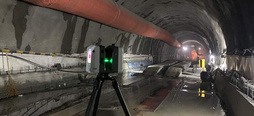
- For higher efficiency and speed, the Leica RTC360 3D laser scanner has a measuring range of up to 130 metres and a scanning rate of up to two million points per second.
- When long-range scanning is required at a safe distance, the Leica ScanStation P-Series delivers high-quality 3D data, collecting up to one million points per second for ranges up to 1 km.
- For large-scale infrastructure projects, the Leica Pegasus TRK mobile mapping system offers a highly efficient solution that can be mounted on almost any vehicle for faster data capture.
Dilapidation survey
The dilapidation survey is essential for protecting all stakeholders. It provides accurate documents, legal protection and better planning for potential impacts. This helps to ensure a smooth and responsible construction process that considers the interests of neighbouring properties and stakeholders. Tunnel construction can significantly impact an area, and a pre-construction assessment is one of the most effective ways a developer can provide evidence in any claims for property damage. The Leica Pegasus TRK fully integrated modular imaging system is a highly efficient mobile mapping solution, which can be used to identify surface cracks by autonomous information extraction using Leica Cyclone MMS DELIVER.
Topographic survey
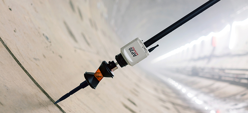
A topographic survey captures detailed above-ground site conditions, aligning with subsurface data to support tunnel engineers in creating accurate designs. The Leica TS16 automated total station and the Leica AP20 AutoPole let surveyors measure with a tilted pole for greater productivity. Using Leica Captivate field software, surveyors can map point and line features in the field to minimise post-processing in the office and create deliverables ready for design activities to begin.
Underground utility mapping
Underground utility mapping is essential for worker safety. The construction team can only avoid life-threatening buried cables and pipes if they know exactly where they are. Therefore, Hexagon offers a range of solutions for subsurface mapping, depending on the project complexity and requirements:
- Easily detect and map underground utilities with the Leica DSX utility detection solution, consisting of portable hardware with intuitive software. The Leica DSX maximises productivity with cutting-edge software that automates data analysis and creates a 3D utility map in the field.
- For greater depths, Stream DP, a multi-channel Ground Penetrating Radar (GPR), is an array solution for real-time 3D mapping of underground utilities and features that sets a new standard for underground surveys. It offers performance-maximising asset detection to a deeper range than any other solution available, while being easy to use and assemble by a single person.
- For extensive areas, surveyors can use Stream UP to map the subsurface. Mounted to a vehicle, this allows users to capture underground utility assets in urban environments faster and more safely than other GPR systems.
2. Construct and build: fast and reliable tunnel surveys that help ensure safety, efficiency, and project success
In tunnel environments, space is limited, and accessibility is restricted. It’s challenging to maintain accurate positioning once work starts. Therefore, the key priorities for surveyors at this stage are being able to work efficiently and accurately. They need to give on site decision makers the information they need quickly, to minimise waste, keeping everyone safe and the project on track.
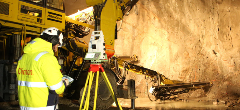
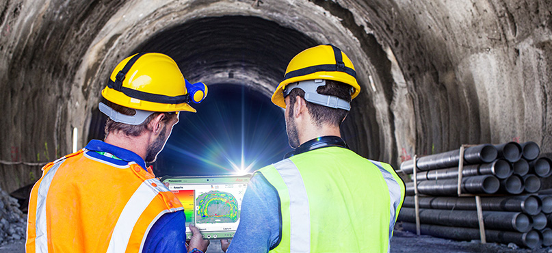
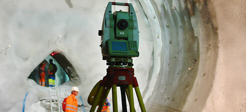
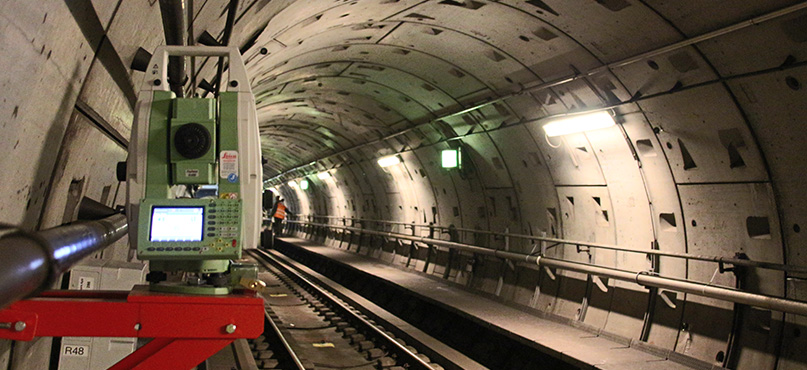
On site tunnel inspections
Surveyors can inspect and report in real-time with Leica MS60 and the Inspect Surfaces application for progress checks on site. The Leica Captivate Inspect Surfaces app empowers surveyors to make the right decision directly in the field when comparing and analysing surfaces against tunnel designs. Automated surface analysis generates a coloured heatmap, providing an interactive, graphical 3D visualisation for quick identification of areas with significant differences.
Minimising waste
To minimise wastage of expensive materials during construction, Hexagon has created the Leica ScanCrete solution. The end-to-end solution optimises sprayed concrete application directly in the tunnel and improves data capture efficiency, minimising waste and streamlining productivity. As well as a cost-saving imperative it also helps construction companies to reduce their environmental impact. Concrete is an environmentally ‘expensive’ material. Its production consumes a large amount of the world’s industrial water supplies and generates a high level of CO2.
For surveyors, ScanCrete makes it easy to conduct visual reporting of the concrete thickness directly in the tunnel through industry-proven technology for accurate and real time as-built analysis.
Monitoring for safety
Safety and security are paramount in tunnelling construction projects. Leica Geosystems’ deformation monitoring systems provide real-time information about ground movements and tunnel distortions (e.g. displacement, ovalisation, convergence), allowing rapid and critical decisions to ensure the highest levels of safety and effective risk management. Project teams can proactively mitigate risks and ensure a secure working environment for all involved.
Deformation monitoring enhances safety within the tunnel environment and identifies displacements or changes above ground. For example, during the construction of the Gotthard Base Tunnel, the world’s longest and deepest rail tunnel, Leica Geosystems instruments were used to monitor dams above the tunnel. There was a slight probability that the tunnel construction – 1.4 kilometres underneath the lakes – would affect the stability of their dams. The fully automated devices monitored the dams throughout the entire tunnel construction from 2000 until 2015.
Automated monitoring with scanning
For consistent and continuous monitoring, surveyors can choose the Leica Nova MS60 MultiStation. The MS60’s advanced sensor technology merges automated scanning, imaging, reflectorless and prism measurements, providing holistic information for accurate detection of movement with Leica GeoMoS: a scalable software solution that’s suitable for continuous or periodic monitoring of projects. The merging of 3D laser scanning and total station technology creates a best-of-both solution, combining accuracy and coverage. For example, the MS60’s accuracy isn’t limited to single measurements. Areas can be scanned and compared at different points in time to identify deformations. It can be left running 24/7 at a safe distance, keeping watch without disrupting work.
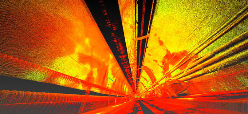
Powerful analysis with Leica Cyclone 3DR
For surveyors obtaining and manipulating scan data from different sensors for multiple purposes, there is the option to perform tunnel analysis in greater detail in the office using Cyclone 3DR. The scanned as-built tunnel point cloud can be compared to the design used to generate as-built cross-sections and to report on overbreak and underbreak.
3. Operate and maintain: monitor tunnels in real-time, detect potential issues earlier, and document assets efficiently
Surveying continues after construction. Tunnels present demanding environments that require continuous monitoring to ensure operational efficiency and safety. As such, surveyors play a crucial role in the ongoing life of the tunnel.
Minimising downtime
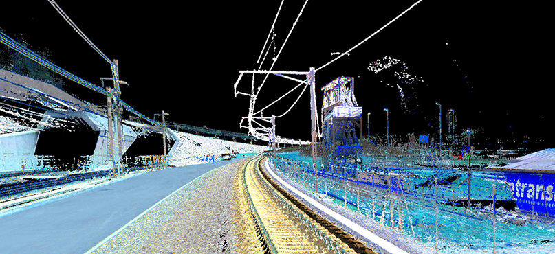
Safe operation is ensured by remotely measuring inaccessible or dangerous areas within the tunnel, and road or track interruptions are minimised by rapid data collection. Leica Geosystems mobile mapping systems empower users to capture data efficiently over long distances more completely than conventional surveying techniques.
Hexagon has made it easy to create a digital twin of a tunnel using the latest Leica Pegasus TRK solution. Mounted on almost any vehicle, the Pegasus TRK, with an integrated Inertial Measurement Unit (IMU), a Distance Measurement Instrument (DMI), and Simultaneous Localisation and Mapping (SLAM) technology, enables efficient data capture and intricate point clouds, to deliver detailed digital twins.
Clearance analysis
Hexagon’s autonomous information extraction solution for road and rail tunnels allows clearance analysis for 2D and 3D profiles. Leica Cyclone MMS DELIVER inputs the trajectory information, point clouds with all meta information, and imagery previously processed with Leica Cyclone Pegasus OFFICE. An easy object recognition function transforms the data into asset inventory and actionable information. The extracted information can be autonomously delivered into industry-standard formats that can be shared seamlessly among multiple offices and collaborators.
Easy asset capture for as-built documentation
Hexagon solutions make it easy for surveyors to efficiently capture assets for future reference. For example, during construction of the Gotthard Base Tunnel, surveying specialist Grunder Ingenieure AG was contracted to deliver a complete inventory and as-built documentation of the tunnel’s newly built open tracks. Using Leica Pegasus:Two the company’s surveyors captured everything required in only a few weeks, without disrupting the ongoing activities. This included a complete database of 3D imagery and point clouds covering the rails, signage, posts, electrical lines, and further installations and structural elements.
Real-time deformation monitoring
Surveyors can deploy Leica Geosystems’ real-time monitoring solutions for complete peace of mind. Automated monitoring is the right choice for tunnel projects with a high risk of movement and in locations where accessibility is dangerous. Points can be identified and automatically measured either by a total station, MultiStation, digital level, or geotechnical sensors and instantly checked to ascertain if movements have occurred. Real-time notifications are issued, and experts can immediately decide to evacuate areas at risk.
To instantly detect and report physical changes in a predefined area at tunnel entrances or on passenger platforms, operators can install the Leica BLK247 3D surveillance system. The BLK247 provides smart 3D surveillance that immediately determines threats versus non-threats with accuracy and reliability. The system reduces false alarms and increases overall confidence in the tunnel’s security system.
Tunnelling, making smart connections
Reality capture solutions are essential tools for surveyors working on tunnel projects. These challenging heavy construction environments require reliable and efficient technologies that get the job done as quickly, accurately and safely as possible. Hexagon solutions can support the surveyor with every aspect of their role, from:
- Collecting complete, accurate and reliable data to reduce risks
- Providing on site reports for informed decisions directly in the field
- Providing critical monitoring data that helps to improve safety.
Hexagon’s technology allows for fast and complete data acquisition. And increasingly, greater levels of automation are transforming productivity and efficiency, shining a guiding light on tunnelling projects.

Raphael Goudard
Global Segment Manager, MMS
Reality Capture Division
For more information about Hexagon’s tunnelling solutions, please visit our website.