Eric Barone, a French sportsman who also goes by the name of The Red Baron, broke the world speed record for cycling on snow on 18 March 2017. He reached a speed of 227.72 kilometres per hour (141.499 mph) whilst cycling down the world’s fastest skiing slope in Vars, a village in the Hautes-Alpes in south-eastern France, famous for its ski resort. Barone’s previous record was established in 2015 on the same slope at 223.3 km/h (138.75 mph). His talent, commitment and self-control together with two years of preparation with a team of experts allowed him to break it.
So what exactly does a world record have to do with geospatial data capture?
In order to plan and prepare the perfect slope for The Red Baron, the crew needed an accurate 3D model of the snow-covered slope to calculate the optimal curvature of the track. The concept involved taking an existing digital surface model (DTM) of the slope in summer without snow coverage and compared it with a newly captured 3D model of the slope in winter with snow coverage in order to simulate the perfect track curvature and texture. The simulation could then be transferred to the snow grooming machine to carve out the perfect slope just hours before Barone started his attempt to break his record.
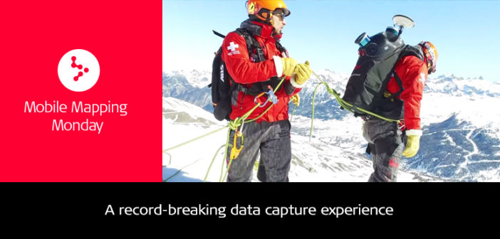
Mapping a steep slope in high altitude and cold weather conditions is a tough task that comes with its own set of challenges. On 10 March a mobile mapping team led by Julian Bret from MTSI Europe and Raphael Goudard from Leica Geosystems set out to accomplish this mission using the Leica Pegasus:Backpack wearable mapping solution. With the backpack strapped to his shoulders and skis on his feet, Bret was ready to accurately map the track in 3D.
 Julian Bret from MTSI Europe ready to map the slope in 3D
Some of the challenges the team faced:
- Accessibility: Naturally, the world’s fastest ski slope is extremely steep. Bret had to be secured with ropes in order not to lose control and endanger his life or the equipment. Thankfully, the backpack provided flexibility to complete the task without any incidents.
- Weather condition: Extremely strong winds and rough weather conditions made the mapping process difficult and prevented the use of UAVs.
- Time sensitivity: The task had to be completed quickly and accurately without wasting timein between measurements. The backpack offered a fast and easy-to-deploy solution with minimum setup time, allowing the team to get off the slope quickly.
- Accuracy: Any small mistake could jeopardise the world record attempt. The data required high accuracy and simultaneous capture of LiDAR and imagery data.
 Securing Julian with ropes was crucial to keeping him safe and avoiding damage to the equipment
Outcome and results
The outcome was a 3D model of 360° images and point cloud data of the slope. With this model, the team was able to calculate the perfect route for Barone that would allow him to accelerate enough to break his 2015 speed record. The data was transferred via Leica iCON alpine to the snow grooming machine, allowing the manoeuvring staff to groom the slope into the perfect condition at the required consistency and texture.

3D model of the slope with Eric’s ideal route marked in red, summer acquisition marked in yellow and winter acquisition marked in white

Alessandro Nuzzo
Product Line Manager, Mobile Mapping
Leica Geosystems AG
About Leica Pegasus:Backpack
The Leica Pegasus:Backpack is an award-winning wearable reality capture sensor platform. A highly ergonomic design combines five cameras offering fully calibrated 360 degrees view and two LiDAR profilers with an ultra-light carbon fibre chassis. It enables extensive and efficient indoor or outdoor documentation at a level of accuracy that is authoritative and professional.
About Leica iCON alpine
To make snow grooming as efficient as possible, it’s important to know the exact snow depth under the blade attachments when processing snow volumes. Leica iCON alpine delivers real-time data on the display in the cabin. This enables operators to respond to snow conditions immediately and perfectly prepare slopes. This not only saves time, cost and adds safety to slopes, but also reduces water and energy needed for slope preparation, dramatically decreasing the customer’s ecological footprint.


