Paul Dainty gives an overview of 10 different types of Staking tasks that are possible within Leica Captivate.
To understand even more about Staking tasks in general have a look at these videos…
1. Staking a point
Staking a point is probably the simplest and most common stake task. The Stake point app is perfect for this, and provides all the options and tools needed, to stake points in the most efficient and intuitive way. Points available to stake can be imported, manually entered, calculated or measured with Captivate.

2. Staking a DTM
Staking a DTM (Digital Terrain Model) is possible when using design data where a surface has been triangulated. The DTM is converted from either a XML or DXF file to a DTM job. Most of the stake apps within Leica Captivate allow using a DTM to define the heights, so it can be used in conjunction with staking points, lines or alignments. A specific Stake DTM app also allows to only stake a DTM surface, in which case only height stake information is given.

3. Staking a line between 2 points
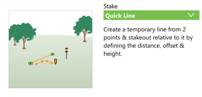
To stake out a temporary line that is formed between 2 points, the Stake line app should be used, with the Quick Line task. Here, any 2 points can be chosen for the start and end of the line, with additional options available to shift or rotate this line. Quick Line is useful when wanting to quickly form a reference line between points, without needing to actually create and store a line in the job.

4. Staking a line
The Stake line app allows staking out a line or a segment of a line. Whether it is a single straight or arc segment, or a multi-segment polyline, the Stake Line task treats the line as continuous, and allows staking at any location along the line. This task is perfect for staking pipelines for example, when needing to reference from the beginning of the line. Using the Stake Segment task, a particular segment of a polyline line can be isolated. This is perfect for staking building footprints for example, when it is needed to reference only one side or one face of the building.

5. Staking a grid of points
Within the Stake Line app, the Stake Grid task is a useful tool when it is needed to stake or measure a regular grid of points. A straight line or segment is needed to define the grid orientation, and the grid spacing is defined along and across the grid. This is useful when needing to stake out a grid reference on a construction site, or simply measuring regular spot points over large areas.

6. Staking a road centreline
When needing to stakeout on road construction projects, the Stake road app makes whatever task is needed as simple as possible. For example using the Stake line task, a road centreline or road edge can be staked out, and options such as being able to work with layers or see the data in a cross section view make the task more efficient. The app handles complex alignment geometry such as clothoids and parabolas.

7. Staking the catchpoint of a slope
The stake road app offers many powerful options for staking out slopes, and is perfect for road construction projects. The slope can be defined manually by the hinge position and the slope grade, or be automatically defined by the design data using two adjacent lines. The slope catchpoint is the point at which the design slope intersects with the real surface, and indicates where to start the earthworks. Using the Stake Slope task, the user is guided to the catchpoint position, and can even stake out the batter rails using the advanced slope options.

8. Staking a road surface
The Stake road app offers staking many different parts of a road project. Using the Stake Surface Grade task, the road surface (or travelling lane) can be staked out. Making use of layers, the user can quickly choose between the various construction phases without needing to choose new design information. The design data must exist as a road job, but can easily be converted from many different formats such as DXF, XML, MX Genio and many more.

9. Staking a rail track
The Stake rail app specialises in staking the geometry of rail tracks. Similar in operation to the Stake road app, Stake rail allows the definition of the rail geometry and the measuring of track specific values such as superelevation (cant) and gauge. This information can even be measured and entered from a separate 3rd-party track measuring device. Like Stake road, the app handles complex alignment geometry such as clothoids and parabolas.

10. Staking a tunnel face
The Stake tunnel app specialises in tunnel specific tasks. Again with a familiarity with the other stake apps, it offers staking out tasks using the tunnel alignment and the defined tunnel profile information. For example, the tunnel profile design can be staked out directly at the tunnel face, by automatically pointing with the instrument’s red laser or by providing guidance information for a jumbo drilling rig.


