


We are living through transformative times in the world of reality capture. The availability of autonomous solutions is changing the way we work in a shift that’s as significant as the move from manual techniques to automated workflows and machines. There are more laser scanning innovations available on the market than ever before, with greater customisability to suit different needs. Powered by artificial intelligence (AI), robotics and mobile platforms, autonomous reality capture technology is even capable of carrying out tasks with minimal human intervention.
Providing powerful levels of accuracy, autonomous technology paves the way for unprecedented capture speed and productivity. It enables improvements in safety and sustainability. However, it also captures more information than before, creating the need for solutions and workflows capable of handling huge data volumes.
In this blog, we explore how autonomous reality capture is revolutionising data capture: its benefits, its potential impact on various industries, and its ability to accelerate and open new business opportunities.
 Autonomy drives both efficiency and accuracy
What do we mean by autonomous technology in reality capture? At Hexagon, our Leica BLK Autonomy portfolio includes a handheld imaging laser scanner with autonomous processing capabilities as you walk, a laser scanning module that can be mounted to robotic carriers and mobile platforms and a flying laser scanner for indoor and outdoor applications. Compatible with all BLK autonomy scanners, our most advanced SaaS data processing platform, Reality Cloud Studio, powered by HxDR, allows you to mix and match devices, merge scans, register 3D data automatically and create meshes.
One of the key advantages of autonomy in reality capture is its ability to significantly enhance both efficiency and simplicity. Autonomous technologies are equipped with advanced sensors, including LiDAR (Light Detection and Ranging), GPS (Global Positioning System) and intelligent imaging systems, enabling them to gather accurate data with exceptional speed. With autonomous technologies, there is no complex setup planning, and they capture data as they move through the environment.
Our autonomous laser scanners can navigate challenging terrains and access hard-to-reach areas that would be difficult or dangerous for humans to get to. For example, the Leica BLK2FLY, a flying laser scanner, allows the accurate and autonomous scanning of inaccessible areas such as rooftops and facades without the need for scaffolding or special safety equipment. It integrates LiDAR for flight planning and collision avoidance and is equipped with a forward-facing laser scanner for the best data acquisition.
Likewise, the Leica BLK ARC can rapidly generate accurate point clouds. For example, in a complex manufacturing plant or a contaminated environment, the BLK ARC can easily capture an area in less than 10 minutes. Customers have told us that a survey of a chemical plant with five floors would typically take eight days to complete, but when using the BLK ARC, the same area can be captured within less than a day.
 Safer scanning protects people and helps business
Safety is paramount in any scanning operation, especially in the hazardous, contaminated, or remote environments where it often occurs. Autonomous reality capture technology offers a compelling solution as it can be deployed to scan in dangerous or inaccessible locations, such as construction sites, mining operations, substations with high voltage or disaster-stricken areas, where safety hazards pose significant challenges. Operators can work from a safe location in a danger zone, perform tasks that would otherwise be too risky or not even possible for humans and access complex sites and structures without needing to cease operations.
Autonomous reality capture technology can operate in unstable terrains and navigate complex landscapes, reducing the need for human intervention in perilous situations. This technology mitigates the potential risks associated with physical strain, falls or exposure to hazardous materials. By assuming these dangerous tasks, autonomous technology ensures the well-being of operators while taking care of the data capture for them.
For example, autonomous reality capture technology provides significant assistance in the scanning of electrical substations. Without autonomy, an electricity company would have to close a substation to scan everything safely, creating revenue losses and potential disruption for its customers. With a solution such as the BLK ARC mounted on Boston Dynamics robotic dog, Spot, the laser scanner can navigate through the substation – which can remain operational – and scan the entire site within hours. The resulting static and dynamic scans can be combined to deliver a dense point cloud.
Likewise, autonomous laser scanners are ideal to scan nuclear sites remotely. Radiation measurement specialist and Leica Geosystems partner Createc Energy has deployed the Boston Dynamics Spot robot with the BLK ARC payload on several nuclear sites. Createc recently added a BLK2FLY to its toolbox: MD Will Newsom explains, “One nuclear customer will get a never-before-seen 3D reality capture of their entire site, including legacy buildings which require continual, regulated inspection and maintenance. We’re confident this technology can be applied to both regular building inspection tasks and decommissioning planning activities.”
 Autonomous data collection empowers sustainability
In addition to enhancing productivity, accuracy and safety, autonomous reality capture solutions drive more sustainable practices across multiple industries. For example, the combination of sensors and software leverages automation and AI to put data to work in more efficient ways. By rapidly collecting precise environmental data, these solutions can support better resource management, decision-making, process and construction efficiency with less waste production and emissions while augmenting conservation efforts.
In agriculture, autonomous laser scanning sensors equipped with LiDAR can scan forests to quantify biomass and track changes over time. By capturing the diameter of trees and the details of branches in a fast and accurately generated point cloud, logging companies can selectively harvest trees in an eco-friendly manner. In fruit cultivation, capturing data on the growth of tree branches supports green farming, by allowing farmers to use the minimum amount of fertiliser needed to produce the optimum levels of yield.
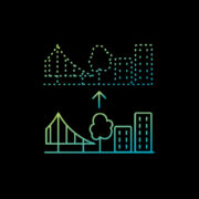
In construction, Green Construction is a newer term being used to describe the practice of creating buildings and infrastructure in a way that is environmentally responsible and resource efficient. Digital twins have a crucial role to play in this approach. For example, by having a digital twin in play from design to construction, it’s possible to minimise not only material waste by prefabricating components and making them off-site in a controlled environment but also to reduce the amount of rework on the project through real-time insights of the project within its digital twin. By making it quicker and simpler to capture site data, autonomous reality capture makes it easier for construction companies to innovate more sustainable processes.
 Versatility creates opportunities in multiple industries
The versatility and adaptability of autonomous reality capture solutions are crucial factors driving their use in various industries. Autonomous robots can be customised and outfitted with different sensors and tools, making them suitable for a wide range of applications. Laser scanners such as the BLK ARC can be mounted on different autonomous vehicles, such as caterpillar or wheeled robots, hand-carried platforms or up to fully autonomous robot dogs.
In the construction industry, autonomous robots can be employed for repetitive monitoring and inspection tasks, ensuring that projects adhere to specifications and identifying potential issues before they escalate. Robots can also conduct topographical surveys, and similarly, in the energy sector, autonomous solutions can be utilised for pipeline inspections, solar panel installations, and wind farm maintenance.
 Advanced data integration and analysis for deeper insights
Autonomous reality capture generates vast amounts of data during operation, including detailed maps, 3D models, 360 panorama images and dense point clouds. Integrating this data with advanced software and analytical tools enables users to extract valuable insights and make better informed decisions. With the help of AI algorithms, the collected data can be analysed in real-time, identifying patterns, detecting anomalies, and improving overall project planning and execution.
Integrating autonomous reality capture technology with Geographic Information Systems (GIS) allows for seamless data integration, enhancing the accuracy and applicability of results. For example, Leica Cyclone 3DR software rapidly and accurately meshes the data collected by the BLK ARC to make it easier to visualise and interpret, while a platform such as BricsCAD can be used to accurately model the pipes of an industrial plant after scanning.

The autonomous future
Autonomous technology is transforming reality capture throughout many applications by enhancing productivity, accuracy, and safety while opening new possibilities for sustainability and advanced data integration and analysis. As autonomous technology becomes more widely adopted, we expect to see significant improvements across multiple sectors, leading to more informed decision-making, optimised project management, and increased overall productivity and results.
With the ever-growing adaptability, expanding features and increasing use cases of autonomous reality capture, industries across the board are poised to revolutionise data capture practices and greatly improve the efficiency of data collection and actionability.
Johannes Hotz
Business Lead Leica BLK ARC
Reality Capture Division
Visit our website to learn more about our Leica BLK Autonomy product portfolio.