


 – First class service and support for GIS, wherever you are")
In the previous two blog posts of this Fit for Purpose series, we focused on the steps to build a customised GIS data collection solution and focused on the hardware and, in a second step, we explained which is the best GIS data collection software for your needs. This blog talks about the third component to set up your customised GIS data collection solution – the different Services and Support options.
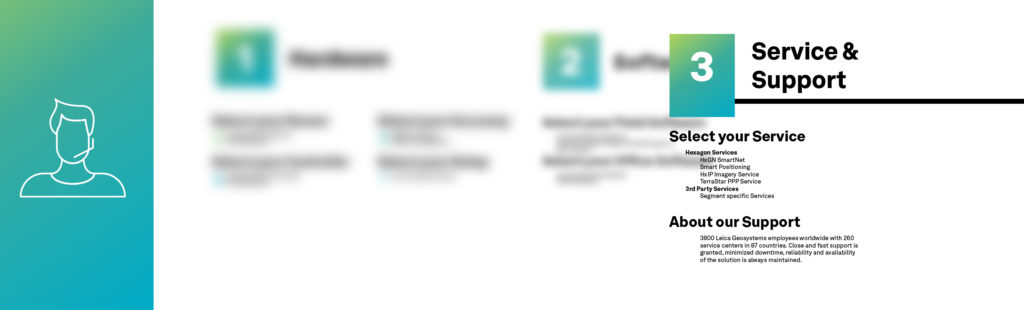
3 Steps to build your Fit for Purpose GNSS solution
Services
 Services are an essential part of the entire GIS data collection setup. This is often neglected during the purchasing process but painfully recognised when missing as the solution does not meet expectations. Besides the product services offered by Leica Geosystems, part of Hexagon, many services are additionally available. Let’s bring them a bit closer to you:
Powerful and dense network of service
Leica Geosystems has 3,800 employees worldwide with 292 service centres in 98 countries. Our service network is operated by Leica Geosystems or certified local distribution partners whose technicians are trained by Leica Geosystems. Help is always close by, so downtime is minimised, and reliability and availability of the solution is always maintained.
HxGN SmartNet
SmartNet is the world’s largest GNSS correction service with more than 4,000 reference stations in 23 countries. The service can serve different accuracy levels and has optional contract periods. The RTK correction service has become the standard in western countries where centimetre accuracy in real time is expected.
-

- Without correction Service
-

- With HxGN Smart net service
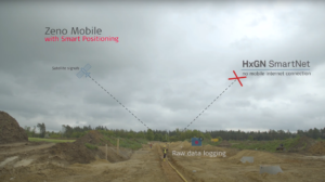
HxGN SmartNet’s Online Post Processing service supports you in cases where, for example, Zeno Mobile loses its mobile connectivity in the field, the GNSS raw data will be stored. After re-connecting to mobile internet, the measured raw data will be post processed in the field. This service is new and unique to Leica Geosystems and HxGN SmartNet.
Precise Point Positioning (PPP) service
The Precise Point Positioning service supplies GNSS corrections via a satellite (Hexagon TerraStar). This service does not need a local CORS reference network or any mobile internet.
There is an option to use between Spot Lite giving <60cm accuracy after a convergence time of 8 minutes and Spot Prime supplying up to 5 cm accuracy after just 15 minutes convergence time. After convergence, points can be measured in real time the same as with a CORS reference network. The PPP service is a perfect solution for remote and developing regions and countries.
Hexagon Content Program, HxIP
The Hexagon Imagery Program provides immediate access to professional-grade and quality controlled aerial ortho imagery. Currently, the program covers US and most of Europe with images not older than two years and with a resolution of up to 15 cm.
Services and support to capture and analyse spatial and geographic data
The importance of services is an essential part of a solution that is often underestimated. With a rich choice to tailor individual solutions to match users’ applications and workflow needs, Leica Geosystems has all the options and services to meet your GIS data collection requirements.
Explore GIS software, collectors and smart antennas for every application.

Silvia Nunez, Marketing Communications Manager at Leica Geosystems