Did you watch your favorite TV show last night on an on-demand service, such as Netflix?
Did you listen to your favorite song on Apple iTunes?
Did you read the latest bestseller on Kindle?
On-demand access to vast amounts of services and content has become a way of life. Owning books, movies, music, even cars, is quickly becoming an idea of the past. In today’s sharing and crowdsourcing society, everything we need and want is available remotely through a simple online search.
Moving to a shared geospatial business model
 Watching and understanding this trend from a purchased-and-owned service to a more cost efficient pay-per-use service, the Hexagon Imagery Program, or HxIP, is taking the geospatial industry to the online cloud.
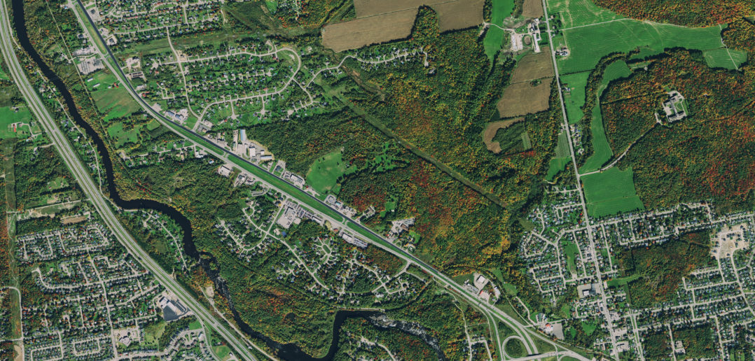
Launched last year, HxIP provides a web-based content delivery service of premium airborne imagery captured with Leica Geosystems industry-leading airborne sensors.
Taking a page from the crowdsourcing playbook, we partnered with our airborne sensor customers to use their professional expertise and resources to build an ecosystem of high-quality and consistent aerial images.
This comprehensive aerial imagery database provides an outstanding business opportunity for our Leica Geosystems airborne sensors customers. Operating about 1,000 airborne sensors to serve multiple imagery clients around the globe, these providers can now give easier and better access for their superior imagery to even more users through the HxIP.
The program streams valuable geospatial content and delivers professional-level data, including enhanced-resolution, four-band orthos, point clouds, and stereo imagery through two service categories:
• Basemap
This service regularly updates cached background maps of current 30 centimetre imagery that will be updated on a regular ongoing basis.
• Multispectral Imagery
This service supports image analysis and exploration activities with 30 centimetre, four-band imagery and related digital surface models.
Imagery is currently available for about 25 percent of the U.S. and Canada and portions of Europe. As more content partners join the HxIP in 2015, program coverage is rapidly increasing with full coverage of the U.S. expected by the end of the year.
Today, the HxIP is available through the cloud via multiple content service providers:
• Esri’s ArcGIS Marketplace
• Hexagon Geospatial’s Power Portfolio
• Valtus
Developing on-demand aerial imagery content in the GIS cloud
 When we first saw the rise of web mapping services, millions of people were helped every day to get to their destinations. Great for the personal consumer, however, these services fell short to address the professional space. These consumer-grade quality services had the direction required, but professionals needed more accurate and deeper imagining capabilities than what was available on the market.
Seeing this gap, the HxIP created a service with imagery quality, consistency and accessibility unprecedented in the market. Opening access to a wider audience of geospatial professionals, this new concept proved valuable across the industry.
Airborne v. Satellite
As an online Geographic Information System, or GIS, is only as good as the content you feed it, the HxIP is revolutionising our field. This online imagery database tackles the consistent problems found with satellite imagery.
Of course, today’s satellite images are reaching higher resolutions and offer global coverage, but the same drawbacks that have always prevented the widespread commercial viability of satellite imagery for professional use still exist:
• geometric accuracy
• radiometric consistency
• off-nadir collections
• inability to capture in difficult weather areas.
With more than 600 km of atmosphere in between even a perfect zoom lens and the topography, you may receive an excellent visualisation of the landscape below but you sacrifice the detail, and that’s on a clear day. If clouds or other atmospheric barriers are in the way, satellites are rendered almost completely ineffective. Property measurements, flood mapping, height models, and other high-precision applications can’t afford such a trade-off.
For more than 90 years, the proven solution for professional use has been airborne imagery. Whereas satellite imagery may provide the big picture, aerial imagery, without concern for cloud obstructions or hazy outlines, provides you with sharp and clear images to make the best decisions on the most reliable information.
Perfectly suited for specialised decisions in GIS and remote sensing projects, the HxIP connects you to a valuable GIS hosted in the cloud, not just full of pictures of the clouds.
To access the only GIS cloud on the market with professional-grade imagery, visit:
• Esri’s ArcGIS Marketplace
• Hexagon Geospatial’s Power Portfolio
• Valtus

John Welter is the president of Leica Geosystems Geospatial Solutions Division and director of the HxIP.


