There are two main purposes for utility detection: avoidance and utility surveying
- Utility detection for avoidance is normally done shortly before the excavation and the location of the utility must be known for a shorter time. Typically, the location of the detected utilities is marked on the road surface with spray paints and the paint indicates the utility location for the excavator operator.
- Utility surveying means detection of the utility and mapping of the utility. Asset owners want to know where their infrastructure is precise. For future planning and maintenance, utilities are mapped digitally. Accurate positioning provided by GNSS or TPS technology is indispensable for utility surveying.

Positioning solutions for utility surveying
Ground Penetrating Radar (GPR) is the preferred technology for utility detection. Radar Technology allows detecting all kind of materials like plastic, metal, concrete, etc. This is a clear advantage compared to Electro Magnetic Location (EML) technology that can only detect conductive materials. Because of this advantage, GPR is commonly used for utility surveying.
The most common positioning solution used with single-channel hand-pushed GPR units is GNSS. The simplicity and high accuracy of GNSS antennas give utility surveyors the edge of positioning for utilities. The limitation of GNSS is the poor satellite reception in urban areas and dependency on RTK correction.
An alternative method is the use of maps or local grid systems for positioning. Although these methods offer flexibility to the users where GNSS cannot be used, high accuracy is very difficult to achieve.
If we look at other positioning options, total stations are the most common positioning system used globally. It is possible to use GPR technology together with a robotic total station, which gives an advantage over GNSS antennae in urban areas where prisms don’t need to stand still for measuring.

uNext software for positioning of utilities with a total station
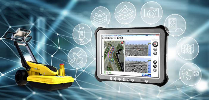
uNext is a part of IDS GeoRadar software family for fast, easy and efficient utility surveying when using a total station (TPS). Running on the Leica CT2000 field tablet, uNext software allows using a Leica Viva TS16 total station with a prism for positioning the utilities together with the Leica DS2000 Utility Detection Radar.
uNext builds a Bluetooth connection between the total station and the onboard software on the DS2000. This solution allows users to replace a GNSS antenna with a TPS Prism. A robotic TPS follows the prism and sends the coordinates to the uNext Software in real time.
Visit the uNext product page and the Leica DS2000 Utility Detection Radar page for more information


