


The reason why surveying professionals are predestined to lead the way in deformation monitoring is that the primary field tool of land surveying, the total station, is also one of the best and most flexible monitoring sensors. Every surveying service provider company owns a total station – and this is all that is needed to start growing your business with monitoring.
In simple words, monitoring is nothing more than repeatedly surveying the same object and comparing the results – it is something every surveyor has already done before, at least to a certain degree.
This blog will explain which total stations can be used for monitoring and how.
Surveying total stations (TS)
The Leica TS16 total station is a golden standard among surveying professionals and a great example of a total station that can effortlessly be utilised for monitoring purposes. Repeated measurements of the same target are easily completed manually, and displacements (changes in position between the measurements) can be calculated using simple tools like Microsoft Excel.
However, the advantage of owning an automated total station also includes the possibility to automate measurements using Leica Captivate apps. The TPS Monitoring Application in Captivate is designed to aid the surveyors by automatically executing their predefined measurement plan. The app also tremendously increases productivity and quality assurance due to a very systematic and repeatable workflow with included data quality checks. When combined with a cloud visualisation platform, the measured data is presented professionally and can be reached from any mobile device while still standing next to the instrument.
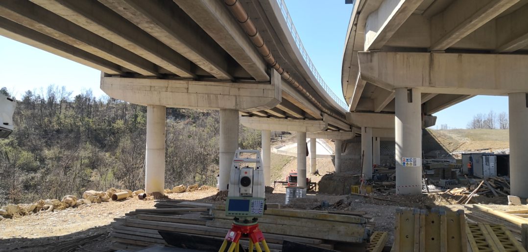
The Leica TS16 total station utilised for surveying works in Istria, Croatia
Which other Leica Geosystems surveying total station (TS) can be used for monitoring? Basically, any that fulfils the project accuracy requirements. The Comparison Chart of the Leica Geosystems total station portfolio gives a clear overview of the most important specifications. Manual total stations mean working within manual workflows, whereas the automation capability of a total station offer more scalability and an easier transition to automated monitoring. Another example of a surveying total station often being used in monitoring is the Leica Nova TS60, the paragon among surveying total stations.
Click here to find out more about how to get started with monitoring.
Monitoring total stations (TM)
What distinguishes monitoring total stations (TM) from surveying instruments (TS) is that they are specifically built for the 24/7 automatic monitoring purpose. Since 2009 Leica Geosystems has a dedicated monitoring total station portfolio, starting with Leica TM30, its very popular successor Leica Nova TM50 and the recently released monitoring crown jewel, Leica Nova TM60.
Once configured and combined with monitoring software, monitoring total stations can perform measurements continuously and without any human involvement. The most important prerequisites are:
- their mechanical design must allow them to withstand operation in harsh conditions with guaranteed stability during the longest maintenance intervals.
- they need to possess the intelligence to automatically adapt to a constantly changing environment to achieve the maximum number of successful measurements.
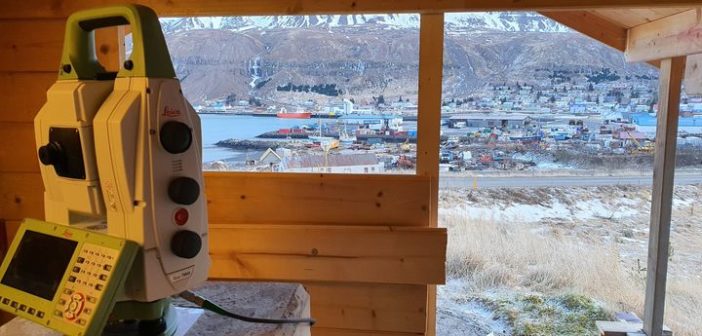
The Leica Nova TM60 monitoring a slopes in the aftermath of landslides in Seyðisfjörður, Iceland.
The TM60 is the world’s first self-learning monitoring total station using the ATRplus (automatic target recognition) technology. It enables advanced automation of long-range prism measurements up to 3,000 m with an angular accuracy of 0.5″. Additionally, it is equipped with monitoring-specific features like AutoLearn, which allows the instrument to automatically search, aim and measure prisms remotely, hence significantly simplifying and accelerating the monitoring project configuration.
Click here to find out more about TM60 and why it is the best monitoring total station in the market.
MultiStations (MS)
Due to different reasons, it’s often impossible to mount the prisms in an area to be monitored, e.g. historic buildings, roads, or protected areas. In the past, these areas were reachable only with reflectorless measurements. Since the release of the world’s first MultiStation in 2013, scanning has been a part of the Leica Geosystems monitoring solution. The Leica Nova MS60 is doubtlessly a flagship and an absolute allrounder for surveying professionals.
Thanks to its scanning capabilities, a single reflectorless measurement is replaced by hundreds or thousands of them in the scanned area. The same area gets scanned repeatedly following the defined measurement schedule. Each scan is compared to the reference scan, and the deformation is calculated. Leica GeoMoS software automatically performs this procedure. The results are visualised as a heat map, graph or table, displaying point cloud statistical values of median deformation, maximum deformation and deformation volume.
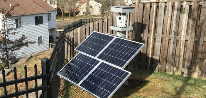
Leica Nova MS60 monitoring wall failure in Maryland, USA
The MS60 brings the flexibility of using the instrument both for prism measurements and scanning. A high-resolution dual-camera imaging system automatically captures images with each scan, allowing users to have complete information for every epoch.
Result analysis from dozens of installations worldwide shows that the MS60, when combined with our GeoMoS solution, delivers 1 to 2 mm level accuracy within 100 to 150 m distances, while also ensuring extreme reliability and repeatability of the data. This is essentially the same level of accuracy expected with prism monitoring under the same conditions.
To find out more about the utilisation of scanning in monitoring, check out this blog or case studies from Singapore, Dublin and London.
Why Monitoring?
Cities are growing, construction has never been faster, and people and equipment’s safety has never been more critical. The demand for deformation monitoring is continuously growing – adding it to your company’s service offering has a huge potential for growing your surveying business.
Learn more about how to get started with monitoring

Lidija Spiranec
Senior Product Engineer Monitoring Solutions