High-speed rail (HSR), the world’s longest and most used HSR network, has become a famous business card of China. Subway transportation systems and HSR bring prosperity to business in China. In the long-term, by the end of 2020, the length of HSR in China will be more than 30,000 kilometres in total length. By that date, there will be, likewise, more than 40 cities having their own underground public transport systems.
The tracks, rails, tunnels and structures for the high-speed rail and the subway, need to be constructed, adjusted, checked and rebuilt. Before starting the work, all assets need to be measured with precision and efficiency.
Chinese customers, Nanjing Institute of Survey, Mapping & Geotechnical Investigation, Co.Ltd and China Railway Design Corporation (CRDC) use Leica SiTrack:One, the mobile track-scanning system with survey-grade 3D point clouds for accurate as-built drawings to successfully develop a new rail detection method.
Tunnel detection in Nanjing subway

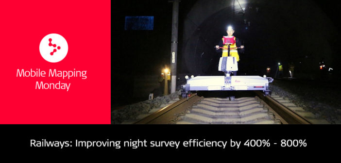
Nanjing Institute of Survey, Mapping & Geotechnical Investigation, Co.Ltd is one of the biggest survey service companies in Nanjing city. The company focuses on improving tunnel detection to reduce heavy nightworks and improve the efficiency of acquisition. In the past, the company used many different devices and tripods into the underground tunnel, and what is worse, make a 500 to 1,000 metres acquisition during a general three-hour nightwork, which costed a huge amount of labour, time and money.
Now with SiTrack:One rail maintenance and refurbishment solution, Nanjing Institute of Survey, Mapping & Geotechnical Investigation, Co.Ltd can make a 4,000 m acquisition in one night, increasing efficiency by 400 to 800 per cent. This survey-grade 3D point cloud solution can provide not only information on mileage, rail line, gauge, clearance, but also on the relative accuracy with 3 to 5 millimetres precision, meeting the needs for tunnel detection.
“We trust Leica Geosystems products and quality. We have been using Leica Nova TM50 robotic total station for automated subway tunnel monitoring for many years. With a design and quality we trust, SiTrack:One satisfies the clients’ needs and our needs,” said Wei Duan, general manager assistant at the Nanjing Institute of Survey, Mapping & Geotechnical Investigation. “Our company has been focusing on the engineering survey, research and application of the full life cycle of rail transit. SiTrack:One brings an innovative mobile scanning way, helping us improve the efficiency and bringing more details.”

Furthermore, surveyors can use the 3D point cloud to analyse the convergence and leakage of the tunnel. With the success experience of this new mode, Nanjing Institute of Survey, Mapping & Geotechnical Investigation has full confidence to bring the SiTrack:One to other cities in the future.
High-speed railway between Nanning and Guangzhou

China Railway Design Corporation is one of the biggest rail survey companies in China. The company was looking for a new way to improve the accuracy of rail facilities inspection and reduce labour, time and costs of each project. The old method not only much labour and time but also often had errors and mistakes. Surveyors had a tough time arriving to right conclusion during the inspection.
Now, using SiTrack:One, experts from CRDC can scan the whole site with the Leica ScanStation P40, achieving a scan rate of 1 million points/second with an accuracy of 2 mm of CPIII, a high-accuracy control point used in Chinese HSR and required for new Chinese subways. Thanks to the larger space on the HSR, SiTrack:One can move faster, capturing from 4,500 to 5,000 m per nightwork. CRDC also uses SiRailScan software to completely extract the as-built railway network with engineering accuracy level. The intelligent rail 3D processing software automatically generates the centre line with mileage of the railway and provides the as-built rail geometry. This new method has replaced the old labour-intensive way, and it is efficient, precise and reliable.
By Run-yu Zhang
Product & Application Engineer, Product & Application for Leica Geosystems,
Beijing China


