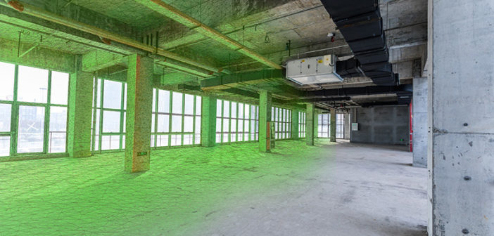
Across the world, reality capture technology has provided many projects with a glimpse into the future. Long gone are the days of capturing site conditions with a tape measure, spending hours on end crunching numbers and hand-collecting data points, point by point. Reality capture was born out of existing and new innovative technologies, fused together to digitally capture site data, enabling users to implement millions of data points straight into the digital design process and create comprehensive 3D models.
Reality capture has evolved into a means of capturing data beyond flat, two-dimensional static snapshots. Now, we capture 3D digital twins, also known as digital realities, that are replicas of objects, people or places in the physical world created in a digital form.
Then there’s the Smart Digital Reality that brings autonomy to the digital twin to transform its function and utility. Using technologies like machine learning and Artificial Intelligence (AI), we can create systems to reduce, or even eliminate, human intervention and develop dynamic workflows that integrate the right data, in the right place and at the right time. While it might sound too good to be true, it’s not. Users can leverage data to enable autonomy across their applications to solve problems, boosting efficiency, productivity, quality and safety across industries. This is what we mean when we say reality capture technology is putting data to work.
However, as reality capture technology has evolved, its capabilities have blurred. Here, we bust the biggest myths about reality capture.
 1. Reality capture is just another phrase for laser scanning
False. Arguably, the biggest misconception is that reality capture and 3D laser scanning are the same. The truth is, 3D laser scanning is just one part of reality capture.
It all started when Leica Geosystems created the Leica RTC360 3D Reality Capture Solution in 2018. New to the market, this solution opened up new possibilities, particularly on complex project sites where accurate and reliable 3D representations were needed. Empowering users to document and capture their environments in 3D, the solution assisted users to automatically capture, pre-register and examine scan and image data directly on-site. Overall, it became a fast, simple-to-use and accurate solution for capturing reality – improving efficiency and productivity in the field and office.
Projects worldwide have used Leica Geosystems’ technology to digitally capture and document the real world. A construction project on the Hyosung Vina Chemicals Port in the Ba Ria – Vung Tau province of Vietnam required a combination of data from different devices including total stations, GNSS systems and 3D laser scanners to develop its digital reality. The seamless integration of Leica Geosystems’ equipment and software solutions meant the data could be seamlessly passed between the team in the field and the off-site team for final processing.
Now, reality capture is moving fast into the future. It’s advanced so far that it can now achieve autonomous data capture. The Leica BLK series is a prime example, achieving Smart Digital Realities that go beyond what technology has been capable of. In today’s world, UAVs and robotic dogs move freely and travel without bounds, scanning and processing data to create high-quality deliverables, precise insights and immersive experiences. However you choose to build your digital reality, it takes much more than just a 3D laser scanner to achieve it.
 2. Reality capture technology is bulky and cumbersome – you can’t access hard-to-reach areas
False. Take the Leica Pegasus:Backpack Wearable Mobile Mapping Solution – it’s an award-winning wearable capture platform that collects data indoors, outdoors and underground. To operate it, you put it on your back like a backpack and start walking – making it perfect for rapid and regular data capture missions.
Leica Geosystems also provides compact and lightweight GNSS smart antennas for accurate and reliable positioning work. The Leica GS18 I GNSS RTK Rover with Visual Positioning is a versatile, survey-grade GNSS RTK rover that’s designed with surveying professionals at its core. The solution allows users to measure points that were previously too difficult to achieve with a GNSS rover without onboarding extra bulky and time-consuming equipment. The “I” in the GS18 I stands for imaging – because it’s a device that’s so powerful it allows users to measure exactly what they see – just like in real life.
Reality capture devices have evolved to become so portable that some can even be carried in one hand. The Leica BLK2GO Handheld Imaging Laser Scanner, for example, allows users to recreate spaces in 3D as they walk while holding the device like a torch. Meanwhile, the Leica BLK2FLY Autonomous Flying Laser Scanner is the world’s first fully-integrated autonomous LiDAR UAV, reaching areas from the sky that were previously impossible to capture. Technology of this kind is becoming smaller, more portable and allows users to go beyond their limits, thus creating more possibilities.
 3. Operatives require a licence and specialist training to use reality capture technology
False. New reality capture technologies on the market make the data collection process simpler. The BLK2GO is so easy to operate that it doesn’t require a trained operator to handle it. The user presses a button to turn it on, walks their desired route and captures millions of accurate measurements of the space around them in 3D – they don’t even need a tripod. This means that nearly anyone can use it, making it the perfect piece of equipment for users without a licence or specialist training. Another example is the Leica BLK360 Imaging Laser Scanner which can be operated standalone, remotely and by pushing one button. Connected to Leica Cyclone FIELD 360 mobile-device app, the BLK360 data capture can be visualised in the field and automatically pre-registered to speed up office processing time.
However, projects spanning hundreds of thousands of square feet benefit from a combination of 3D laser scanners to document a site correctly, quickly and accurately. This allows a project team to onboard trained operatives of specific equipment and understand the ideal combination of equipment to use for an individual project, and onboard lesser trained operatives, such as apprentices. For example, the project team at Changi Airport Group (CAG) created a scanning solution comprising one Leica ScanStation P40 and two BLK360 imaging laser scanners. This combination means that while a specifically trained operator manages the ScanStation P40 – lesser trained operatives can handle the BLK360s to save on spending and maximise resources.
 4. Reality capture is only used in the construction industry
False. New and novice users are adopting reality capture across industries aside from heavy construction and building construction. Police forces, architects, real estate agents, filmmakers, governments, mine owners, plant designers and operators and many more are leveraging the benefits of reality capture – and this is only going to grow.
The opportunities with having a Smart Digital Reality are virtually infinite. These realities are creating autonomous systems in logistics, food manufacturing, travel, and even retail. To put this into perspective, imagine having a digital replica of yourself to try on clothes from online stores or using a robot such as Boston Dynamics Spot® to patrol as a security officer on your construction site?
It won’t be long until we see a transformation in how digital twins are integrated into our everyday life. The truth is, all industries require workable and up-to-date digital twins to advance what’s been done before. While the capabilities of reality capture technology might seem unbelievable, it’s created a new truth that the world can explore for the future.
To learn more about Leica Geosystems technology, visit our website.


