“We’re planning and designing based on what’s actually there using real-world workflows. Why would someone want to handle a pipefitting project—or any upgrade or retrofit project—any other way?” Zachary McNeil, owner of Proport Pipefitting Inc.
Oil and gas terminals are some of the most expensive sites for construction work. Every second that a pipe is under specified capacity costs money, so the time that they are offline due to building work needs to be as short as possible. Engineering drawings are only as good as the data used to create them, so if the models are inaccurate, incomplete or non-existent, clashes and rework can lead to production losses.
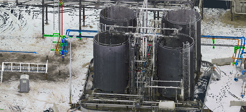
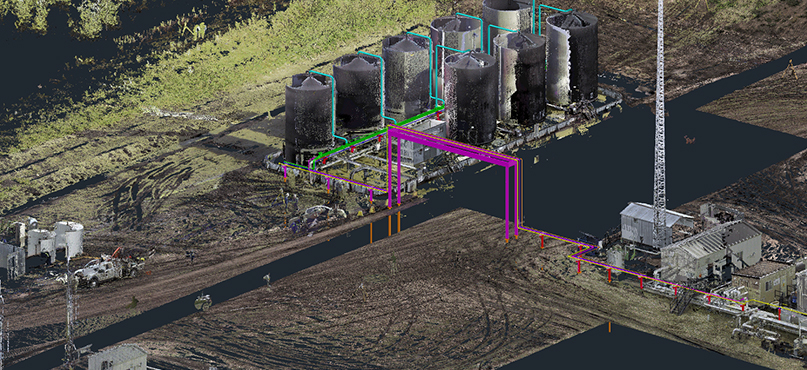
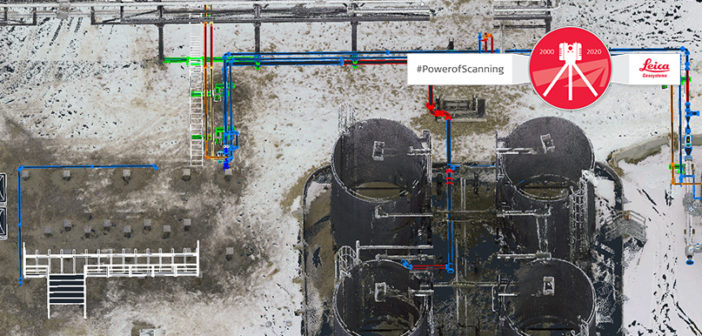
This is why the industry is moving towards more accurate digital data collection. 3D laser scanning is becoming the standard approach, replacing manual measurements. A non-contact method of capturing accurate as-built data, laser scanning works by capturing physical objects in 3D. It produces a comprehensive set of measurement points known as a point cloud, managed in engineering and design software. Zachary McNeil, owner of Proport Pipefitting Inc., Canada explains: “By scanning the site and then doing the drafting and designing portion from the point cloud data, we’re able to have one hundred percent fabrication done before the project even begins.”

Depending on the application, McNeil uses either a Leica ScanStation P40 (long-range) or RTC360 (high-speed) laser scanner to quickly capture accurate, comprehensive data across the site, using target-based registration to ensure survey-grade accuracy. He then registers the point clouds in Leica Cyclone software, publishes them through Leica JetStream, and then imports the data into Hexagon PPM CADWorx Plant software to design the piping with no guesswork. From there, McNeil and his team can export the data to any file type needed by the end user. All images courtesy of Proport Pipefitting.
Here we look at five benefits of using 3D laser scanning in oil and gas construction projects, an approach that is easier and faster than previous methods and produces more accurate – and safer – results.
-
Accuracy makes projects more efficient
“Starting with an accurate point cloud is the most efficient and effective way to move a project forward,” says McNeil. 3D laser scanning data is accurate to plus or minus three millimetres and gives real rather than standard measurements. In the real world pipes aren’t perfect, and that’s a challenge when you’re designing tight-fitting, complex piping work. Laser scanning captures idiosyncrasies that are otherwise ignored, creating a real digital twin. You avoid inaccuracies rather than amplifying them through the design process.
-
Comprehensive datasets save time
Manual methods of data collection are time-consuming, labour-intensive and from time to time a safety risk. Additionally, the collection is singularly focused and subjective. But, the scope of projects can change, meaning you might need to go back into the field to get more information. Or the manual collections was not accurate. With 3D laser scanning, it’s easy to get a comprehensive scan of the site and collect thorough accurate data in one visit, avoiding the cost of re-visits.
-
Laser scanning is a competitive advantage
Service providers and contractors that offer 3D laser scanning can pitch for more work. McNeil says that in Western Canada, many oil and gas producers won’t allow engineering and construction firms to bid on certain projects unless they use laser scanning. In fact, the need for 3D laser scanning is so great he now focuses only on the virtual side of the process. Likewise, oil and gas companies that use laser scanning, whether outsourced or in-house, also gain a competitive advantage through faster project turnarounds, improved safety and digital remote management of plant operations.
-
Data-sharing keeps everyone more informed
High-accuracy laser scanning is an essential foundation for a 3D digital twin that’s easy for people to navigate. Being digital, it’s easy to put into a format that can be shared with suppliers and people new to the project. They can do a virtual walk-around of the site either before or instead of visiting it. For example, it can be a training and orientation tool for new operators, a visual guide for maintenance staff and project managers, and a map for safety advisors. Visualisations can also be shared remotely with key stakeholders to help them make better decisions.
-
Working virtually increases access to talent
Having an accurate digital replica of a site to work from means that it becomes much more affordable to work with global experts. If site visits aren’t necessary, you don’t need to consider travel costs and limit your project to only local suppliers. And looking forward, technologies like VR, AR and MR (virtual, augmented mixed reality) are making it easier to work with contractors based off-site. McNeil explains: “If you can walk the operators through a system design so they can experience the height of the valves and tell you to move them up or down or switch the handle orientation around, that’s a huge benefit.”

The accuracy and completeness of the point cloud data virtually eliminates rework and ensures perfect-fit fabrication on every project.
3D laser scanning is making maintenance and construction work in oil and gas terminals faster, safer and less costly. To talk through ideas or gain more insight on how to leverage 3D data to improve your pipefitting project, please contact us.

Mr. Joel Hurt, Vice President – Industrial Plant Solutions | USA/Canada with Leica Geosystems, leads a team of subject matter experts responsible for and specialising in technology solutions for the industrial plant industry. Mr. Hurt has been a global leader in developing and driving laser scanning technology for over 15 years. Prior to Leica Geosystems Joel was the President and COO of VisiImage, also specialising in laser technology. Additionally Mr. Hurt has worked extensively in the engineering design industry. Joel executed key roles with major Engineering, companies on projects around world; with 20 plus years with Bechtel, Raytheon and Jacobs Engineering. Mr. Hurt, a Mechanical Engineer, an alumnus of Texas Southern University, brings a vast amount of practical real-world field experience as well as insight as a leading-edge technological innovator.


