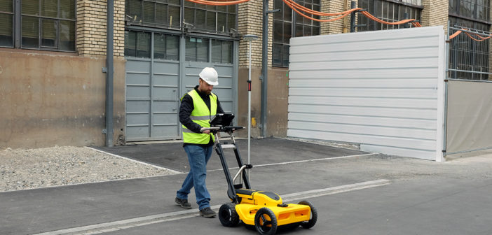
Utility location, as the process of identifying and labelling utility mains that are underground, is a growing concern. For this reason, the market for utility locating equipment is evolving and growing.
The traditional way to locate a buried utility is with an electro-magnetic locator but the difficulty with this technology is that in order to locate an asset underground either the utility being located, or the conduit carrying that utility, must be conductive, i.e. carrying an electrical signal or an electrical signal must be introduced to the utility with a range of accessories.
Meet the Leica DS2000 Utility Detection Radar
Being aware of the need to better understand what is going on underground, Leica Geosystems developed the DS2000. The Leica DS2000 utility detection radar increases safety by lowering the risk of accidently hitting underground assets by detecting buried utilities including non-conductive pipes and fibre optics.
6 reasons why the Leica DS2000 is your best utility detection radar option
- Detects metallic and non-metallic utilities
- Detects deep and shallow targets simultaneously with the dual-frequency antenna
- Combines superior detection and precision positioning technology
- Effortlessly manoeuvre around challenging sites
- Easily collect and understand data with the powerful software and cloud connectivity
- Be protected with the strongest warranty – PROTECT by Leica Geosystems
In a recent interview with Planet Underground, Richard Fling, one of Leica detection experts, with a strong background in the underground utility locating industry, gives an insight into the advances of detection technologies. Richard shows how these latest developments are helping to lead the industry to the ultimate goal of minimising utility damage.
Click here to read the full article of American Locator Magazine

Changing the Future of Locating: Talking Tech
With Richard Fling of Leica Geosystems in American Locator magazine
Having this in focus, Leica Geosystems has developed a set of EM and GPR locators focused on meeting the needs of construction and utility detection markets where the combination of quality, performance and outcome reliability are highly valued.
Digitalising Detection Solutions
Simon Pedley, US Detection Solutions Specialist, talks about getting digital mapping into a cloud system. He stresses the need to have a simple solution for the crew in the field so users can just walk out and survey the point with the locator and send this record directly to the cloud in real time. This can be done while the operator is in the field without the need of creating a ticket requesting that another survey crew goes back to the spot.
With the Leica ground penetrating radar (GPR) solutions, the utility survey can be done in the field in real time while you are collecting the raw data and, identifying pipes. Users can send the information to the cloud saving time and increasing your efficiently while in the field.
GPR locator technology
Nowadays there is increasing interest from specialist application areas including asset mapping, mining and civil engineering projects looking for detection solutions using GPR location technology.
For many operators the interpretation of the classic output radargram display has been a challenge, requiring a trained operator to deliver good interpretation and utility line identification. Post processing software, however, can significantly simplify this interpretation and is therefore making the technology easier for new users to adopt.
Leica Geosystems recognises that utility locating equipment market is evolving and customers are rightly expecting easy to use, reliable products with dependable outcomes. Workforces are becoming more multi-skilled and technology aware, so Leica Geosystems products reflect these trends with an innovation focus that has responded to these changing requirements.


