


From 1941 to 1945 the prisoner of war camp 5790 in the Rehburg Forest, Lower Saxony, northern Germany operated and housed Soviet workers. The internees were put to work on the surrounding farms to support the area during the war. As part of an initiative, the idea arose to uncover this historic prisoner of war camp in order to find out more information about the past.
The volunteers of the working group Stolpersteine Rehburg-Loccum have been working in the forest since last year, digging trenches, clearing ground and finding many artefacts from the camp as they uncover the past.
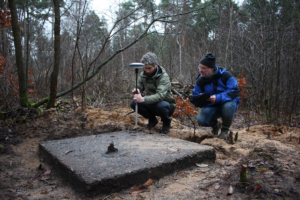
Accurately recording the location of finds.
The working group identified two key requirements to help facilitate the management of the 4,000 sqm site:
- Accurately measure the geographic location of all finds for future reference.
- Identify new areas to excavate whilst minimising the impact on the forest environment.
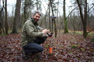
The Leica GG04 plus smart antenna was chosen for the survey work. The lightweight and portable smart antenna is optimised for use in difficult GNSS conditions such as the Rehburg Forest. To help achieve the centimetre level accurate measurements required by the project, HxGN SmartNet was used as a correction service via a mobile internet connection on the Android device, paired by Bluetooth to the smart antenna.
The Leica Zeno Mobile data collection app was used to collect the data measured by the GG04 plus. Zeno Mobile can run on any Android mobile device and makes it easy to collect data in a variety of formats.
Staking out new areas for excavation
For the first requirement, the corners of foundations and other unearthed structures were measured with the GG04 plus and the data stored in Zeno Mobile. A 30cm resolution aerial imagery layer provided by the HxGN Content Program was used in Zeno Mobile for context during the survey.
To satisfy the second requirement, potential new excavation sites were identified by combining scanned war-time aerial reconnaissance photographs and up-to-date Lidar imagery. UTM coordinates of areas of interest to dig were then determined. These coordinates were imported into Zeno Mobile ready for staking out. Using the stakeout function in Zeno Mobile makes it easy to accurately navigate to desired points and stake the ground ready for future excavations.
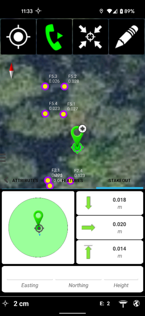
Staking out points in Zeno Mobile
60 points were measured in the forest in 1 hour with an average accuracy of 4cm. The undergrowth was often dense but it was no problem to manoeuvre from point to point using the lightweight and compact equipment.
Because of the high accuracy measurements, trenches dug for new excavations will be kept to the smallest size possible meaning the forest environment is disrupted as little as possible.
Head of excavations, Ronald Reimann commented “It’s impressive how quickly and accurately the points were collected meaning we can now continue excavations with confidence.“
All the collected data were exported from Zeno Mobile in Google KML format and shared over email. The KML file makes it easy for the working group to manage the excavations using Google Earth going forward.