


 In the fast-paced world of surveying, Zenith Survey exemplifies the importance of embracing innovation to keep pace with the ever-evolving geospatial landscape.
In a recent interview, Odd Nohr, Innovation and Development Manager at Zenith Survey, provided insights into how his company is driving this transformation and using the technology to adapt to the changing demands of the industry. Nohr is a key player in Zenith Survey, a dynamic company celebrating its 10th anniversary this year.
Read on to discover Nohr’s illuminating perspectives about the company’s journey, its reliance on advanced technology, and its vision for the future of surveying.
Zenith Survey: A Decade of Excellence
 Zenith Survey, established a decade ago, started as a surveying firm serving HæhreEntreprenør, a prominent player in the Norwegian construction industry. Over time, Zenith Survey evolved to handle all survey work for its parent company, including data collection and management for large-scale road, tunnel and dam infrastructure projects.
To meet the requirements of their demanding projects, Zenith Survey relies on Leica Geosystems products, including high-accuracy instruments like the Leica MS60 MultiStation and the Leica RTC360 3D laser scanner, along with a range of software, including iCON site, Leica ConX, Leica Cyclone REGISTER 360, Leica Cyclone 3DR, and Leica Captivate. They also employ Leica MC1 for machine control, managing data for approximately 300 machines.
Meeting Data Challenges
Surveying projects in Norway face a unique challenge when it comes to the high volumes of data captured and processed, and Nohr notes that solutions for efficient data exchange are crucial.
“Our projects are very data-heavy, with a lot of files, and we quickly realised that we couldn’t rely on the surveyor driving to and from the office for the USB stick and data,” said Nohr.
This realisation led to their adoption of Leica Geosystems’ ICON solutions.
One way they addressed this challenge was by adopting Leica Geosystems’ iCON solutions. The connectivity offered by iCON was a game-changer, enabling data synchronisation. Additionally, the platform’s support for Industry Foundation Classes (IFC) files enabled a critical advantage, as IFC files encapsulate extensive attribute data.
Ensuring that data from industry-standard formats are available and accessible across field applications, Leica Captivate also includes 64-bit architecture and IFC files support, making it a great software partner for MS60 and TS16 devices.
“Both of those things mean that we can start looking back into Captivate as the software that we use in the field,” said Nohr.
The Promise of HxGN GeoCloud
Data management is a critical aspect of Zenith Survey’s operations because of the significant amount of data collected during projects. Implementing cloud solutions, like transitioning to cloud-based software for various functions, is cost-effective and provides better resource access. The cloud, Nohr emphasises, is essential for pushing technological boundaries and, without it, even the most advanced software will become inefficient.
![]() GeoCloud Drive, an integral storage service within HxGN GeoCloud, powered by HxDR, is Hexagons’ cloud platform. It caught Nohr’s attention for the potential it could bring to their data management process, including empowering the software’s support for folders to manage extensive data with a structured approach. The vast amounts of data generated on their projects require efficient organisation for easy access and retrieval. In addition to meeting the challenges of storing and managing data, GeoCloud Drive provides more efficient field-to-office and office-to-field data exchange, so that the entire workflow is streamlined.
GeoCloud Drive, an integral storage service within HxGN GeoCloud, powered by HxDR, is Hexagons’ cloud platform. It caught Nohr’s attention for the potential it could bring to their data management process, including empowering the software’s support for folders to manage extensive data with a structured approach. The vast amounts of data generated on their projects require efficient organisation for easy access and retrieval. In addition to meeting the challenges of storing and managing data, GeoCloud Drive provides more efficient field-to-office and office-to-field data exchange, so that the entire workflow is streamlined.
This is why the advent of GeoCloud Drive, as part of the overarching HxGN GeoCloud solution, is highly promising for their operations, as it addresses their need for robust data management. Nohr believes robust data handling and cloud support are the foundation that ensures Leica Geosystems’ technologies remain effective in the field. Cleverly designed to enhance daily workflows with data and sensors, the suite marks Hexagon’s ongoing achievement in technological innovation, continuously expanding to offer additional features that further streamline Nohr’s operations in the future.
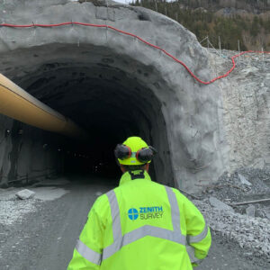
Solving Challenges in Tunnelling
From rehabilitating tunnels for increased traffic safety to blasting new tunnels alongside existing roadways and fortifying with full rock protection, Zenith Survey relies on latest-technology to enable their work efficiently and accurately.
“We started looking into several different suppliers for use in tunnelling,” recalls Nohr. “And after we tested a couple of systems, we found that Captivate would be the best choice for tunnelling.”

The Leica Captivate Tunnel app streamlines tunnel construction and maintenance tasks, such as staking out tunnel designs, checking tunnel alignment and profiles, excavation, and profile scanning.
In addition to automating a range of setup and measurement processes with Leica Geosystems total stations and MultiStations, Leica Captivate features a Tunnel app that streamlines all tunnelling work, from staking out designs to checking alignments and profiles.
Currently, Zenith Survey is working on a major project in Trondheim, Norway encompassing 22 kilometres of tunnelling and costing approximately 5 billion Norwegian kroner, or approximately 425 million euros. Given the scale and timelines of the project, they have deployed 30 surveyors to work around the clock. As this project evinces, adapting to modern technology enables them to stay ahead of the competition and satisfy their clients’ demands for complex projects with data-heavy captures and deliverables.
Nohr explains that one important way they do this is through using cutting-edge technology for positioning and laser scanning.
“We use the MS60 for both navigation and scanning, and we also implemented the RTC360,” explains Nohr.
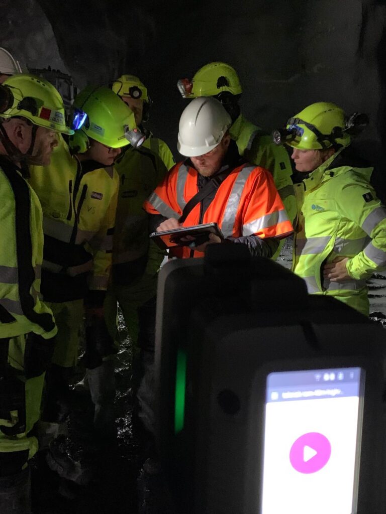
Zenith Survey crew employing the Leica RTC360 in a tunnel
The RTC360 enables both extensive data capture and, with the simplicity of use, frees up surveyors for other work:
“On one tunnel project, the only reason for the surveyor to be there at night was to scan and document the blasts. But with the RTC360, we could hand this task over to the foreman. They just have to put out black and white targets, set it up, and scan.”
In this new workflow, when the surveyor comes in the morning, he can simply extract the data from the RTC360 via USB stick, import into Leica Cyclone 3DR, and prepare the data for further processing in the Norwegian industry-standard Gemini Terrain office software.
The Need for Adaptability
Reflecting on the evolving landscape of surveying, Nohr emphasises the need for adaptability in the industry as a key asset for both individuals and companies:
“We have to use technology to meet the more demanding clients who set higher efficiency standards.”
He also highlights the growing importance of technology in handling repetitive tasks and predicted that future technology would require a more adaptable mindset from professionals.
The adaptability mindset Nohr advocates can also be seen in the technological innovation ideas that start in progressive markets like Norway and are then implemented and adopted by the rest of the world.
Embracing Innovation in Construction with Leica Geosystems
Reflecting on his 16-year journey in the construction business, Nohr marvelled at the rapid pace of technological evolution and looked forward to what the next 16 years might bring. His optimism is centred on the creative and imaginative ways in which technology will solve real-world challenges.
Nohr confirmed the pivotal role Leica Geosystems has played in Zenith Survey’s journey of embracing technology and innovation. Their instruments, such as the Leica RTC360 3D laser scanner, have made it easier for both surveyors and non-surveyors to use advanced technology effectively. This shift has allowed them to meet their clients’ increasing demands for efficiency and cost-effectiveness. By continually innovating their products, Leica Geosystems has helped Zenith Survey remain at the forefront of surveying.
Ultimately, Nohr expressed his enthusiasm for the future of the surveying field, saying,
“I think we’ve just started to see the impact of technology in the business. The possibilities are endless; we just have to be imaginative enough to see the opportunities that we have or could have.”
Get inspired to deliver civil engineering surveying services on time and within budget while reducing waste and increasing safety in every construction phase.