The construction economy is facing an unprecedented labour shortage and supply chain disruption. Digitalisation can help companies to reduce further financial losses and prepare for the new normal in a post-crisis world. This will enable them to create a technology-driven agile ecosystem and mitigate future challenges. By leveraging the present and emerging trends in surveying technologies, teams across the construction lifecycle can use data to make decisions that help build a digitally transformed ecosystem. BIM has an important role in this transformation.
The Role of BIM in Digital Construction
Project delays are one of the main reasons for 60% cost overruns in the construction industry. With its predictive visualisation of the construction progression, BIM enables surveyors, AEC professionals and other stakeholders to collaborate on a seamless, single source of digital truth that accommodates different workflows. This, in turn, helps mitigate the risks of delays and cost overruns.
With a BIM ecosystem, construction owners can estimate operational costs more accurately, improve the project quality and optimise operational efficiencies. For these reasons, the use of BIM is in rapid growth in construction markets across the world. In Singapore, the Building and Construction Authority (BCA) of Singapore has mandated e-submission of architectural or engineering plans in BIM format for regulatory approval.
Amidst the growing use of BIM, these five technologies are morphing as game-changers to take digital construction to the next level.
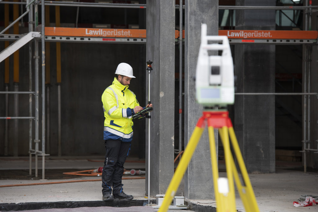
1. Motorised, Robotic Total Stations and MultiStations – Best-in-class for Fast, Accurate and Safe Surveying
Difficult terrains, uneven topographies, steep angles, and awkward positions pose unique surveying challenges. New-generation equipment combining state-of-art imaging and augmented reality can help to extract intelligent data from the most difficult of locations with ease and precision.
The world’s first self-learning multistation, the Leica Nova MS60 is the ultimate surveying solution and meets the demands of our ever-changing circumstances. An all-in-one powerful surveying tool combining a robotic total station with laser scanning capabilities, it provides the ability to have true one-man-operation work while staying safe, efficient and highly accurate. Organisations can effectively shift towards a nimbler, more productive team while streamlining the workforce.
Similarly, the intuitive Leica Viva TS16, a single-operator motorised total station has helped revolutionise surveying with its ability to automatically adapt to any environmental condition and lock precisely onto a target. This means there are fewer errors, reducing the need for rework and the time and manpower costs associated with it.
The Leica Captivate software used in Leica’s motorised and robotic total stations enables a fully digital complete field-to-finish workflow to achieve seamless data transfers. It allows the layering of measurement data over design data to create a live augmented reality, which enables surveyors to perform quality checks on a newly scanned dataset immediately onsite. The result is improved accuracy, efficiency and speed which are key drivers for the successful, timely completion of a project within budget.

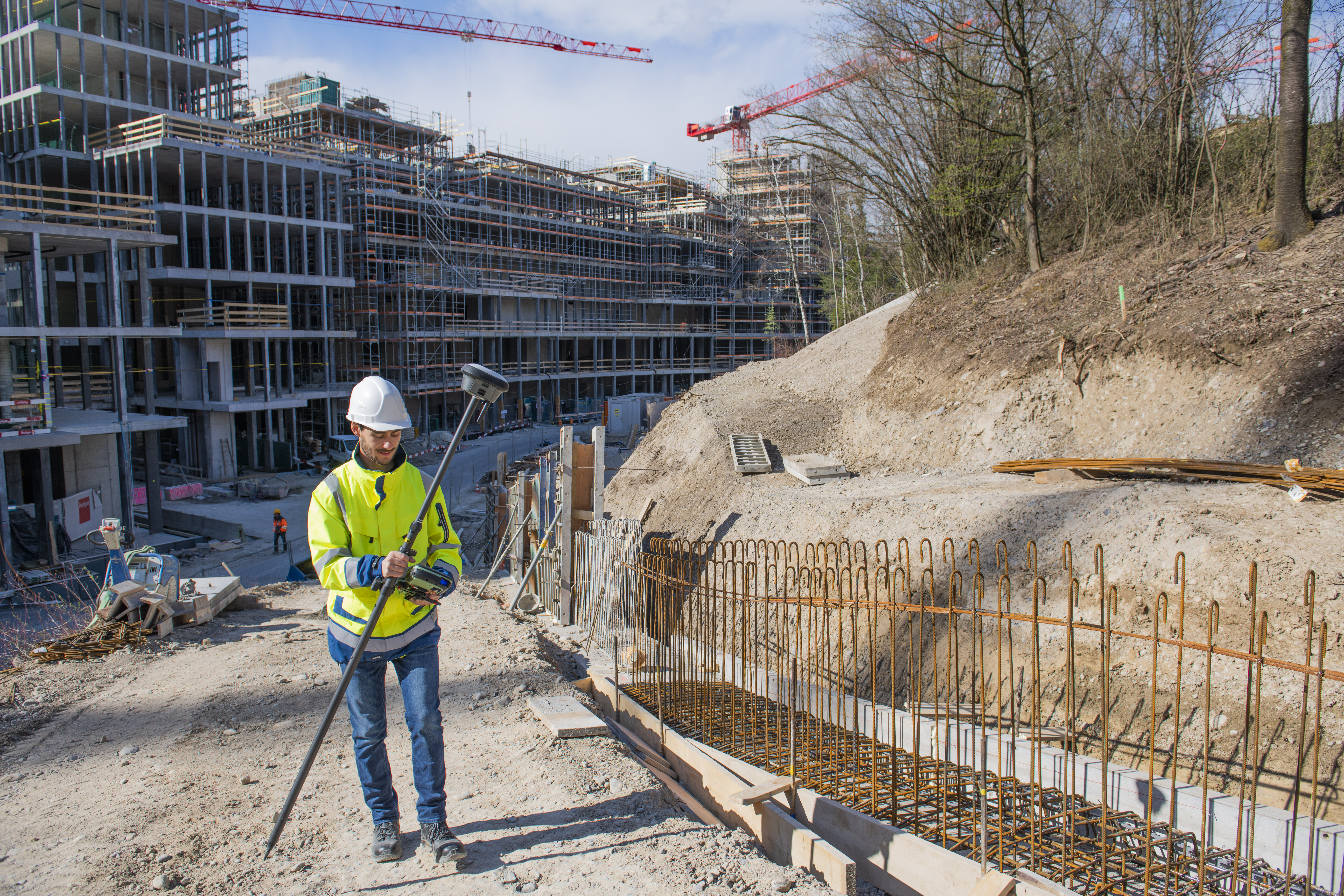
2. GNSS RTK Rovers – Eliminating the Need to Level, Calibrate and Manage Magnetic Disturbances
These cutting-edge instruments have made point-measuring easy, fast, and accurate. Proven to increase productivity by at least up to 20%, these rovers do not require surveyors to level the pole vertically to stake out points. Being IMU-based, they are immune to magnetic interference from moving cars, light-poles, and construction concrete. And their AI capability embeds self-learning into their smart antennas.
Leica Geosystems’ latest offering, the Leica GS18 I enables surveyors to complete projects with unmatched efficiency and increased safety by easily measuring what you see, including points that were previously inaccessible. The GS18 I also offers visual positioning that integrates GNSS, IMU, and camera capabilities to offer fast, versatile, and accurate point-measurement for various applications such as surveying and mapping, utilities and documenting crash scenes.

3. 3D Mobile Mapping – Accurately Capturing Detailed Data of Large and Inaccessible Areas at Speed
3D Mobile Mapping systems facilitate highly detailed 3D rendering of diverse environments from a range of mobile vehicles. Surveyors will find their real-time, instant results very helpful in generating analysis-ready visual data. The Leica Pegasus Two: Ultimate Mobile Sensor extracts accurate 360-degree imagery at varying vehicle-speeds from its multiple cameras. And the Leica Pegasus: WebViewer software enables data visualisation anytime, from anywhere. Construction teams are thus empowered to remotely analyse rich data of difficult terrains in real-time.
4. 3D Laser Scanners – Fastest 3D Reality Capture Solution for Improved Efficiency
They are the fastest means to capture 3D reality of built environments in exacting details. Converging measurement and digital imagery seamlessly, 3D laser scanners make BIM design processes faster, simpler, and more efficient. This results in enhanced accuracy of construction documents and ultimately build quality.
For example, the Leica RTC360 3D reality capture solution is designed for optimal productivity. This intuitive scanner documents and captures environments in 3D, in less than two minutes. The efficient combination of a high-performance scanner with edge computing enables the seamless integration of 3D models into any workflow.
The Leica BLK2GO adds a whole new dimension to reality capture capabilities. It is designed to capture reality on the move and recreate spaces in 3D, with unprecedented efficiency and speed. Its compact handheld design offers surveying teams a much greater degree of mobility, making it easy to capture spaces and objects that were previously challenging to scan.

5. Unmanned Aerial Vehicles – Delivering Comprehensive Aerial Data Sets with Speed and Accuracy
The new generation of UAV technologies generates fast and accurate data sets, with a user-friendly interface. In terms of hardware, the Leica Aibot CX facilitates digitalisation of construction sites with faster documentation and accurate calculation of volumes.
Integrating UAV data into workflows allows automation, which supports the timely completion of construction projects. In combination, Leica Geosystems’ software and hardware offer a complete aerial surveying solution.
The labour-force scarcity created by the current situation is expected to extend to the post-crisis phase, as relaxation in human movement restrictions remains unpredictable. With the latest surveying technologies within an agile BIM ecosystem, construction companies can bounce back in the crisis aftermath, at reduced labour force-attributed cost.
The benefits of digitalisation are undeniable. Rather than adopting stand-alone technologies, integrating a suite of technologies that complement each other will improve functionality and throughput at every stage of the construction project lifecycle.
To know more about the growing importance of reality capture in digital construction, visit this page.
Visit Pure Surveying – Shaping every phase of construction and get inspired to deliver civil engineering surveying services on time and within budget while reducing waste and increasing safety in every construction phase.

With more than 20 years of business experience, Mark Concannon serves as Hexagon’s Geosystems Division Executive Vice President for the EMEA and Asia regions. In this role, he is responsible for developing channel and M&A strategies for multiple countries, driving sales across various segments resulting in rapid growth.
Beginning his career with Hexagon in a sales role, Concannon has steadily progressed through the corporate structure. He has held managing director and senior vice president roles, introducing new technologies into markets while successfully negotiating multi-million-Euro deals. Concannon was the first president of Geosystems’ Machine Control division, restructuring the underperforming business into a successful and profitable business.


