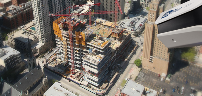
How AI-powered construction progress documentation and real-time site control benefit construction
New advancements in video capture technology using AI and machine learning allow for better documentation and tracking of the construction site. This information can be shared among all stakeholders to keep everyone updated on the status, to easily adapt to new situations and become more efficient and cost-effective.
Everyone working in construction knows that there are always many moving parts on the jobsite. Understanding construction progress, verifying schedules, assessing quality, identifying project delays and ensuring safety compliance are essential to keeping a project running smoothly and delivering on time and budget.
Stakeholders would like to have complete visibility of what’s happening on-site to be able to address issues, optimise performance and ultimately meet or exceed planned expectations. Recent advancements in technology, particularly gaining insights from machine learning and AI, provide this high visibility to make construction much more time-efficient and cost-effective.
How are these technologies being used to capture construction projects on an ongoing basis and as-built; from the initial stages and throughout the project life cycle.
High-definition time-lapse photography and live video streaming combined with AI insights
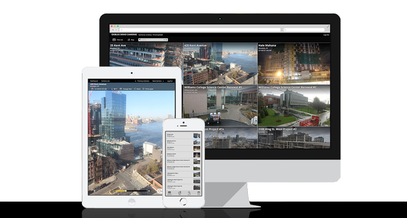
For real-time documentation of everything that happens on a project site, both on the exterior and interior, owners and contractors can now deploy high-definition time-lapse photography and live video streaming systems, such as those provided by OxBlue, part of Hexagon. By combining the latest AI-powered camera technology and machine learning algorithms, stakeholders can connect to the site from anywhere, at any time and get instant access to up-to-date information about the progress and critical milestones of a project. This could include quality assessments, overall performance and even risk detection and management.
You can view an entire project and take snapshots in real time. For example, by capturing images every ten minutes, a project can be viewed day by day or on any particular day and time throughout the project life cycle or at significant project milestones along the way. Even the smallest changes can be seen. Progress can be shared with team members via the website and integrated into project management software.
AI insights for activity tracking and safety monitoring and much more
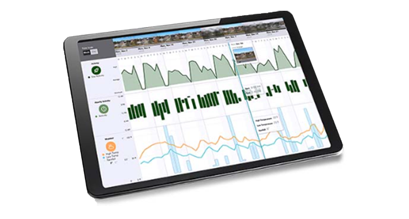
AI can track and analyse on-site project activities like the moving of machines and other equipment, concrete pouring as well as other events that occur during the construction phase. AI analysis detects incidents like pouring concrete during cold weather, missing site activities correlated to rain or cold weather, safety-related issues and much more.
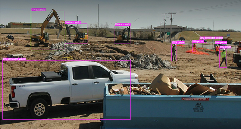
AI identifies which employees on site are not wearing the required protective equipment. Using that date to benchmark safety incidents compared with other construction sites and overall helps make sites safer.
Cloud-based construction progress documentation makes the invisible visible and improves collaboration
Throughout the entire life cycle of a build asset gathering and also while managing the ongoing progress, documentation is critical for maintaining visibility of the construction progress. Visual construction progress documentation including still images, video, reality capture, UAV and webcam can be used to provide progressive digital records of ground-up development, shared via a cloud-based platform such as the one Multivista provides.
For example, with “360 photo construction documentation,” project teams can update schedules and demonstrate progress to stakeholders. HDR-enabled 360 cameras capture both the exterior and interior views of the entire site and make them available to the project team via interactive floor plans. Integration with data captured of real-world objects and environments is used to create accurate point clouds and measurements, for example, using Leica RTC360 3D laser scanners and Leica TruView software to share point cloud data, design models and mark-ups.
This combination can create a complete record of a site at significant milestones or current conditions and progress to document underground and in-slab utilities, exterior weatherproofing, and mechanical, electrical and plumbing systems during the critical period between inspection and completion. In addition, the use of AI analysis provides insights into construction work progress and possible safety issues.
360 ‘walkthroughs’ as virtual tours
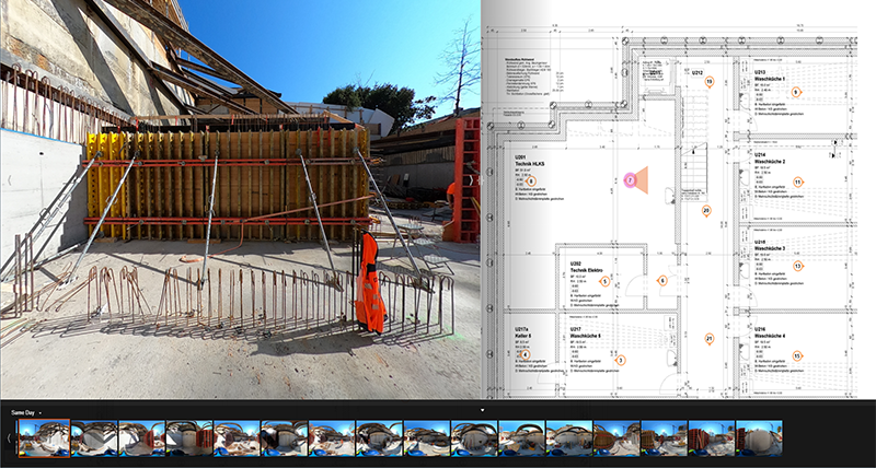
Site-Walk 360 enables clients to do a virtual tour of the project on their device. The 3D construction walkthroughs allow owners, general contractors and facilities managers to review project progress remotely as well as use the virtual tours to provide complete documentation. This process is ideal for QA/QC inspection and monitoring, validation of as-built conditions, capturing hard-to-visualise spaces and also project marketing.
Eyes in the skies
Increasingly building projects are being planned and monitored from the sky. UAVs are now frequently utilised for site planning and progress tracking, aerial site surveys, tracking equipment and measuring volumes, QA/QC inspection, and site mapping. Adding aerial data into a single collaborative online platform means it can be accessed alongside terrestrial data so the entire project can be viewed, measured and managed instantly, without having to step on site.
Better construction for a smarter future
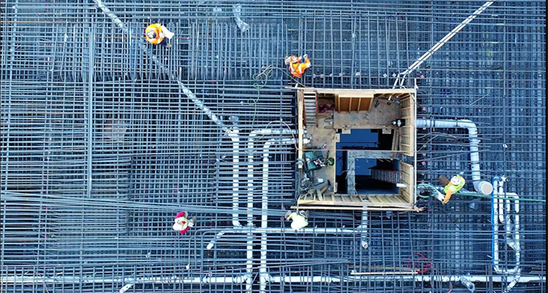
To build better construction projects around the world collaboration is increasingly required across remote global departments and dispersed team members, which means access barriers to information must be removed. By capturing and sharing measurable data with stakeholders wherever they are, all parties can virtually visit the site and stay connected to the build.
Some of these latest technologies enable all project stakeholders and teams to avoid delays and respond to real-time changes with minimal delay, which creates efficiency, cost-effectiveness, improved safety, and sustainability for the entire industry. By developing and deploying reality capture and sharing digital realities, the industry can bring greater focus on building better for smarter cities of the future.

Fabio Ponzio
EVP Geosystems Business, Development


