


In the last decade, the digital preservation of heritage sites has become a job for Leica Geosystems products worldwide. Towns, cities and entire nations look to our portfolio of 3D laser scanning technology to preserve their rich history, safely manage specialist sites and restore buildings to their former glory.
Take a trip with us as we tour the globe. From the gold mines of Brazil to one of the seven wonders of the world, here are 10 of the top world heritage sites scanned using Leica Geosystems technology.
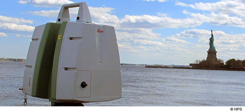
1. Ellis Island, New York, USA
In 2012, a project to digitally capture three hospital buildings on Ellis Island – the dilapidated Georgian Revival buildings, the Main Immigration Building and the 1950s park housing. The buildings suffered decades of deterioration and had 11,148 metres of maze-like corridors to contend with – all of which required laser scanning as part of a preservation project by the National Park Service (NPS).
The project team worked with a Leica ScanStation 2, Leica ScanStation C10 and the Leica ScanStation P40. As a result of the team’s efforts, the Heritage Documentation Programme (HDP), run by the NPS, provided its first online virtual tour to the public. Paul Davidson, Historic American Buildings Survey architect for the HDP, commented: “While creating the final archival drawings and records to be delivered by the HDP, knowing the precise relationship of building components to one another eliminated guesswork and saved valuable time in the field and office, allowing us to focus our energy on the significant and unique detailing of the Hospital Buildings. To me, laser scanning rocks!”
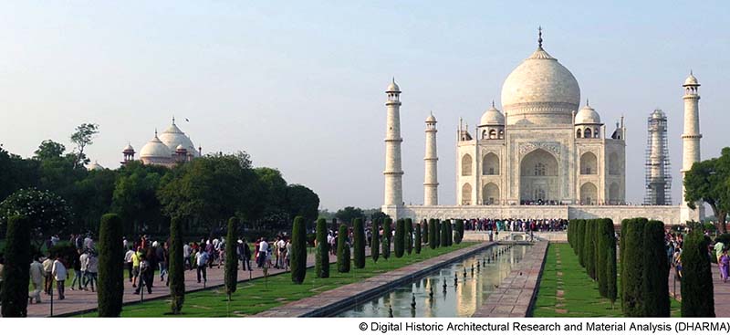
2. Taj Mahal, India
In April 2015, archaeologists worldwide had concerns for one of India’s UNESCO World Heritage sites – the Taj Mahal – following the nearby earthquake that razed Nepal to the ground. Professor Krupali Krusche, Architecture Professor at the University of Notre Dame in the United States, decided to measure the injury the earthquake may have caused to the treasure and digitally preserve the Taj Mahal should the unthinkable occur in the future.
In October 2015, a team of engineers and students documented the Taj Mahal using the Leica ScanStation P20 and Leica Cyclone point cloud processing software. They captured portions of the tomb with up to 1-millimetre accuracy to obtain the spatial information necessary to analyse the state of the structural stability. They found that, thankfully, no damage had occurred to the structure. Plus, students got to learn in a real-world environment using the ScanStation P20.
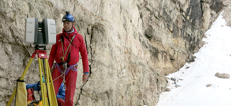
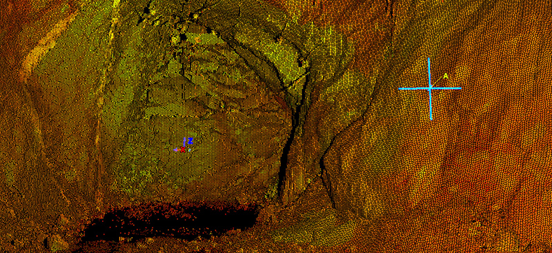
3. Dolomite Mountains, Italy
In the same year, a team scanned one of Italy’s deepest ice caves at 285 metres – the Abyss of Cenote in the Dolomite Mountains. This project was initiated to better understand the impact of global warming on the Dolomites.
A Leica HDS 7000 scanner helped researchers generate a 3D scan of the innermost chamber in 2015. In 2016, a second expedition took place in the same cave to understand and compare climate changes occurring in the Dolomites today. The ScanStation P40 helped complete 38 high-quality, low-noise scans to a depth of -130 metres quickly with realistic 3D coloured point clouds of the ice for researchers to monitor. This was with the help of a Leica Viva GS16 GNSS smart antenna to measure fixed points, Cyclone software to process the data and 3DReshaper (now Cyclone 3DR) software to generate complex meshes. The team now has the first complete 3D model of the cave, ice samples and records of one year’s monitoring with data loggers.
4. Gold mines in Minas Gerais and Goiás, Brazil
Anglogold Ashantis, a leading global gold producer, operates four mines in the Brazilian state of Minas Gerais and Goiás. At almost 400-metres deep, the company’s Córrego do Sítio 1 Mine required detailed information about its galleries and stopes – rock-surrounded rooms that are unstable with loose sterile falling and walls collapsing.
Safety engineers on-site forbid human access inside stopes. But operatives gained access by remotely operating a ScanStation C10 using a Leica Viva CS15 controller. A set of targets were also collected and coordinated to the mine with a Leica TS06 Total Station, and the team processed data in Leica Cyclone REGISTER software. Within seconds, the stope was modelled in 3DReshaper. Knowing the environment around you is fundamental for ultimate security and extraction planning. In this case, laser scanning exposes fewer miners to dangerous environments for less time, exceeding surveying and extractions demands.
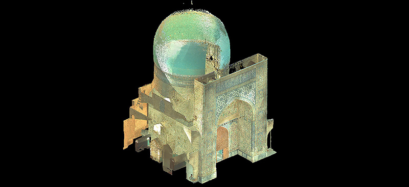
5. Kuk Gumbaz Mosque on The Silk Road, Uzbekistan
The Kuk Gumbaz Mosque on the UNESCO World Heritage List in Shakhrisyabz, Uzbekistan, required laser scanning for structural analysis. The project team scanned the mosque from 13 stations and the minaret with a ScanStation C10. Then, they scanned the second point cloud with the ScanStation P-series. The team conducted periodic monitoring with laser scanning and data registration in Cyclone software. Laser targets were permanently installed to consistently compare point clouds collected at different times.
Amir Gilani, Miyamoto International, Manager of Earthquake Engineering Department, commented: “Without this advanced technology, it would be challenging to get the as-found geometry of historic structures with the accuracy of a few millimetres that is essential for structural analysis.” In recognition of the team’s effort and value of the collected data, the point clouds were accepted into the CyArk 500 Challenge database – an international effort to catalogue and archive endangered cultural heritage.
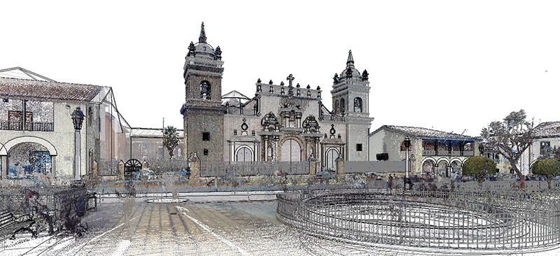
6. Ayacucho, Peru
In 2017, a team started creating a smart digital city model of Ayacucho, Peru, to carry out recovery and maintenance works essential to meet UNESCO’s standards to have the historic centre declared as a World Heritage Site.
The team used the Leica Pegasus:Two mobile sensor platform and the ScanStation P40 to increase the level of detail. They used Cyclone software to post-process the point clouds. Then, they used Leica CloudWorx digital reality plugins for CAD and Leica JetStream software to create a BIM model. This was to allow for better modelling and inclusion of the point cloud.
The 3D models are now the base for any architectural intervention within the area, guiding the cultural heritage evaluations and reconstruction of protected city elements that could degrade through time.
7. Malé Hukuru Miskiy, Maldives
A project took place in the Maldives to unfold and document the secrets behind the construction of the Malé Hukuru Miskiy – currently in UNESCO World Heritage tentative list.
To preserve this cultural heritage and honour Maldivian craftsmanship, the team captured and georeferenced the mosque in a couple of days using a combination of technology; The compact Leica BLK360 imaging laser scanner; Leica Viva TS16 robotic total station; Leica GS18 T GNSS RTK rover; and Cyclone REGISTER 360 software.
The team introduced laser scanning in the Maldives for the first time. It has even enabled the development of small-scale 3D models and virtual reality applications to teach students about Maldivian history, craftsmanship, traditional architecture and ancient construction techniques.
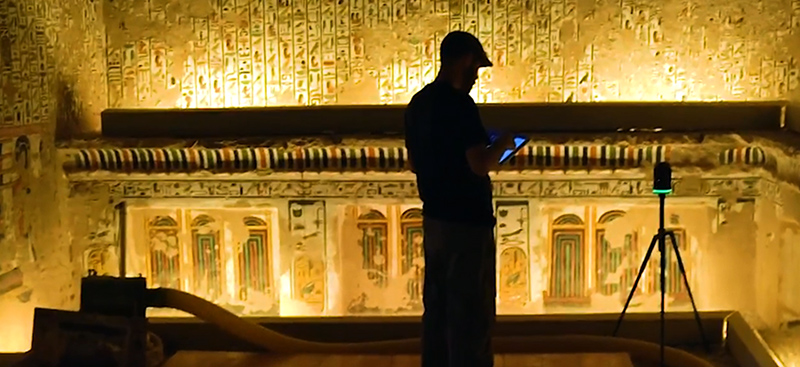
8. Sistine Chapel of Egypt
Queen Nefertari’s 3,000-year-old tomb – named Egypt’s Sistine Chapel – was captured with 3D laser scanning technology to generate a virtual reality (VR) experience of one of ancient Egypt’s most beloved rulers, “Journey to Eternity.”
The team created an immersive VR experience by capturing every detail of Nefertari’s tomb with the BLK360 and using Cyclone processing software and Autodesk’s ReCap PRO mobile. Laser scanning followed by overlapping thousands of DSLR photographs to the point cloud created an identical reconstruction of Nefertari’s tomb navigable in VR. By embracing and preserving the original spirit of Nefertari’s royal tomb through 3D laser scanning and VR, the ancient site has been digitally reopened to the world.
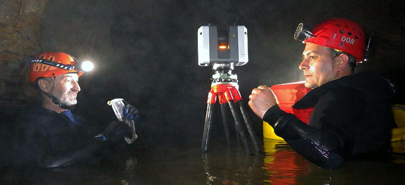
9. The Meziad Cave, Romania
To preserve and understand Romania’s speleological heritage, the Meziad Cave – a 6,298-metre natural wonder in the western Carpathians – was scanned using multiple Leica Geosystems software and hardware solutions.
The Leica RTC360 and BLK360 were put into waterproof containers and floating bags to drift from location to location in the cave. The RTC360 captured sites of interest inside the cave in two hours at 750 metres per hour. The team scouted the mountain area and georeferenced it with the GS16 and GS18 T GNSS RTK rovers with SmartLink Service and real-time corrections from the Romanian National Reference Stations Network (ROMPOS), running on GNSS Spider software.
The sensors proved to be capable of working under challenging environments and meeting the highest standards in measurement excellence to preserve Romania’s speleological heritage.
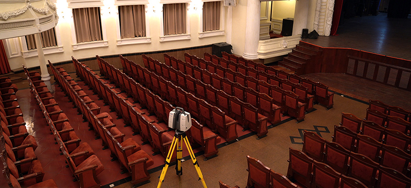
10. Futureproofing Saigon Opera House in Ho Chi Minh City, Vietnam
The Saigon Opera House – one of Ho Chi Minh City’s most elegant and historical cultural assets and much-loved municipal performing arts venue – required accurate digital condition surveys to help the authorities successfully manage future renovations or reconstruction.
In terms of software, the team used Leica Infinity for georeferencing the point cloud data, Cyclone 3DR to create the digital model of the statues and reliefs and the CloudWorx plug-in for Revit to add the top roof frame truss system to the BIM model. The team constructed a base heritage-BIM model and created a 3D digital representation of the current status of the theatre. They can now share a precise reality capture visualisation through an impressive interactive virtual tour!
There are even more world heritage projects that Leica Geosystems’ technology has contributed to. To name a few, our 3D laser scanners have also been used to preserve a Roman billionaire’s villa, capture Hell’s Gorge bridge in the German Alps and re-develop a former convent in Portugal. Leica Geosystems is proud to be the globe’s partner of choice for cultural preservation and will continue to contribute laser scanning technology for accurate models of our world’s great heritage sites.
Learn more about Leica Geosystems 3D laser scanning technology and how it supports digital transformation in Heritage preservation and can provide a window into the past.
Click here to subscribe to our quarterly newsletter to receive the latest reality capture news directly to your inbox.